About Rancheria Falls
Rancheria Falls was a surprisingly popular waterfall in the heart of the Sierra National Forest near Huntington Lake.
Given how out-of-the-way it was from the typical Yosemite route via Fresno, it blew our minds just how busy the hike to get here was.
We imagined that most visitors to this area during our visit were Central Valley weekenders looking for recreational opportunities at both Shaver Lake and Huntington Lake, and that this impressive waterfall was the perfect excuse to do something more Naturesque with the family.
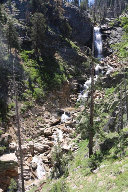
Indeed, as you can see from the photo at the top of this page, it was said to be 150ft high though when we first showed up here back in 2002, we only managed to get right up to the main drop without figuring out how to earn this full contextual view.
In any case, it was a pleasant and easy hike, and it was easy to see why this trail was quite popular, especially for a place that seemed a bit off the beaten path at least as far as the Sierras were concerned.
Hiking to Rancheria Falls
Our hike was a pretty straightforward 2 miles round trip from the trailhead (see directions below) to the base of the main drop of Rancheria Falls.
The trail gently ascended among a lot of impressive pine trees as well as some blooming wildflowers adding a bit of color to the scene.
Where the tree growth had opened up, we noticed some granite peaks (the kind we’d associate more with Yosemite National Park) in the distance.
Our most recent visit here in July 2016 followed a very severe drought throughout California so we could see evidence of dead pine trees as bark beetles managed to get into the sickly trees that were unable to create the sap to keep them at bay due to the lack of moisture.
Aside from the brown trees resulting from this condition, the scenery here was otherwise mostly green.
The hike was mostly quiet as we wouldn’t be hearing Rancheria Creek until almost the very end. That was when the trail made a bend and meandered right up to the base of the main 50ft drop of Rancheria Falls.
From this spot, it was hard to get an all encompassing view, and the steep and rocky terrain ensured that we’d have to be content with the limited view of the falls from the official trail’s end.
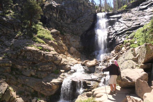
However, we did notice quite a few younger individuals who continued scrambling further to get up to the steep top of the waterfall.
That said, I did notice further back on the main trail a trail-of-use that descended to a rock outcrop that produced the photo opportunity you see at the top of this page.
Indeed, this contextual view of the falls made it clear that there was way more to the waterfall than the limited view you get from the official trail, and it made me wonder whether the 150ft height figure might be underestimating it a bit.
As far as lighting was concerned, both times we visited this waterfall were at the height of the day from late morning to high noon.
Under these lighting conditions, the sun was pretty much right on top of the falls, which made viewing and photographing it a bit challenging.
I’d imagine that if we were to time our visit for better lighting conditions, then mid- to late afternoon would probably produce better backlighting.
We’ve never had the opportunity to stick around late enough to test this theory, but maybe one of these days when we’d stick and better enjoy the lakes here, we’ll give it a try.
Surprising Popularity
When we returned to the trailhead in the late morning, this was when we realized just how popular Rancheria Falls was as we’d encounter large groups of people of all ages heading to the falls.
Indeed, we noticed plenty of families with kids as well as seniors doing this otherwise quite easy hike.
Even when we made it back to the trailhead parking, we were amazed at how full it was, especially when we were only one of about a half-dozen or so cars here when we first showed up.
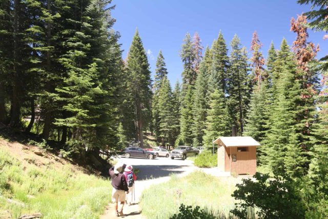
Anyways, when all was said and done, we had spent under 90 minutes away from the car, but easily less than an hour of this time spent was hiking the trail itself.
We simply took our time and enjoyed both the scenery as well as the impressive waterfall display as everything about our experience here literally coerced us into slowing down and just enjoying ourselves.
Perhaps the hardest thing about reaching this waterfall was the somewhat rough dirt road lasting for about a mile away from the Hwy 168.
I didn’t recall the road being this rough when we first made our visit back in 2002, but then again, things can change over time and perhaps my memory wasn’t very good from 14 years back.
In any case, you read a little more the drive down below in the directions.
Authorities
Rancheria Falls resides in Sierra National Forest. For information or inquiries about the reserve as well as current conditions, visit the USDA website or their Facebook page.
Related Top 10 Lists
No Posts Found
Trip Planning Resources
Nearby Accommodations
This content is for members only. See Membership Options.Featured Images and Nearby Attractions
This content is for members only. See Membership Options.Visitor Comments:
Got something you'd like to share or say to keep the conversation going? Feel free to leave a comment below...No users have replied to the content on this page



Only logged in users can post a comment Please login or sign up to comment