About Millard Falls
Millard Falls was a local waterfall that really felt like one of the more family-friendly adventures when it came to waterfalling in the Southland.
Not only was the hiking short and the terrain more-or-less flat, but it also helped that the falls had nice dimensions to it (said to be about 60ft tall).
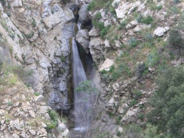
Moreover, the waterfall’s distinguishing feature was the boulders wedged at its brink, which actually split the falling water into more-or-less of a contorted Y shape.
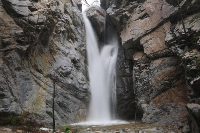
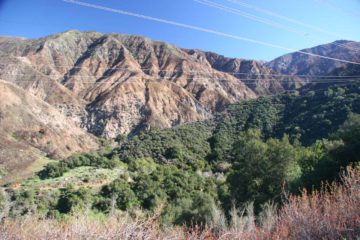
Aside from the waterfall, the canyon scenery encompassing the falls was scenic in its own right. We were literally surrounded by impressively tall mountains with nearly vertical rock walls enclosing the canyon around us.
This provided that rugged beauty that you can only find in Nature when it’s relatively untouched and unspoiled by people.
And yet despite all these positive attributes, it had been a long period of about 13 years between our visits to the waterfall’s base (where we were able to get the photo you see above).
Millard Falls Timing
The closures resulted from a combination of landslides and falling boulder hazards. It was also not helped the Station Fire in the Summer of 2009.
In addition to the closures, Millard Creek required a certain degree of timing since its stream was considered to be intermittent according to our Topo maps from both National Geographic and Garmin
.
Indeed, when we first saw this waterfall way back in late 2002 (actually Julie and I visited the falls individually on separate occasions since 2001), it didn’t really have that great of a flow.
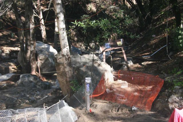
I’d attribute that to the late starts to the rainy season on each of those years.
The one time (before 2017) that I did visit the falls in very good flow in the Spring of 2010, the trail to the bottom was closed.
It wasn’t until one of our most recent visits in early 2016 that we were finally able to appreciate the falls intimately from its base.
However, even on that most recent visit, its flow was limited despite being only about 3 dry weeks removed from the last series of storms creating snow in the San Gabriel Mountains.
A Wet Adventure
In February 2017, we took advantage of a break in some saturation rains that seemed to have finally put a dent in our multi-year drought situation, and that yielded the state of the falls that you see pictured at the very top of this page.
Of course, with everything that I had been saying up to this point about this hike being somewhat family-friendly and easy, the hike was definitely more of a wet adventure during our 2017 visit.
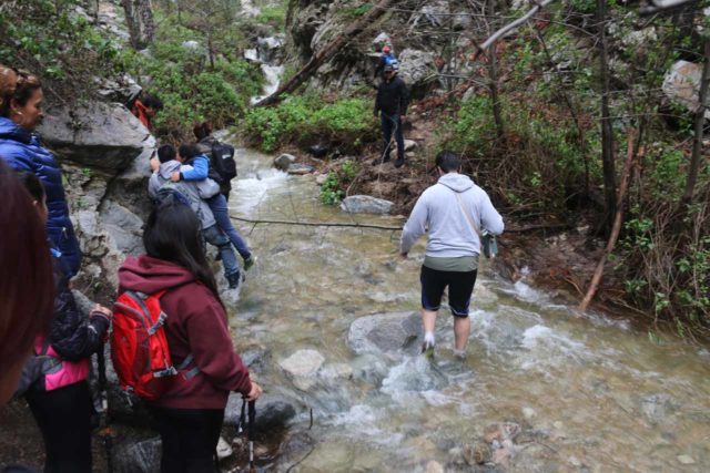
During that visit, Millard Creek was as swollen as I had ever seen it.
Obviously, given the narrowness of the canyon, this would not be the place to be during a downpour as flash flooding would be a killer here.
That said, it was next to impossible to keep our feet dry under the conditions that yielded the photo at the top of this page.
Indeed, we urge you to know the conditions and come prepared (or even be prepared to turn back if it’s too dangerous to proceed).
Mother Nature can be very unforgiving, especially under extreme weather conditions.
Anyways, given the couple of different ways to experience this waterfall (at least that I’m aware of), let’s get into each method that we were able to accomplish.
The Base of Millard Falls
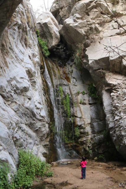
Getting to the base of Millard Falls was the most obvious way to experience the waterfall.
Almost everything about the excursion seemed to be relatively family-friendly as our daughter was able to enjoy it while hiking under her own power with our supervision.
As for the logistics, the hike was said to be about 1 mile round trip with very minimal elevation change.
The hike took about 25-30 minutes in each direction (about an hour round trip), but we totally took our time, especially since we let our daughter set the pace.
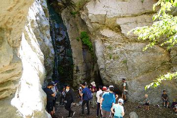
Now given that it was such a relatively easy hike, it wasn’t realistic to expect to be at the waterfall alone for any long stretches of time.
It’s too close to the Los Angeles basin to be unpopular and uncrowded.
If you’re trying to avoid this, then it’s probably best to not come on the weekends or on holidays.
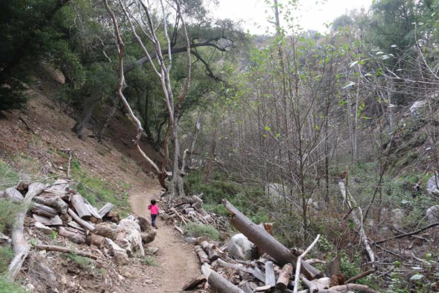
The hike began at the main parking lot for the Millard Picnic Area and Campground (see directions below).
From there, we followed an obvious trail that quickly led to the campground area. There were some toilet facilities there as well as picnic tables and room for tents to be set up.
I’ve been here on weekends where this campground was packed even when the trail to the falls itself was closed.
On one of our most recent visits, the campground was pretty much empty even though the trail to the falls was re-opened.
In any case, just before the dirt road passing by the campground dipped into a creek ford, a signposted trail pointed us to go right.
From there, the trail walking began. For the most part, the trail was pretty obvious to follow despite the canyon walls closing into a relatively narrow passageway.
We were able to keep our feet dry throughout the trail except for a couple of pretty easy creek crossings.
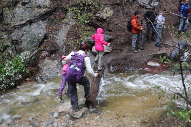
When Millard Creek would have heavier flow, then I can see where it might be trickier to keep the feet dry on those creek crossings or where the trail abutted against the creek itself.
And when there’s a flash flood danger, this canyon would definitely not be the place to be as there would be limited opportunities to escape the onrush of water (so definitely pay attention to the weather forecasts and conditions before doing this hike).
Anyways, the trail pretty much meandered about the canyon for the next half-mile or less.
We spotted some interesting grandfathered wooden cabins perched high up on the canyon cliffs as well as an interesting mine shaft.
The trail undulated while twisting and turning with the curves of the canyon. However, the trail would make an abrupt end right at the Millard Falls where the canyon walls would box itself in with vertical rock walls.
Given the presence of a few large boulders on the ground around the falls, we were cognizant of the potential for rock falls. In fact, upon closer inspection of the top of the waterfall itself, we could see at least two or three large boulders wedged against each other.
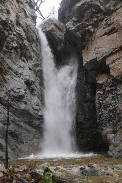
While they look pretty securely wedged in, you never know how Mother Nature can change the circumstances over the years so we tried to limit the amount of time spent directly underneath the waterfall.
Each time we’ve been to the bottom of this waterfall, we’ve noticed folks standing near the boulders at the top of the falls.
While it may be tempting to find a way to scale the vertical rock walls to get up there, it’s actually not a smart thing to do given the risk of injury or death as a result of the steepness of the canyon walls here. I’m not saying it’s impossible, but it’s definitely not necessary, which you’ll see in the writeup below.
The Top of Millard Falls
Before the Station Fire in 2009, I never contemplated visiting Millard Falls in any other way than from the obvious trail to its base.
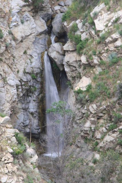
However, ever since the resulting closure of that trail, it opened up my mind to consider other ways to see and experience the waterfall, and that was how I learned about a trail that took me to the top of the falls yielding the types of views like you see in the photo above.
Little would I realize that parts of the trail I would end up taking would also expose me to some interesting history concerning the Mt Lowe Railway. This was an engineering attempt in the 1890s at taming the San Gabriel Mountains and essentially creating a “railway to the sky” as well as a city atop Echo Mountain.
For a period of about 40-50 years, this was said to be Southern California’s most famous attraction, but Mother Nature didn’t give in very easily. Eventually, storms would ultimately dislodge some loose boulders that would ultimately smash key parts of the pavilion atop the railway thereby putting an end to the Mt Lowe Railway.
From the gate barricading the start of the Mt Lowe Road near the old Sunset Ridge Station (right where the Chaney Flat Road hit a T-intersection before descending to the parking lot for the Millard Picnic Area and Campground; see directions below), I walked the Mt Lowe Road as it narrowed to become more or less a mostly paved foot trail as it ascended the ridge and veered to the left under some power lines.
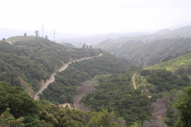
Looking back in the other direction, I was able to see the road descending to the Millard Picnic Area and Campground below as well as the Sunset Ridge Station itself, which was a power substation tapping into the high voltage lines in the area.
Continuing along the road-turned-trail for about another 8-10 minutes or so, I then followed a signposted path that forked to the left leaving the Mt Lowe Road.
This dirt trail was the Sunset Trail, and it pretty much skirted the parts of Millard Canyon where the main waterfall trail was directly below.
After roughly 5 more minutes of walking this trail, I started to get eye-level views of Millard Falls in the distance. However, given the presence of thick foliage around the base of the falls, I never really got a totally clean view from anywhere along the Sunset Trail.
And as I continued further on the trail, the views became even more obscured, but then I realized that the trail skirted right past the top of the waterfall itself.
So if one wanted to get a closer look at the boulders wedged above Millard Falls, this was the right trail to do it.
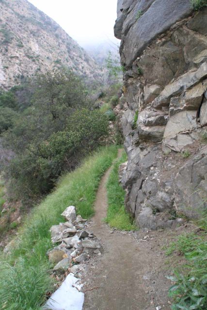
Beyond the waterfall, the Sunset Trail then entered deeper along the rim of Millard Canyon before reaching another fork.
One of the forks looked like it went towards someone’s cabin. The other fork continued the Sunset Trail, which would ultimately rejoin the Mt Lowe Road near the Cape of Good Hope.
This fork was my turnaround point so I can’t make any further comments about that section of the trail.
Overall, this hike took me under 40 minutes round trip though I probably didn’t need to go as far as I did (so it could require even less time than this).
Thus, from a difficulty standpoint, I figured it was about the same difficulty as the obvious trail leading to the base of Millard Falls described in the section above.
Authorities
Millard Falls resides in the Angeles National Forest. For information or inquiries about the area as well as current conditions, visit their website or Facebook page.
Related Top 10 Lists
No Posts Found
Trip Planning Resources
Nearby Accommodations
This content is for members only. See Membership Options.Featured Images and Nearby Attractions
This content is for members only. See Membership Options.Visitor Comments:
Got something you'd like to share or say to keep the conversation going? Feel free to leave a comment below...No users have replied to the content on this page
Visitor Reviews of this Waterfall:
If you have a waterfall story or write-up that you'd like to share, feel free to click the button below and fill out the form...No users have submitted a write-up/review of this waterfall


Only logged in users can post a comment Please login or sign up to comment