About McCloud Falls (Lower, Middle, Upper)

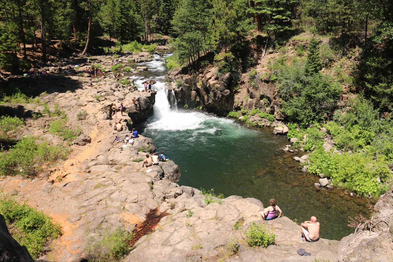
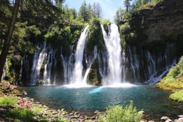
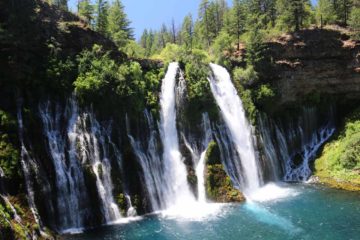
What we’re referring to as McCloud Falls was really a series of three major waterfalls on the McCloud River – Lower Falls, Middle Falls, and Upper Falls. The Lower Falls was really more of a wide swimming and play waterfall with a stocky 12-15ft drop into a deep and emerald green pool. The Middle Falls featured an impressively wide drop that was said to be 50ft tall and at least twice as wide as it was tall (so it’s at least 100ft wide). The Upper Falls was kind of a chute waterfall with some interesting cascades further upstream feeding its dramatic chute. Although each of these waterfalls had different sizes and shapes, hands down the most scenic of the them had to have been the Middle McCloud Falls, which we were able to scramble closer to as well as experience from a cliff overlooking the whole scene, and if we were so pressed for time that we’d have to pick just one waterfall to visit, it would have to be this one.
Luckily for us, when we made our visit, time was on our side. We ultimately visited all three waterfalls on a well-used trail that linked all the waterfalls for a 3.6- to 3.8-mile round trip hike (all waterfalls were said to be geographically within one mile of each other). That said, we very easily could have driven to each waterfall (see directions below) and essentially save a lot of time doing that though we’d miss out on a lot of the subtleties that can only be appreciated when you leave the car and the crowds behind. Indeed, we could have broken up this write-up into three where each waterfall would have its own dedicated page. But since we did this whole thing in one shot, we’ll just describe all the waterfalls on the McCloud River as a singular hiking excursion.
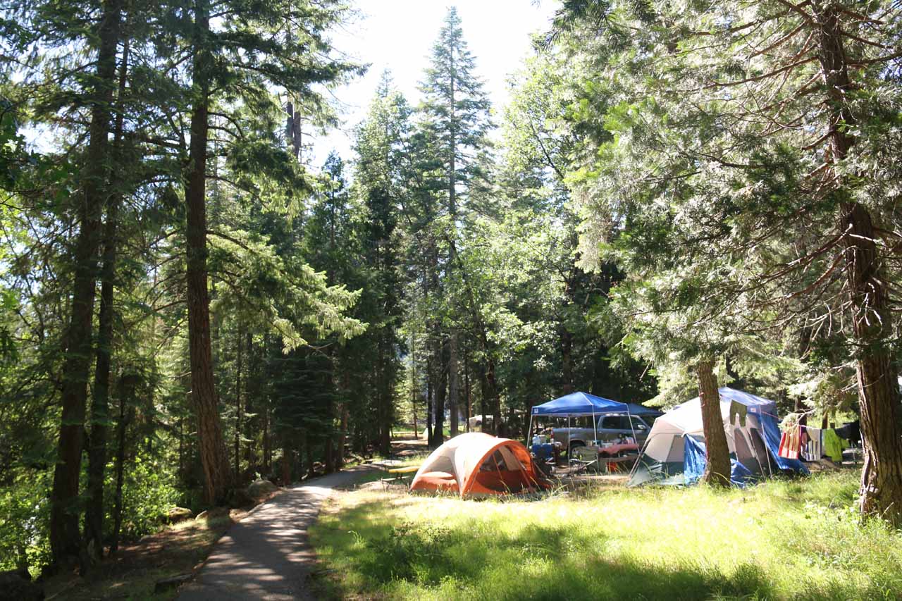
Next, we continued on the paved trail (so it was wheelchair accessible) for the next quarter-mile towards the Fowler’s Campground as it meandered amongst some tall trees with glimpses of the McCloud River along the way. The trail was considerably quieter than the party scene at the Lower McCloud Falls though it was still quite busy given that the campground looked full and many people were still walking back and forth to the Lower Falls and the camp. Some of the tents were practically adjacent to the trail.
The lull in waterfall activity (25 minutes from Fowler’s Camp and 40 minutes from Lower Falls) also set us up for the dramatic appearance of the Middle McCloud Falls as the impressively wide and commanding block-type waterfall made its presence known. We could get partial views of the falls from the trail, but in order to really appreciate it, we had to do a little boulder scrambling from the end of the lowermost switchback to see the falls’ base in context with its very wide plunge pool. When we showed up at almost 3pm in late June, the far right side of the falls was already in shadow, which necessitated doing some tricks with the camera to resolve the bright and dark regions of the waterfall to resolve both zones in one photo. Nevertheless, from a waterfall appreciation standpoint, Mom and I chilled out at this divine scene for a bit while we also observed other people making their way down from the overlook high above us as well as watching others who were here before us even fishing at the banks of the plunge pool.
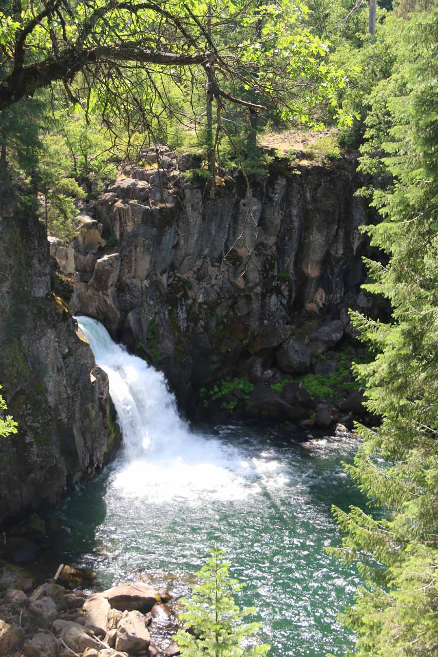
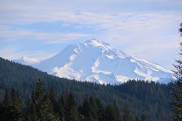
Beyond the overlook, we followed the cliff-hugging railings offering us more views of the McCloud River canyon below. Further beyond the railings, the trail would continue between more trees and bush containing some blooming wildflowers for the next quarter-mile. Along the way, we were able to get partial glimpses back at Mt Shasta (too many tall trees in the way as the mountain could be better seen from the Middle McCloud Falls parking lot) as well as hiking next to some interesting rocks flanking the trail. Finally, after another ten minutes of walking, we reached the first lookout for the Upper McCloud Falls, which was angled and a bit distant, but we could clearly see the short 30ft waterfall wedging itself between a cut in the adjacent hard rock layer and lunging itself into its deep plunge pool below.
There were more overlooks as we walked closer to the brink of the falls, but of the three waterfalls on the McCloud River, this one was definitely the look-but-don’t-touch type as the plunge pool at its base was not safely accessible. Nevertheless, at the waterfall’s brink, we were also able to look upstream as the McCloud River cascading its way to the free-leap of the Upper McCloud Falls. The trail continued further upstream beyond this part, but that merely led up to the parking lot for this falls in another 0.1-mile (so again, there was a “lazy” option to experience this falls instead of hiking between the Middle and Upper Falls.
The brink of the Upper McCloud Falls was our turnaround point. The hike back was pretty quick as it was mostly flat with the downhill stretch to go from the overlook of Middle McCloud Falls to its bottom. And it took us about an hour to make it all the way back to the parking lot at the Lower Falls. Overall, we had spent nearly three hours away from the car, but we felt it was time well-spent as we could easily see why the McCloud River area was one of the Mt Shasta area’s best known and popular attractions.
Related Trip Reports
Related Top 10 Lists
Related Itineraries
Trip Planning Resources


Nearby Accommodations
This content is for members only. See Membership Options.Featured Images and Nearby Attractions
This content is for members only. See Membership Options.Visitor Comments:
Got something you'd like to share or say to keep the conversation going? Feel free to leave a comment below...No users have replied to the content on this page
Only logged in users can post a comment Please login or sign up to comment