Lower Eagle Falls

South Lake Tahoe / Emerald Bay State Park, California, USA

About Lower Eagle Falls


Hiking Distance: 2.6-2.8 miles round trip
Suggested Time: 90 minutes

Date first visited: 2016-06-23
Date last visited: 2016-06-23

Waterfall Latitude: 38.95165
Waterfall Longitude: -120.11134

Waterfall Safety and Common Sense

Lower Eagle Falls was the big two-tiered waterfall that kept us wanting more no matter how we were able to experience it from the various options that were available to us. From the brink of the waterfall near the Eagle Falls Picnic Area and Trailhead (for the Upper Eagle Falls), we were only able to peer over its top towards Emerald Bay. From the popular Emerald Bay Overlook, we were only able to get a distant but more or less complete view of its entirety with some trees blocking parts of its downward trajectory. Then, from the bottom of the falls, we were only able to satisfactorily enjoy the lowermost of the two tiers (see photo at the top of this page). Indeed, this felt like the ultimate tease, and even the short snow melt season between May to July ensured that timing in addition to location were key when it came to maximizing the experience with this falls.

I was tempted to combine the Upper Eagle Falls writeup with this one, but I figured breaking it up in two made the most sense since there was enough to say about this particular excursion alone. Regardless of whether this page should have been combined with the other or not, in hindsight, I’d recommend committing to a parking lot then hiking to both the Upper Eagle Falls and the Lower Eagle Falls in one go. Not only would this save you from having to pay the parking fee twice, but the parking area for the start of this hike was a mere quarter-mile or so from the other trailhead (see directions below for details). Plus, it would open up the possibility of experiencing the Lower Eagle Falls from its top along Hwy 89. We’ll pick up the hiking route from the Emerald Bay Overlook.

Lower_Eagle_Falls_179_06232016
The Emerald Bay Overlook, which also doubled as the start of the hike to Vikingsholm as well as the bottom of the Lower Eagle Falls
First and foremost, the immediate temptation when at the Emerald Bay Overlook would be to check out the views over Emerald Bay and Fannette Island. We were able to check out these views both from a sanctioned viewing area as well as from atop a windy granite knob after a short scramble for an even higher vantage point. The benefit of getting these views was that we were able to get perhaps the most complete (albeit distant) view of the Lower Eagle Falls’ two main drops. While this might be enough to for some, it left us wanting to get close to the falls to truly experience it. Even from our lofty vantage point, we could clearly see that there was a viewing area right at the bottom of the falls. But in order to get all the way down there, we needed to take a hike.

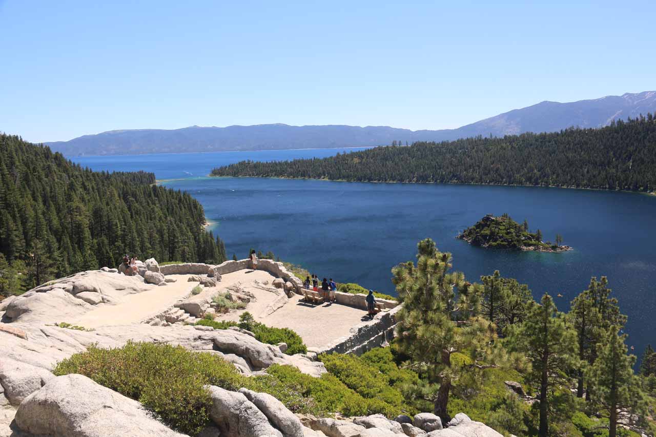
Near the sanctioned lookout area for the Emerald Bay Overlook, there was a signposted junction indicating to us that it was a one-mile hike along a graded unpaved road to descend to the historical Vikingsholm (a former Summer home said to be one of the best examples of Scandinavian architecture in the United States). It turned out that this hike was shared with the folks intending to visit Vikingsholm as well as the activities on offer down there (e.g. kayak tours to Fannette Island or swimming or picnicking on the beach along on or along Emerald Bay’s calm waters, respectively). Anyways, the hike down the road involved a pair of switchbacks. Throughout the descent, we were treated to different views across Emerald Bay as well as a few odd springs and runoff channels running along the cliffs then continuing beneath the road.

Lower_Eagle_Falls_150_06232016
The back side of the historical Vikingsholm
Towards the bottom of the descent, the road joined up with a smoother paved road (leading us to believe that there might have been an alternate way down here though we weren’t sure if the paved road was public or not). Going right at the paved road to continue heading towards Vikingsholm (now there were signs to help us along), we’d end up reaching the back of the building for the historical Vikingsholm after nearly 25 minutes from the start. Apparently, they run tours of the Summer home from 10:30am to 3:30pm from Memorial day until the end of September so this made us realize how this was just one of the ways we could have extended our hike into a half-day or full-day visit on the shores of Emerald Bay. In addition to Vikingsholm tours, we also noticed people engaging in kayak tours to Fannette Island, which also seemed to be quite popular, and there were picnic tables as well as beaches along Emerald Bay’s shores for a more relaxing (and less expensive) way to spend a day here.

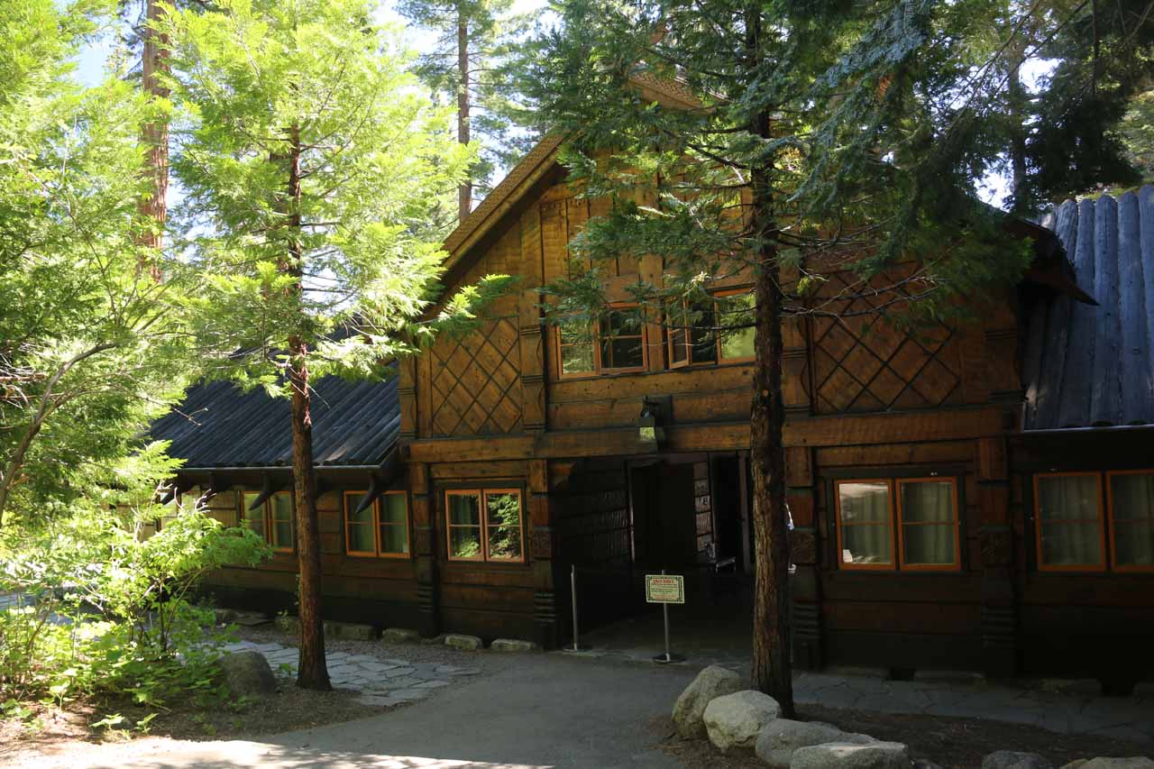
Anyways, beyond Vikingsholm, we continued following the signs towards the official trailhead of the Lower Eagle Falls. At roughly another quarter-mile beyond Vikingsholm, there was another wooden house that marked the start of the last 0.3 miles to the base of the falls. After being greeted by tall trees, the trail narrowed and meandered up along Eagle Creek towards a footbridge, where there was another trail junction. Across the footbridge, the trail continued on the so-called Rubicon Trail. But continuing on the trail along Eagle Creek (to the right) led us another 0.2 miles uphill to the viewing area for the Lower Eagle Falls and its refreshingly cool spray.

From this vantage point, we were only able to see the entirety of the lower of the two drops of Lower Eagle Falls. The upper drop could barely be seen between the trees. So again, this view left us wanting more, but there was no sanctioned way to experience the upper drop though we did notice some people make unsanctioned scrambles from Hwy 89 to the brink of the lower drop of the Lower Eagle Falls seeing the foot of the upper drop along the way. We don’t recommend doing this given the potential for a fatal accident so we were pretty content with the sanctioned views that we were getting. Since Mom and I had an early start, we pretty much had this viewing area to ourselves. However, as we started to hike back up to the Emerald Bay Overlook, we noticed scores of people heading down to this area underscoring this place’s popularity.

While the hike back up to the Emerald Bay Overlook was hot and sweaty, the fairly gentle grade of the road ensured that we could take our time and re-enjoy the views over Emerald Bay all over again. Overall, this hike wound up being about 2.6-2.8 miles round trip. It took us nearly 45 minutes to get down to the viewing area at the bottom of the falls, and it took us another 45 minutes to make it all the way back up (for a grand total of 90 minutes of hiking). The rest of the two hours we had spent away from the car was for taking photos and basking in the scenery around the shores of Emerald Bay at Vikingsholm. That said, it was very easy to spend a lot more time down here as we noticed so many other people intending to do (bringing things like ice chests, lawn chairs, swimming gear, and more).

Lower_Eagle_Falls_013_06232016
Lower_Eagle_Falls_019_06232016
Lower_Eagle_Falls_037_06232016
Lower_Eagle_Falls_040_06232016
Lower_Eagle_Falls_041_06232016
Lower_Eagle_Falls_045_06232016
Lower_Eagle_Falls_049_06232016
Lower_Eagle_Falls_054_06232016
Lower_Eagle_Falls_071_06232016
Lower_Eagle_Falls_078_06232016
Lower_Eagle_Falls_083_06232016
Lower_Eagle_Falls_087_06232016
Lower_Eagle_Falls_089_06232016
Lower_Eagle_Falls_097_06232016
Lower_Eagle_Falls_099_06232016
Lower_Eagle_Falls_105_06232016
Lower_Eagle_Falls_134_06232016
Lower_Eagle_Falls_067_06232016
Lower_Eagle_Falls_062_06232016
Lower_Eagle_Falls_063_06232016
Lower_Eagle_Falls_065_06232016
Lower_Eagle_Falls_157_06232016
Lower_Eagle_Falls_169_06232016
Lower_Eagle_Falls_182_06232016


From the Hwy 89 and Hwy 50 junction at the intersection of Lake Tahoe Blvd and Emerald Bay Rd in South Lake Tahoe, we headed north on Hwy 89 (Emerald Bay Rd). After about 8.5 miles there was the Eagle Falls Trailhead and Picnic Area on the left, which turned out to be one perfectly fine place to park for this excursion (as well as the Upper Eagle Falls excursion). However, just another 500 yards further along Hwy 89 to the right, there was the Emerald Bay Overlook parking lot, which was the starting point for Lower Eagle Falls as well as Vikingsholm and other activities down by the shores of the bay.

Given the popularity of this place, we want to impart a couple of things about logistics. First of all, this parking area can fill up fast (we showed up at around 8:30am when there were still some parking spaces, but by 10:30am, this place was packed as even the shoulders alongside Hwy 89 were full of cars). Needless to say, getting an early start ensures that you’d be free of the stress of finding parking.

Lower_Eagle_Falls_186_06232016
The crowded parking lot at the Emerald Bay Overlook. Notice how many cars are parked on the shoulder along Hwy 89 just to show you how packed the lot was in the late morning
The second thing we have to say is that the Emerald Bay Overlook was run by the California State Parks system so it had its own parking fee in addition to possible tour fees for some of the activities on offer there. The Eagle Falls Trailhead and Picnic Area was administered by the National Forest Service (as part of Eldorado National Forest) so there was a separate fee system in place there. Whichever parking lot you pick, just stick to one of them to avoid paying twice (one for each parking lot). Both parking areas are close enough to each other that you don’t need to move from one lot to the other. Since we had a National Forest Adventure Pass (very handy for the Lake Tahoe area since everything had a day use fee that seemed to be enforced), it would have been wise for us to park in the National Forest lot (i.e. the Eagle Falls Picnic Area and Trailhead) and walk to the Emerald Bay Overlook area just 500 yards further to the west along Hwy 89.

Finally, this drive took us about 25 minutes though a large chunk of that time was spent waiting for road construction to let us through. Again, an early start is imperative to avoid the stress of finding limited parking space because it’s very popular (as Emerald Bay seemed to be a much cleaner play area than the less cleaner beaches on the shores of South Lake Tahoe).

As for some geographical context, South Lake Tahoe was 62 miles (about 90 minutes drive) south of Reno, Nevada, 104 miles (2 hours drive) east of Sacramento, 139 miles (under 3 hours drive) north of Mammoth Lakes, 188 miles (about 3.5 hours drive without traffic) from San Francisco, and 443 miles (7.5 hours drive) north of Los Angeles.

Find A Place To Stay

Checking out the lowermost tier of the Lower Eagle Falls from the end of the trail to its base


360 degree sweep from Emerald Bay Overlook showing the entirety of Lower Eagle Falls as well as Emerald Bay and Fannette Island, then doing another closeup of just Lower Eagle Falls again


Upstream to downstream sweep of some cascades seen on the Eagle Creek from a footbridge on the Rubicon Trail

Related Top 10 Lists

No Posts Found

Trip Planning Resources


Nearby Accommodations


Tagged with: south lake tahoe, emerald bay, state park, vikingsholm, eldorado, el dorado, california, northern california, waterfall, fannette island, sierra nevada


Visitor Comments:

Got something you'd like to share or say to keep the conversation going? Feel free to leave a comment below...

No users have replied to the content on this page


Share your thoughts about what you've read on this page

You must be logged in to submit content. Refresh this page after you have logged in.

Visitor Reviews of this Waterfall:

If you have a waterfall story or write-up that you'd like to share, feel free to click the button below and fill out the form...

No users have submitted a write-up/review of this waterfall


Have you been to a waterfall? Submit a write-up/review and share your experiences or impressions

Review A Waterfall

Nearest Waterfalls

The Waterfaller Newsletter

The Waterfaller Newsletter is where we curate the wealth of information on the World of Waterfalls website and deliver it to you in bite-sized chunks in your email inbox. You'll also get exclusive content like...

  • Waterfall Wednesdays
  • Insider Tips
  • User-submitted Waterfall Write-up of the Month
  • and the latest news and updates both within the website as well as around the wonderful world of waterfalls


How To Build A Profitable Travel Blog In 4 Steps