About Kitchen Creek Falls
Kitchen Creek Falls sits within the typically hot and dry Cleveland National Forest about 50 miles east of San Diego.
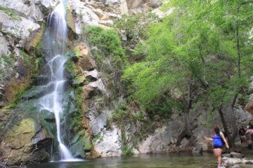
From what we were able to tell, seeing the falls flowing required quite a bit of timing as we could envision its flow easily become nothing by late Spring or early Summer. Ultimately, it depends on how much Winter rain has fallen in Southern California). Nonetheless, when it does flow (as it did for us), the falls are pretty impressive since it tumbles with a cumulative drop of a reported 150ft in desert-like terrain (thereby making this falls a bit of an oasis).
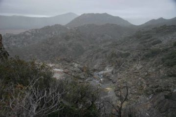
Now despite the fact that the falls sat quite close to the Interstate 8, we definitely had to work to get a view of the falls as it wasn’t easy. First, we had to hike for about 2 miles along the Pacific Crest Trail before leaving the trail at an easy-to-miss spur. On the initial two-mile stretch, we passed underneath the loud I-8 before the trail climbed alongside fences (some of which had holes cut into them). It seemed like those fences were meant to be deterrents for people illegally crossing the border (as further evidenced by Border Patrol vehicles routinely surveying the road where we parked the car). Anyways, as we went further on the trail, the sound of the freeway slowly faded (thankfully) and we could start to hear sounds a little more indicative of Nature (e.g. foliage rustling with the winds or the faint hissing of a stream).
Once we took that easy-to-miss spur trail (leaving the PCT), it didn’t take long before this trail degenerated into a cross-country scramble. It was here where we had doubts as to whether we’d find the waterfall since scrambling without an obvious trail can be pretty dodgy, especially considering we were out in the desert like this with the possibility of rattlesnake encounters. Plus, frequently brushing against hard, prickly desert vegetation wasn’t fun either.
Anyways, we started to hear the sound of the waterfall, which was clearly flowing well enough to be heard, and used that sound to lead us closer to its stream. However, we then eventually found ourselves at the top of the falls (which wasn’t quite visible from where we were at) and looking for a way down for a better look.
That was when we found a very steep scramble down a dry gully. It seemed a bit dicey as there were plenty of loose rocks that we managed to pry loose on the descent. The whole time we were cognizant of how steep it would be going back up as well! Once we got to the bottom of this descent, we had to cross the stream and do some additional rough scrambling until we finally got a satisfying view of Kitchen Creek Falls.
When we had our fill of this waterfall, we still had the non-trivial task of climbing back up the gully and then do some route-finding to regain the Pacific Crest Trail. So as you can see from the photos on the page, there was a bit of drama on our excursion as we were caught in a freak snowstorm (further adding to an already difficult scramble)!
Related Top 10 Lists
No Posts Found
Trip Planning Resources
Nearby Accommodations
This content is for members only. See Membership Options.Featured Images and Nearby Attractions
This content is for members only. See Membership Options.Visitor Comments:
Got something you'd like to share or say to keep the conversation going? Feel free to leave a comment below...No users have replied to the content on this page


Only logged in users can post a comment Please login or sign up to comment