About Etiwanda Falls

Etiwanda Falls was one of those waterfalls that Julie and I had previously overlooked over the years even though it wasn’t far from places like Bonita Falls and San Antonio Falls. But as we were starting to get tired of seeing the same local waterfalls over and over again (the California drought from 2012 to 2015 and counting didn’t help), it was about time that we finally resumed our search for local waterfalls we hadn’t done before; starting with this waterfall. The one thing that struck me about this waterfall excursion was that it was pretty much situated in a desert. Even though there were a lot of new housing developments in and around Rancho Cucamonga, which conspired to conceal or make less obvious the dry climate here, it was pretty clear that this area tended to see more heat waves and gusty Santa Ana winds than rainy days. So it was one of those places that I would’ve least expected to encounter a waterfall (and a real popular one at that!).
Further reinforcing the fact that we were indeed in the high deserts, we experienced one of the desert extremes on our first attempt at visiting this waterfall in late January 2015. That was when we were blasted with very strong Santa Ana winds that were probably around 50-70mph gusts. Such winds easily knocked down trees, made flying pebbles sting as they were kicked up and flung towards us, and made it hard for us to stand up straight. Under these conditions, we aborted the hike. Fortunately, our retry a week later took place without the strong winds, but then we were exposed to the arid conditions while being beat down by temperatures in the high 70s to low 80s with little shade throughout the hike. I can’t imagine how unbearable the hike would be later in the year when the temperatures could easily soar in the 90s or 100s.
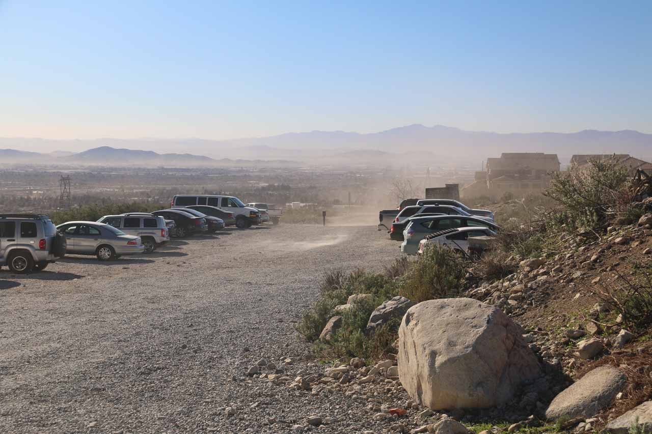
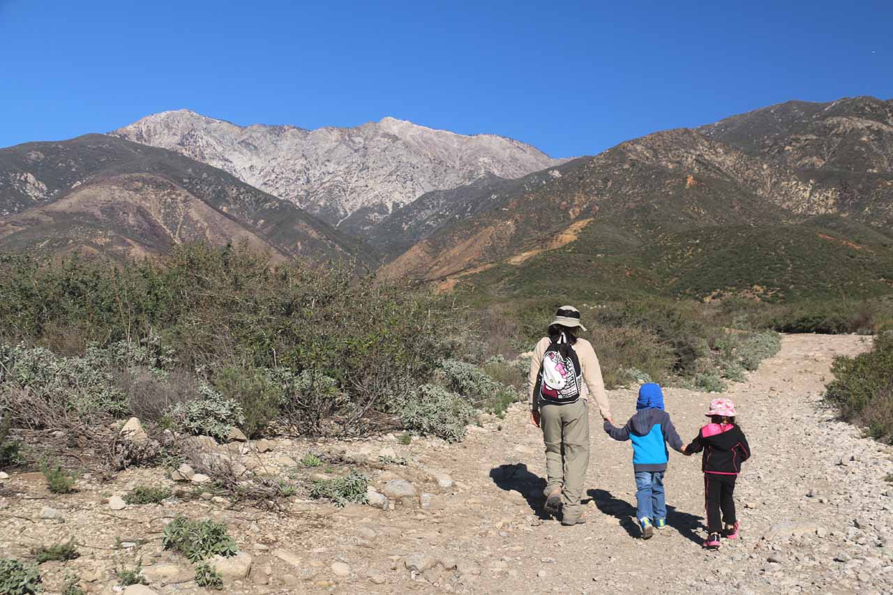
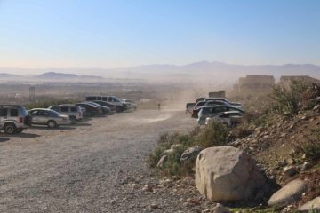
The hike began from the designated car park for the North Etiwanda Preserve (see directions below). It was next to some seemingly newly-built homes. And after finding a spot to park, we then headed directly north past a wide gate at the far northern end of the unpaved car park and fire road. We then continued hiking on the somewhat rocky fire road going past a large water tank, then continuing to snake our way north with some impressive foothills of the San Bernardino Mountains immediately ahead of us. The impressive scenery helped to keep our minds off the hot and sweaty uphill nature of the hike as it was pretty much all exposed to the sun. We also made sure to stay on the trail (very important when hiking with kids like we were) to minimize the threat of surprising a rattlesnake hiding in the desert shrubs flanking the wide trail.
After another half-hour from the gate (or an hour from the car park), we then reached a yellow gate. The climb somewhat flattened out at this point, and I was able to peer over my shoulder for glimpses of the impressive views of the basin. Less than five minutes after the yellow gate, there was a short spur trail leading to a vista point to better enjoy the views of the Inland Empire. This spot had a rock with graffiti that said “Frank’s Rock” though I doubted whether that was really the official name or not. Anyways, after a brief climb on the main trail, it then started to curve left just as we reached some kind of water contraption.
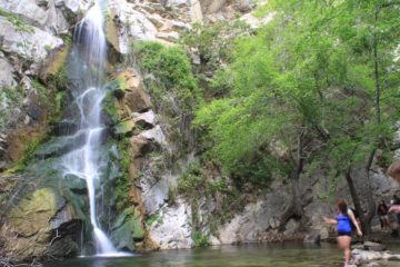
Anyways, back on the main trail, it made one last short climb before bending to the right. It was only at that point that the trail eventually started to disappear as it descended towards the stream responsible for Etiwanda Falls. There were several scrambling paths leading to more frontal views of the uppermost tier of Etiwanda Falls (see photo at the top of this page), but for all intents and purposes, the official trail pretty much led us to the brink of Etiwanda Falls. The dozens of folks who had made it here were pretty much playing in the stream above the falls.
The picture you see at the top of this page was merely the uppermost drop, which was probably about 15-20ft tall at best. It was definitely the most accessible of the tiers of Etiwanda Falls as it was a short and relatively simple scramble (just be careful) to get to that frontal view. There was then a shorter drop a short distance downstream, but that one was harder to appreciate given how steep and precarious the viewing spots were. The lowermost drop of Etiwanda Falls was definitely not safely visible nor accessible from this area.
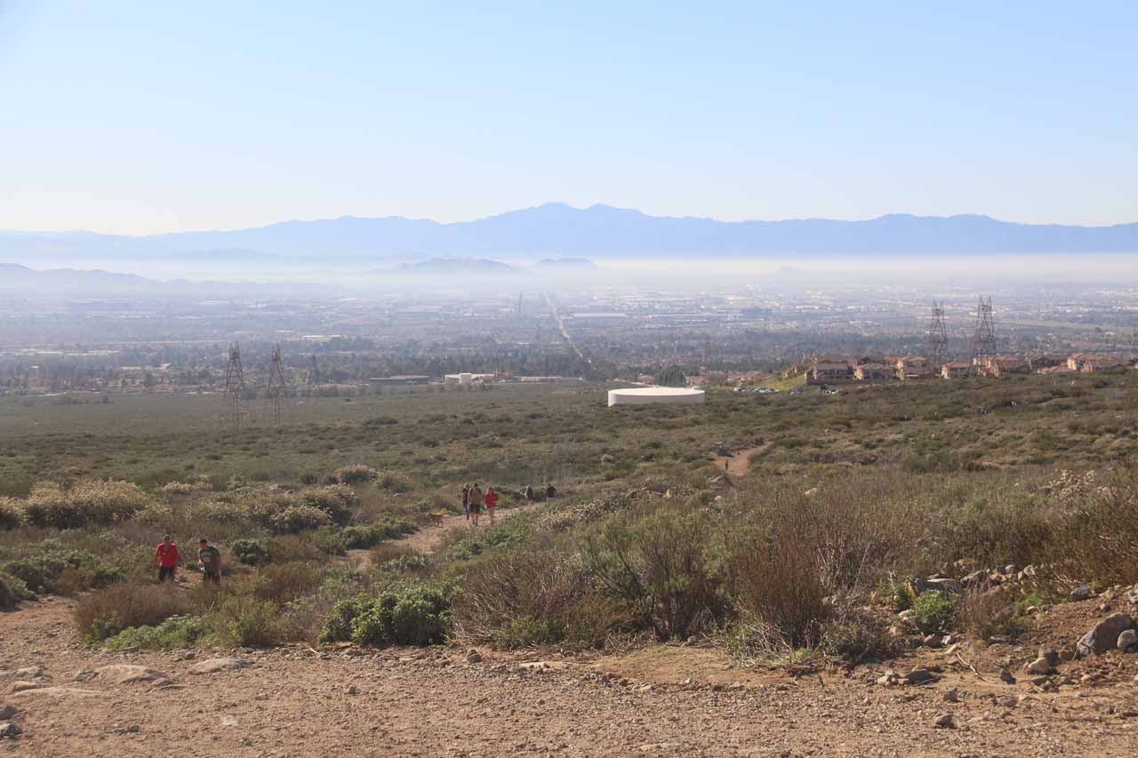
When we had our fill of Etiwanda Falls, we got to look forward to the all-downhill hike on the way back to the trailhead. An added benefit of the return hike was that the impressive vistas of the Inland Empire (smog haze and all) were pretty much consistently in front of us throughout the descent. When we were back at the trailhead, we had logged about 3 miles round trip, and we had spent roughly three hours away from the car. Again, because we were hiking with a bigger party that included three kids, we took our time so conceivably, this entire hike could be done in around two hours in an unhurried pace.
Related Trip Reports

Related Top 10 Lists
No Posts Found
Trip Planning Resources


Nearby Accommodations
This content is for members only. See Membership Options.Featured Images and Nearby Attractions
This content is for members only. See Membership Options.Visitor Comments:
Got something you'd like to share or say to keep the conversation going? Feel free to leave a comment below... Some more info about San Bernardino Mountains February 12, 2016 1:24 am - Not a big deal by any means but the picture on your site that shows the snow-covered San Bernardino Mountains with the caption "This is the view east in the direction of Big Bear (I'd imagine) and the last vestige of south-facing snow," captures San Bernardino Peak (left) and San Gorgonio Mountain (right). San Gorgonio… ...Read More
Visitor Reviews of this Waterfall:
If you have a waterfall story or write-up that you'd like to share, feel free to click the button below and fill out the form... Etiwanda Falls Should Be a Solid 2 On the Ratings Scale March 21, 2016 6:29 pm - My wife and I visited Etiwanda Falls on the first day of spring and we were pleasantly surprised by the beauty of the canyon (once you get up into it). We braved the descent to the (almost) bottom of the falls (she's a trooper). It is a strenuous scramble, but from here you get a… ...Read More
 That waterfall is just the beginning… July 31, 2015 4:30 pm - I have explored Etiwanda Canyon and Day Creek Canyon quite a bit and there are other water falls further up the canyons that most people never see. The ones to the left are most accessible and a short distance. Several of these have graffiti all over them. But if you follow the canyon up to… ...Read More
Only logged in users can post a comment Please login or sign up to comment