About Cedar Creek Falls

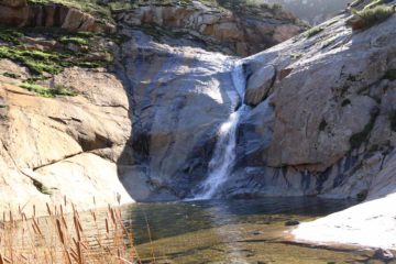
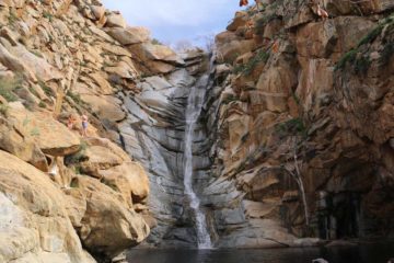
Cedar Creek Falls was certainly one of the most attractive (if not the most attractive) waterfalls in San Diego County. What made it so appealing was the bare rocks enclosing the rocky oasis-like grotto into which the vertical 80ft or so waterfall dropped. Adding to the scenic allure of the falls was some impressive mountain scenery backing the San Diego River basin. In fact, this waterfall seemed to grow so much in popularity in recent years (it definitely felt busier on our most recent visits in 2016 and 2017 than when I first made this writeup back in 2008) that the authorities now require permits to do this hike (more on this later).
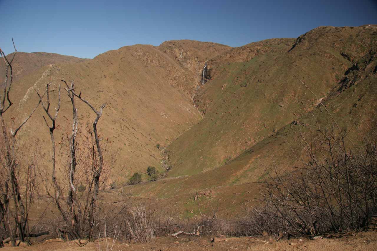
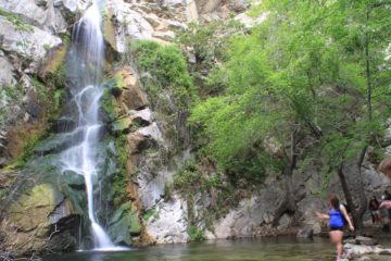
As you can see from the photo at the top of this page, the recognition and popularity was well-deserved. However, that picture was taken only a couple of days after a freak snowstorm hit the Julian area so it was pretty much at or near peak flow as far as I’m concerned. In our experiences, this waterfall tended to have a pretty short season, and it’s very dependent on how much snow had accumulated in the watersheds that ultimately drained into Cedar Creek. On Julie’s first visit to this waterfall back in early May 2001, it was completely dry. Recently in 2016 and 2017, we made visitd here at least a week or two after the previous major storm systems that passed through here. You’ll see in the photos below that the flow was noticeably less than the one shown at the top of this page. The bottom line is that the more time has passed since the last storm, the more limited the amount of water in the falls will be. Therefore, I’d say late Spring and Summer would not be good times to visit due to the lack of waterflow and the higher temperatures, which can be downright dangerous if you don’t know what you’re getting yourself into with this hike.
Speaking of the permits, the system was implemented around 2012 after too many injuries and fatalities had occurred on this trail as well as the cliffs surrounding the waterfall. We noticed on the online reservation site (the link can be found through the USDA website) that there was a daily limit of 75 group permits of up to five people per group issued per day. We managed to book our permit for a Saturday of our two most recent visits just a couple days prior to our arrival. We didn’t need to get permits on any of our visits prior to 2012. That said, I’d imagine availability can vary, especially with this falls maintaining its popularity on social media and on hiking blogs. In any case, by limiting access, it seemed to have curbed the number of rescues.
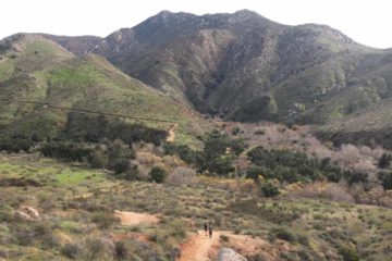
As for the hike itself, there are actually two different approaches to the waterfall – the west entrance at the San Diego Country Estates accessed from Ramona and the east entrance at the Saddleback Hill accessed from Julian (see directions to both trailheads below). Both trails require similar hiking distances of just under 6 miles round trip, and they’re both upside down hikes (meaning you descend to the falls and hike up on the way out). Therefore, despite the obvious trails and lack of off-trail scrambling, this hike can be deceptively strenuous. That said, of the two trails, by far the most popular method of doing this hike was from the Ramona side. I suspect the main reason for its popularity would be from the easy driving route to get there. It also didn’t hurt that the Ramona side arguably had better scenery en route to the falls. So I’ll first start with the trail description from the Ramona side.
[tabby] [tabby title=”Ramona Side”]West Entrance / San Diego River Trail (“The Ramona Side”)
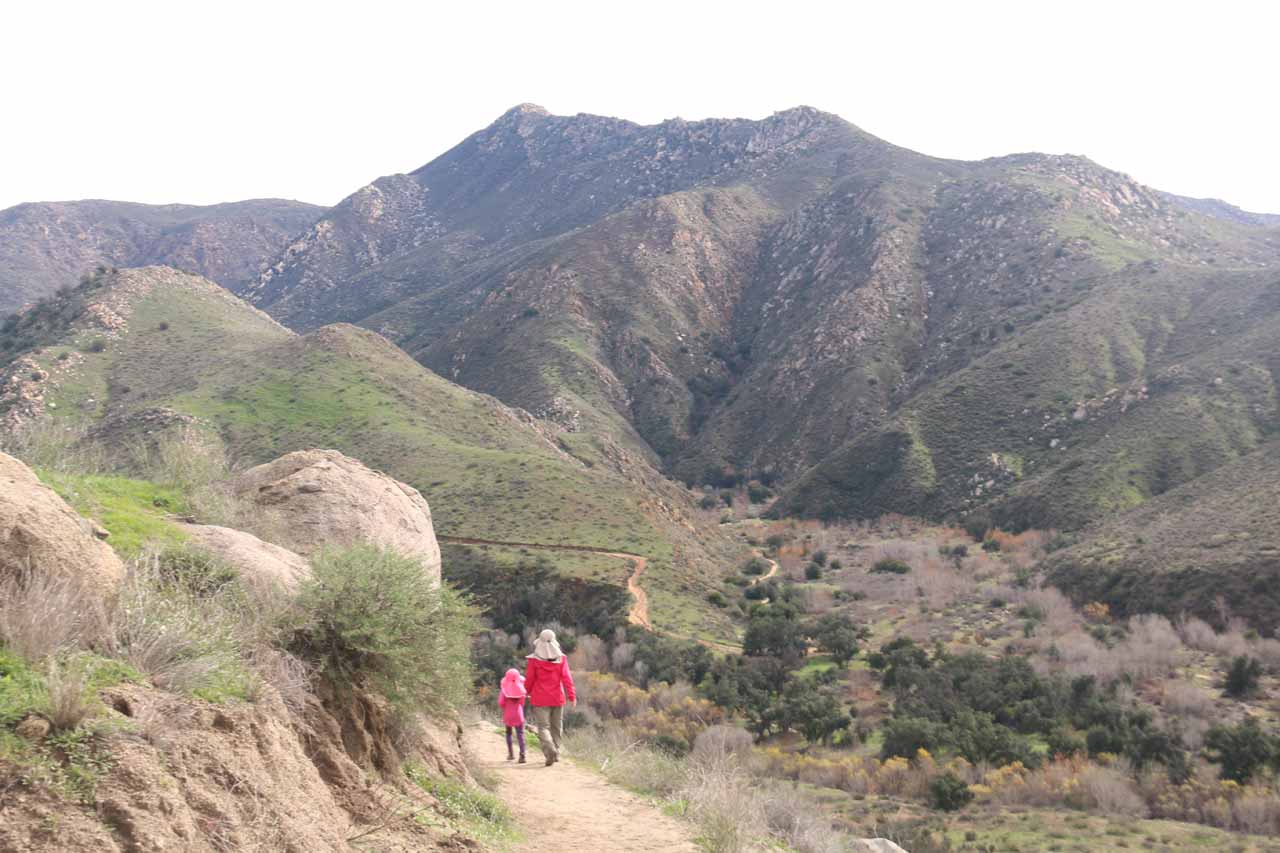
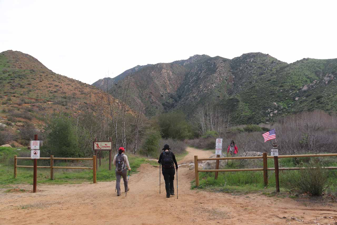
Once past the check-in area, the trail then immediately traversed a fairly wide and very sun-exposed path with increasingly nice views towards the San Diego River basin and its backing mountains. Following this well-used trail was pretty straightforward though it was pretty much downhill from the get go. It seemed like there were posts with trail signs indicating your progress on the trail, and these were spaced out at roughly a quarter-mile apart (at least towards the beginning). Later on, they became even more spaced out.
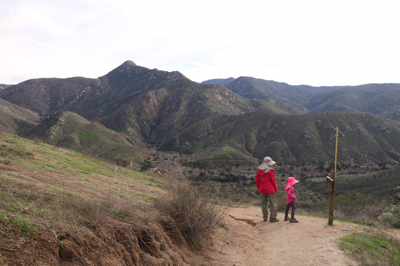
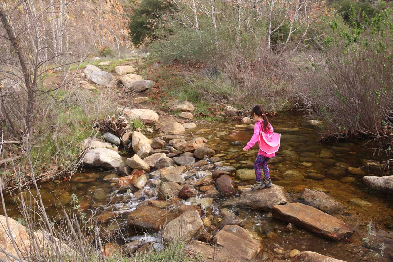
Once we got to the bottom, we had to cross the San Diego River, which in our experience was a pretty short crossing where someone had put a small log to facilitate the traverse without getting the feet wet. Shortly after the river crossing, we then reached a trail junction where the Saddleback Trail (or Eagle Peak Trail) was coming in from the left, the San Diego River Gorge Trail was continuing to the right, and the Cedar Creek Falls Trail continued straight ahead past some fencing. Naturally, we continued straight ahead past the fencing for the waterfall. By the way, this fence technically marked the entrance to the permit area, and there was still roughly a half-mile to go before arriving at the base of Cedar Creek Falls.
According to the signage, this long and mostly downhill hike was just under 3 miles. It took us around 75 minutes to get to the falls from the Ramona side trailhead (with a five-year-old hiking with us). However, the key thing to remember was that on the return hike, this three-mile stretch would be pretty much all uphill and exposed to the sun. We normally do this hike on cool winter days, but I can totally imagine how brutal this trail would be in the Summertime even though it would also be the time for people to want to be going for a swim in the large plunge pool fronting Cedar Creek Falls. That said, it took us over 90 minutes to return to the trailhead for a grand total of roughly 3+ hours spend away from the car.
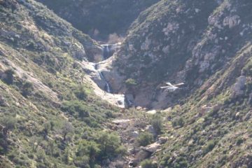
Speaking of swimming, it was no longer permitted to climb around the falls (that was part of the agreement when securing the mandatory permit to go on this hike). In our last couple of times in seeing this waterfall in 2016 and 2017, we noticed at least one helicopter doing a circle around the end of the trail. However, that hadn’t deterred some daredevils from scrambling up to one of the rock ledges and do a scary cliff jump into the deep plunge pool beneath Cedar Creek Falls.
[tabby title=”Julian Side”]East Entrance / Saddleback Trail (“The Julian Side”)
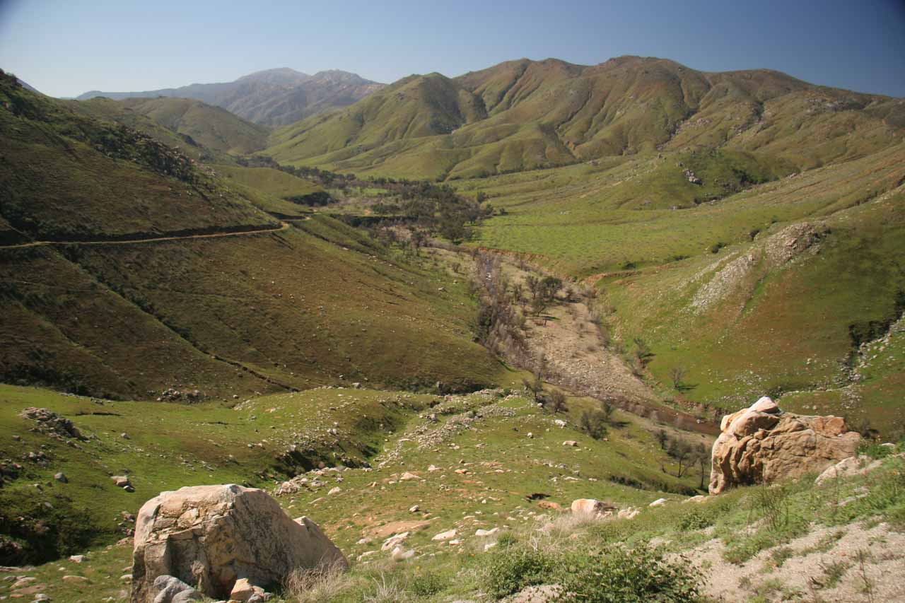
The trail then hugged the mountain and curved to the left as it flanked the ravine cut through by the San Diego River. As we got closer to the river level, we were able to look across the basin towards the San Diego Country Estates (formerly the Ramona Estates), where we could spot the water tank and some homes near its trailhead as well as the zig-zagging trail itself. Roughly half-way towards the bottom of the descent, there was a trail junction where the left path climbed then followed Cedar Creek for roughly 1/4-mile or so before reaching the top of Cedar Creek Falls. This trail detour was not necessary to get to the front of the waterfall, but when Mom and I first did this hike in 2008, we didn’t know any better (we even did a pretty dangerous scramble down a gully from the top of the falls to its base, which is now forbidden). By the way, this little detour entered the designated permit area so technically a permit would be required.
Like with the Ramona-side trail, when we returned back to the Saddleback Trailhead, we had to do a relentlessly long 2.5-mile or so uphill hike. Unlike the Ramona-side trail, the Julian-side trail actually had the benefit of some shade from the mountains that the trail was on. Furthermore, we only encountered a few hikers along this trail as opposed to the waves of hikers on the Ramona side. That said, we still managed to sweat a lot and drink most of our water during this uphill stretch even though we were here in the Winter each time we’ve done this side of the trail. I can only imagine just how much hotter and dehydrating it must be to do this hike on a hot day in the Spring and Summer months!
Overall, we spent about 3.5 hours on this 6-mile round trip excursion, which included the hiking as well as the time spent enjoying the waterfall. It should be noted that the trail description from the Ann Marie Brown book stated that the hiking distance was only 4.5 miles, but that was because she only went to the top of Cedar Creek Falls and back. I don’t think at the time of her writing that she ever made it to the bottom via the trails described on this page.
[tabbyending]Related Trip Reports

Related Top 10 Lists
Related Itineraries
Trip Planning Resources


Nearby Accommodations
This content is for members only. See Membership Options.Featured Images and Nearby Attractions
This content is for members only. See Membership Options.Visitor Comments:
Got something you'd like to share or say to keep the conversation going? Feel free to leave a comment below... Cedar Creek Falls Closed July 27, 2011 4:01 am - Cedar Creek is currently closed....Sad really, beautiful falls. This was a tough hike but well worth the reward. ** A teenager died falling from one of the tiers** ...Read More Cedar Creek Falls – Caution Against Hiking in Hot Weather! July 19, 2010 5:22 am - We hiked to the Cedar Creek Falls on Sunday, July 18th, 2010. This was a VERY Difficult hike!!! We are probably not coming back. We hiked from the Ramona, Thornbush, side and it is very steep going down. As we made our way to the first patch of shade we found a couple there, who… ...Read More Cedar Creek Falls Blu3Fish June 28, 2010 5:15 pm - Very nice swimming hole and falls. We hiked there in Spring of '09 and the water was flowing (don't remember month sorry). If you are up for the rocky scramble, the top of the falls was quite amazing also. You can actually get in the water (3-4 feet deep) and lay/float with your head looking… ...Read More
Visitor Reviews of this Waterfall:
If you have a waterfall story or write-up that you'd like to share, feel free to click the button below and fill out the form... My dog and I love the hike and the falls (Cedar Creek Falls) June 19, 2011 10:21 pm - Rocky (black lab mix) and I hike 3-6 miles per day in the Ramona area. We hiked down the new trail to the falls from the Ramona side on Friday, June 10, 2011. We started about 4:30 p.m. bringing enough water for both of us (a hydration pack for me, a 24 oz. bottle for… ...Read More
Only logged in users can post a comment Please login or sign up to comment