About Bonita Falls
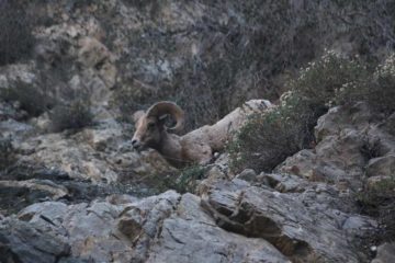
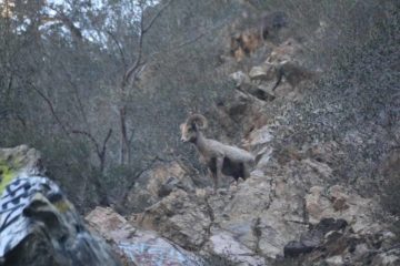
Bonita Falls was one of those waterfalls where you really had to look past its flaws (most of which were human-induced) in order to appreciate its true beauty and the fun experience to get to it. On one of our visits here, we even managed to get a surprise visit from bighorn sheep! Indeed, we got to experience both the good and the bad and ugly with this falls.
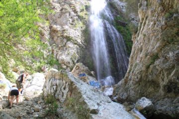
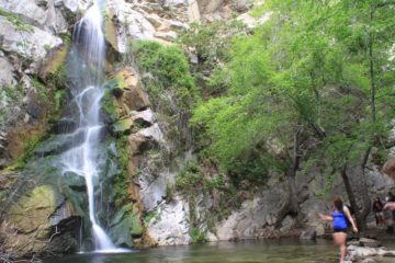
Speaking of the falls, it was one of the taller waterfalls in Southern California as it’s said to have a cumulative drop of some 400ft. However, we were only able to see its final 90ft drop from its base (shown in the photo above) as well as a very distant view of one of its upper drops (possibly 100ft or higher) from a nearby private campground turnoff. Adding to the allure of this waterfall was the adventure we had to go through involving a fording of Lytle Creek in high flow, a rough boulder scramble in a wash, and then a little bit of some rock scrambling to get right in front of the falls.
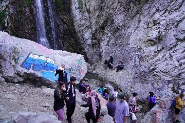
The only real bummer with this falls was the presence of insane amounts of graffiti and litter all throughout the hike (you might have guessed this already from looking at the photos on this page). Although I’ve seen such poor displays of respect for Nature in places like Eaton Canyon Falls and Hermit Falls among others, I think this one by far took home the crown for the most trashed waterfall that we’ve been to so far in the Southland.
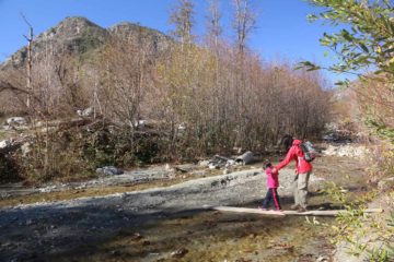
The adventure started after parking the car in one of the pullouts in the area around the confluence of Middle Fork and South Fork of Lytle Creek (see directions below). Once we got out of the car and scrambled down towards the banks of Lytle Creek, we then had to look for a place to cross that creek in order to access the wash on the other side. On my first visit here, the creek had high flow so I thought it was treacherous enough to employ river crossing techniques seen in survival shows (or at least be willing to turn back if the creek was deeper than my thighs). By river crossing techniques, I meant that I had to look for the widest part of the creek or river, unhook the waist belt of my pack, face upstream, and use a stick for added balance. For added comfort (and to prevent ruining my hiking boots), I actually crossed Lytle Creek in Keens and then changed into hiking boots once I got past the creek crossing.
Anyways, the hiking boots were definitely needed because the next phase of the adventure involved walking a wide and bouldery wash. It was here that the thought of twisting an ankle did cross our minds, even though we were wearing proper footwear.
So while in the wash, we made a beeline for the south (left) wall of the South Fork of Lytle Creek. We did this because the waterfall “trail” itself lacked any signage indicating its presence, and the south wall was the nearest wall after the creek crossing, which served as sort of a trail guide for us since we knew that we had to leave the wash on this side at some point (roughly a half-mile or so from the creek crossing). Without the wall serving as our trail guide, we potentially could have missed the part of the trail that left the very wide and bouldery wash.
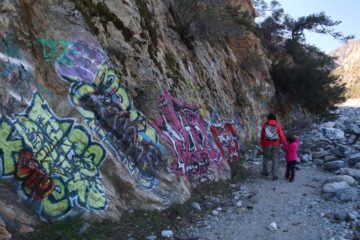
Thus, we figured that on a first visit, hugging the south wall might be the easier thing to do even though the hiking might be slower going. But on the return, hiking the flatter and more sun-exposed trails of use within the wash would make for a quicker exit.
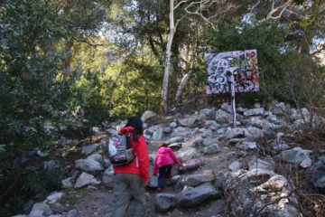
Anyways, once we reached the fairly easy-to-miss footpath about a half-mile from the creek crossing (there were more trees and vegetation surrounding this escape from the wash hinting at the presence of water), we then promptly climbed up some more conventional trails, which even passed by a reassuring sign a bit above the wash itself. It was too bad the sign didn’t say anything and it was covered in graffiti, but that sign kind of mentally assured us that we were on the right path to Bonita Falls.
At the base of the falls, it was possible to do a little more scrambling to get right up to the pool beneath the main tall drop of the falls. It seemed the intensity of the graffiti was maximized around the waterfall itself, which illustrated just how defiled this otherwise beautiful waterfall was. That said, this was also the place where we saw icicles spreading out from the upper reaches of the falls while bighorn sheep were grazing high up on the cliffs nearby.
Given how steep the surrounding cliffs were, we had to be cognizant of the rockfall and icicle danger. So we stayed as far away from the cliff walls as we could, and we didn’t linger longer than we needed to. In fact, the bighorn sheep we saw were inadvertently kicking down rocks, which rapidly tumbled to the base of the falls. Getting hit by one of these rocks would definitely cause injury, and it just illustrated the inherent dangers of a place as beautiful as this.
In addition to the falls (and the sheep), I also made a steep scramble up the south side of the canyon (before the final dead-end containing the waterfall itself) up to where there was a trio of tiny caves as well as the possibility of glimpsing the main waterfall rising above the foliage. I only managed to scramble up to two of the three caves and didn’t see the upper tier during my visit. But like the rest of this side canyon, these caves were also loaded with graffiti. I even noticed toilet paper soiled with poop left right in front of one of the caves.
All in all, it took me roughly 30 to 45 minutes in each direction to cover the roughly 1.5- to 2-mile return hike and scramble. When Julie, Tahia, and I did this hike as a family, we spent roughly 2.5 hours away from the car (a bit longer than the 90 minutes I had spent when I did this hike solo four years prior).
Related Top 10 Lists
No Posts Found
Trip Planning Resources
Nearby Accommodations
This content is for members only. See Membership Options.Featured Images and Nearby Attractions
This content is for members only. See Membership Options.Visitor Comments:
Got something you'd like to share or say to keep the conversation going? Feel free to leave a comment below...No users have replied to the content on this page


Only logged in users can post a comment Please login or sign up to comment