About Phantom Falls

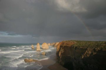
Phantom Falls was the last of the waterfalls in Victoria that we visited in the Great Ocean Road vicinity, which happened to be an area so full of waterfalls that visiting this one was almost an afterthought. But as you can see from the photo above, this 15m falls on the St George River was attractive and worth the effort to reach. Each time we’ve made a visit (once in November 2006 and another in November 2017), the falls had healthy flow though I’ve seen other photos in the literature showing the falls with even more volume and width. That said, just the fact that this waterfall was flowing on that first visit when southeastern Australia was caught in a nearly decade-long drought certainly made me think of this falls as a pretty reliable one.
It seemed like there was more than one way to hike to this waterfall, but Julie and I took an out-and-back hike from the Allenvale Road access (see directions below), which took us about 90 minutes to cover the 3.6km round trip distance. The mostly uphill track pretty much meandered alongside the St George River, including going through some private property, which made this somewhat of an unusual hike.

The climb seemed like it was endless as it kept going up for the next 500m or so. The steepest part of the climb was near the apex, and it was steep enough to make me feel like each step was burning my calves. Once we got past this relentless climb, we were well above the gorge carved out by the St George River. By then, the track had flattened out and meandered alongside the southern rim of the gorge with the river rushing audibly below. Eventually, after 1.6km from the start, we reached a pair of signposted trail junctions leading to other trails and trailheads. Sticking to the waterfall route, shortly thereafter, we reached a signposted spur a short distance before the main track was about to cross over a ford (above the target waterfall).
Taking the spur track, it steeply descended a couple of switchbacks with railings to hold onto. The track was also alongside some surprising water pipes (possibly to divert some of the St George River for agricultural purposes like that private property we had passed through earlier) before reaching the banks of the river below. That was when we were finally face-to-face with the Stevenson Falls and its well-shaded plunge pool and alcoves. While this was one of the more unsung waterfalls of the Angahook-Lorne State Park (let alone the Great Otway National Park), there were still a surprising number of people sharing the falls with us on each of our visits here.
I suspect that the presence of people could be due to the fact that there were multiple ways to hike to the falls in addition to the Allenvale Car Park approach that we took. According to the maps, it appeared that the Erskine Falls Road approach near the Cora Lynn Car Park could be a slightly shorter approach distance-wise though that would involve going across the St George River ford that we avoided at the top of Stevenson Falls. In any case, despite the misleading signage at the Allenvale trailhead suggesting the hike to the falls was either 2.5km each way or 2.5km round trip, according to my GPS logs, we went 3.6km round trip (or 1.8km in each direction).
Related Trip Reports

Related Top 10 Lists
No Posts Found
Related Itineraries


Trip Planning Resources


Nearby Accommodations
This content is for members only. See Membership Options.Featured Images and Nearby Attractions
This content is for members only. See Membership Options.Visitor Comments:
Got something you'd like to share or say to keep the conversation going? Feel free to leave a comment below...No users have replied to the content on this page
Visitor Reviews of this Waterfall:
If you have a waterfall story or write-up that you'd like to share, feel free to click the button below and fill out the form...No users have submitted a write-up/review of this waterfall
Only logged in users can post a comment Please login or sign up to comment