About Pelverata Falls

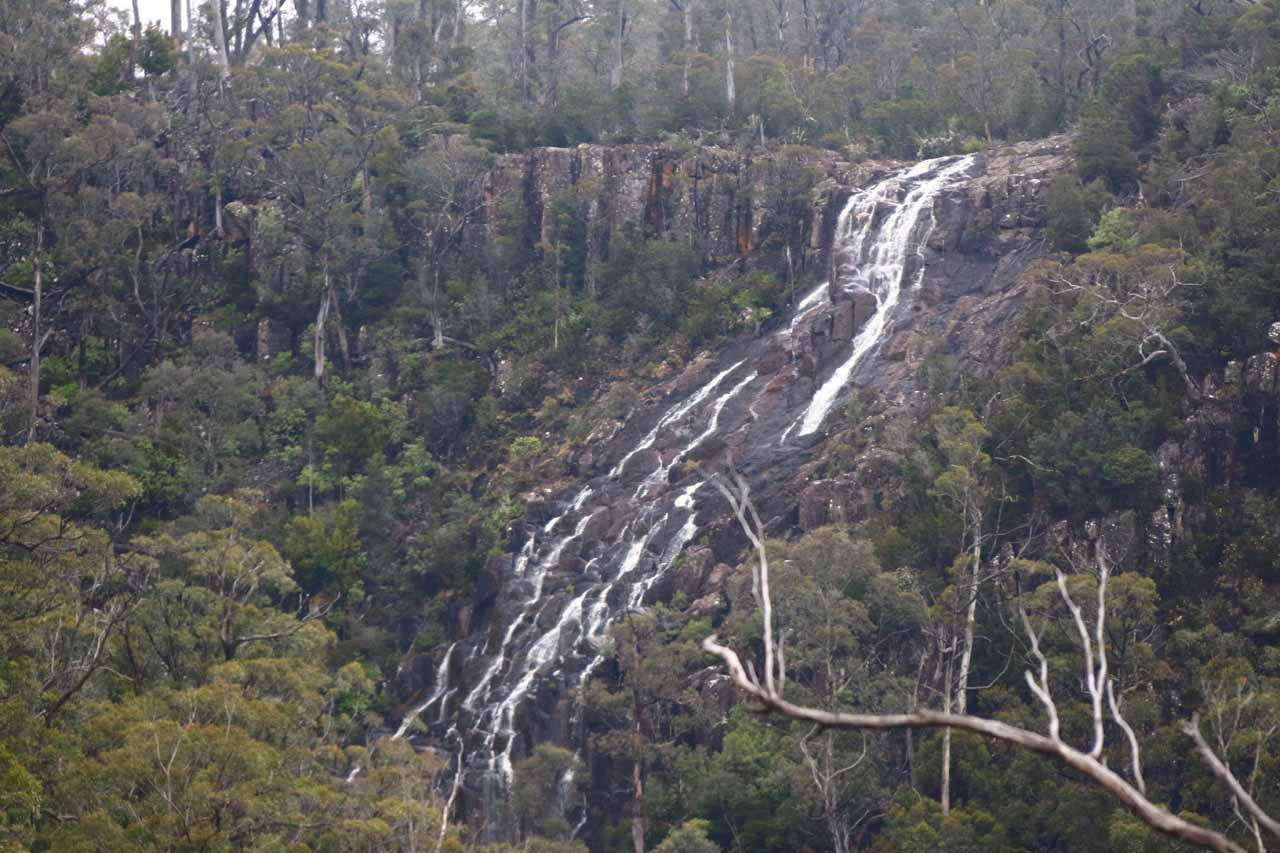
Pelverata Falls was an attractively tall waterfall that was said to be 114m tall. The main drop didn’t look to be that tall, but the overall height figure might have included the cascading tiers further downstream as the Pelverata Creek raced to the bottom of the steep ravine before eventually draining into the Huon River. I must have been lucky on both of my visits to be seeing this waterfall flowing (especially on my second visit, whose state you can see pictured above), because I’ve been told that this falls tended to not have a long life without significant rains replenishing its creek. On my first visit in late November 2006, the falls had a more diminished flow as much of Southeastern Australia (Tasmania included) went through a nearly decade-long drought, but it was still flowing!
Adding to the scenic allure of Pelverata Falls was that the same excursion yielded a second waterfall sighting on Slippery Creek, which was aptly called Slippery Falls. This cascading falls tumbled on the opposite side at the head of the gorge containing both Pelverata and Slippery Creeks. Even though I was only able to get a distant look at it, a good zoom could bring it closer. Perhaps the only trick about this additional waterfall as to not make the mistake of thinking it was the Pelverata Falls and prematurely turn back (which I almost did the first time I came here). In any case, given all these impressions, I tended to think of this waterfall excursion as one of Tasmania’s more rewarding ones despite its apparent need for a little luck and good timing.
Immediately from the car park (which can be muddy as it was when I did this hike the second time after a rain storm), the track started off wide and pretty open as it skirted the boundaries of a private farm. For the most part, the track typically was shaded by trees on at least one side since it was practically at the edges of the Snug Tiers Nature Recreation Area. Signs were set up at each fork or trail junction to keep hikers on the path and out of the private property.

As the track transitioned from narrow dirt into loose rocks, the hike became even more rugged as there would be dropoffs on one side without ever being completely certain about how stable the loose rocks were on the track. It was also in this stretch of track that Slippery Falls started to come into view in the distance. Given the rough nature of this part of the hike, it was easy to think that Slippery Falls was the Pelverata Falls, and then turn back prematurely. Don’t make that mistake!
So I kept persisting on the rocky part of the track as I even encountered one fairly non-trivial scramble where I had to climb a small rock face as the track was severely eroded. There was an orange arrow put on a tree up above that assured me that I was not only going the right way, but it provided the hint I needed to know where to go next. Beyond the orange arrow, the views of Slippery Falls continued to improve and shortly after that, the track then started descending steeply just as I was starting to hear the sounds of falling water from Pelverata Creek. After about 125m of the steep descent, I reached the familiar lookout platform with the view up towards the Pelverata Falls.
I was told that it was possible to continue the descent towards Pelverata Creek, but I didn’t bother as the sanctioned track was already rough enough. In any case, the lookout platform allowed me to better appreciate the cliffs supporting the tall waterfall, but I was also too far up the gorge to see Slippery Falls anymore. Since the falls was facing west, it might be better seen in the afternoon if it was sunny, but since I came early enough in the morning on each of my visits, the sun either didn’t penetrate through clouds or it still hadn’t breached high cliffs flanking the falls.
After having my fill of the falls, I then climbed back up to the rocky part of the track, and after some tricky scrambling past the rock obstacles by the orange arrow, the rest of the hike was a straightforward downhill hike all the way back to the car park.
Related Trip Reports

Related Top 10 Lists
No Posts Found
Related Itineraries


Trip Planning Resources


Nearby Accommodations
This content is for members only. See Membership Options.Featured Images and Nearby Attractions
This content is for members only. See Membership Options.Visitor Comments:
Got something you'd like to share or say to keep the conversation going? Feel free to leave a comment below...No users have replied to the content on this page
Visitor Reviews of this Waterfall:
If you have a waterfall story or write-up that you'd like to share, feel free to click the button below and fill out the form...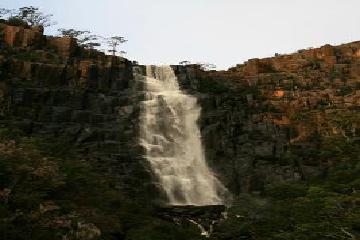 Pelverata and Snug Falls May 2, 2016 11:58 pm - A couple of pictures from Snug and Pelverata Falls in Tasmania after some good rain. Both falls were spectacular, especially Pelverata. I have visited both of these falls many times, but never with this much water flowing. ...Read More
Only logged in users can post a comment Please login or sign up to comment