About Crater Falls
Crater Falls was a series of small cascades and waterfalls where each drop was on the order of 5m to 10m tall though the cumulative height could very well be on the order of more than 30m or so. Given the dense vegetation surrounding Crater Creek, we weren’t able to appreciate all of the drops of the waterfall in one view. Instead, we experienced each small drop separately where the most impressive of the waterfalls was probably the lowermost (and first) tier, which featured a narrow chute that plunged about 5m into some shady forest cover. Another cascade further upstream that was of similar size but fell in multiple drops in succession (pictured above) was also just as attractive. The waterfall series ended with a small upper cascade above the forest cover roughly over 100m from the first drop.
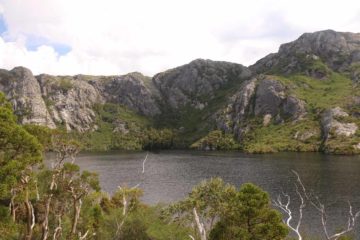
In my mind, Crater Falls was more of an incidental side attraction to longer hikes leading to lookouts and lakes. On our first visit back in late November 2006, Julie and I did the 3.6km round trip hike (nearly two hours return) just to the base of the first waterfall from the Ronny Creek car park and shuttle stop. However, it felt like a lot of work for such a tiny waterfall. We wisened up on on a second visit here in late November 2017 when we extended that same hike another 600m or so to Crater Lake taking in other aforementioned tiers of the waterfall as well as the glacial lake itself, which was fringed by 200m knobby cliffs. It took Julie and I about 2.5 hours to do that longer roughly 5km return hike.
For a wordseye view of the more modest hike that Julie and I took, we’ll take you from the Ronny Creek Trailhead to Crater Lake and back. From the trailhead, we followed along a boardwalk that more or less followed Ronny Creek through a wide open buttongrass moorland that reminded me very much of the type of brown tussock grassland scenery we encountered while hiking in the volcanic Tongariro National Park in New Zealand’s North Island. During this boardwalk stretch, we encountered several sightings of wombats and echidnas happily grazing on the long grasses here.
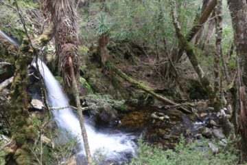
Eventually at around 300m past the Horse Track junction and the start of the forest cover, we reached the lookout for the bottom of Crater Falls, where there was a rest bench as well as a viewing platform. The track continued climbing steeply up wooden steps alongside other cascades of Crater Falls. One of the cascades was an attractive multi-tiered one fringed by large boulders that involved a short spur scramble to reach, and it was the one pictured at the top of this page. As the track continued climbing, it eventually left the forest cover and became more semi-exposed bushlands with some higher elevation trees as it skirted by another spur track for the uppermost cascade of Crater Falls.
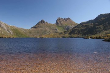
For the remaining 600m or so, the track continued to climb moderately up steps as the knobby cliffs fringing Crater Lake were getting closer. The climb at this point felt more on the relentless side though it offered attractively expansive views back towards the Ronny Creek Trailhead way in the distance. Eventually at nearly 2.5km from the trailhead, we reached a boat shed shelter right by the mouth of Crater Lake. This was pretty much our turnaround point though I spent some extra time exploring parts of the southwestern fringes of the calm lake. The knobby cliffs fringing the steeper northern and eastern fringes of the lake really made the scenery here stand out.
That said though, I felt that lakes were best seen from the top down and not from near its shores and so in hindsight, I probably should have taken the extra time to keep climbing up to Marion’s Lookout to at least look back over Crater Lake as well as look in the other direction to Dove Lake with Cradle Mountain as well as smaller lakes like Lake Wilks and Lake Lilla. I could have even descended to the Wombat Pool and Lake Lilla to make a circuit out of the hike we just did. In any case, we returned back the way we came in a predominantly downhill hike where we took advantage of the downhill momentum to make good time, and we got to watch wombats and echidnas grazing against back in the buttongrass moors by the trailhead.
Related Top 10 Lists
No Posts Found
Trip Planning Resources
Nearby Accommodations
This content is for members only. See Membership Options.Featured Images and Nearby Attractions
This content is for members only. See Membership Options.Visitor Comments:
Got something you'd like to share or say to keep the conversation going? Feel free to leave a comment below...No users have replied to the content on this page
Visitor Reviews of this Waterfall:
If you have a waterfall story or write-up that you'd like to share, feel free to click the button below and fill out the form...No users have submitted a write-up/review of this waterfall


Only logged in users can post a comment Please login or sign up to comment