About Champagne Falls and Bridal Veil Falls

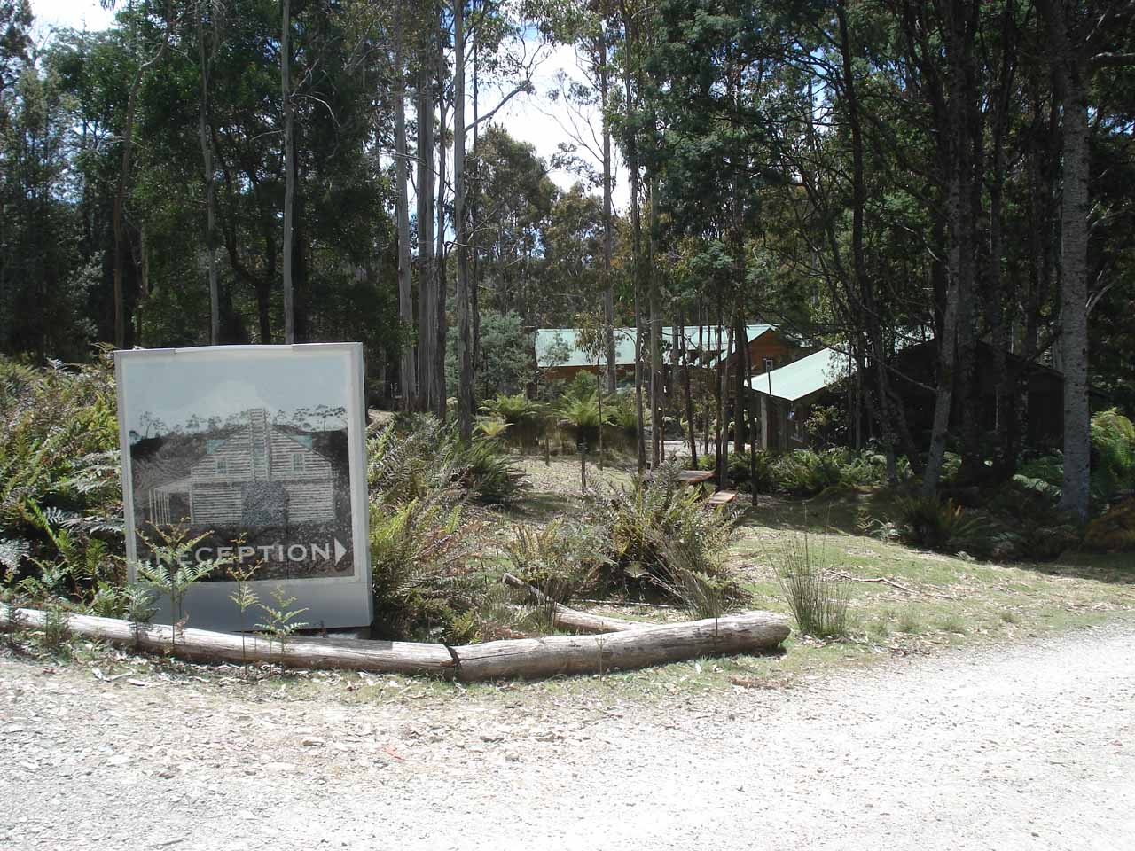
Champagne Falls and Bridal Veil Falls were a pair of attractive waterfalls that we combined into a single excursion that began and ended at the Lemonthyme Lodge Wilderness Retreat. Although each waterfall could have been done individually as separate excursions, we decided to visit both in one slightly longer but non-trivial hike. After all, it didn’t make sense for us to make two trips to this fairly less-traveled part of Tasmania. In any case, both waterfalls were quite different in shape and character. Bridal Veil Falls (pictured at the top of this page) had a taller (about 20m) and potentially wider drop (depending on the volume of Bull Creek) while 15m Champagne Falls (pictured further below) had a mossy and more rounded segmented appearance.
In terms of effort, each waterfall was about the same distance from the Lemonthyme Lodge (said to be 1 hour 45 minutes return walk according to the signage). However, given the very steep hill we had to climb at the very start of the track, it didn’t make a whole lot of sense to do both waterfalls as two separate hikes. So as mentioned before, we combined the two hikes as a slightly longer loop hike. The following trail description is based on this slightly longer looping route.
Next, the track continued to climb briefly for another 400m before it finally started to reach the apex and level out somewhat. We didn’t pursue a fork that continued climbing on our left though a barricade and lack of signage suggested that it wasn’t worth pursuing anyways for hikers. Shortly after the apex, we then reached a signed fork in the road, where the track on our right descended steeply into the forest towards Champagne Falls. So we went right and took this path to embark on the looping part of the hike.
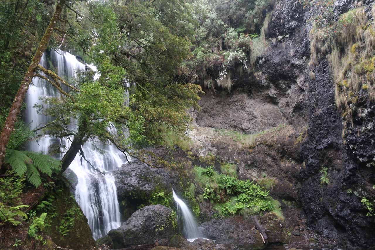
While it was awkward at best to view the waterfall from the signpost, I managed to carefully scramble my way down to Bull Creek for a more frontal view of the waterfall, which might have been overwhelming to see from this close. So in addition to the views from within the slippery rocks of the creek, I also managed to find an outcrop a short distance downstream where I was able to look back at a more contextual (albeit overgrown) look at Champagne Falls flanked by interesting dark cliffs.
Once I had my fill of Champagne Falls, I then went back up the steep track to the signed junction. I definitely had to fight the temptation to take one of the false tracks along the cliff walls. Once on the correct connecting track, we then followed along a fern-flanked path with some stepping stones and boardwalks as well as other numbered signposts along the way. The connecting track would eventually cross the Bull Creek then undulate along the northern banks of the creek (passing by some very minor cascades en route) before ultimately arriving at another bridge over Bull Creek right in front of the Bridal Veil Falls. When we first came here in late November 2006, the bridge was merely a one-sided log, but on a return trip 11 years later, it was a more legitimate bridge with handrails on both sides.
After getting our nice frontal views of Bridal Veil Falls from the bridge, we then climbed up steps that led us back up to the 4wd track that we had forsaken earlier. At this point, it was a predominantly downhill hike on the much wider and more open 4wd track eventually taking us past the Champagne Falls Track junction and then to the familiar picnic area as the road descended even more steeply. The temptation was great to run all the way down the road to the car park, but the presence of rocks and the likelihood of things falling out of pockets tempered that desire. Ultimately, it took us around 2.5 hours to do the entire excursion though I believe spending 3 hours would make for a more leisurely visit.
Related Trip Reports

Related Top 10 Lists
No Posts Found
Related Itineraries


Trip Planning Resources


Nearby Accommodations
This content is for members only. See Membership Options.Featured Images and Nearby Attractions
This content is for members only. See Membership Options.Visitor Comments:
Got something you'd like to share or say to keep the conversation going? Feel free to leave a comment below...No users have replied to the content on this page
Visitor Reviews of this Waterfall:
If you have a waterfall story or write-up that you'd like to share, feel free to click the button below and fill out the form...No users have submitted a write-up/review of this waterfall
Only logged in users can post a comment Please login or sign up to comment