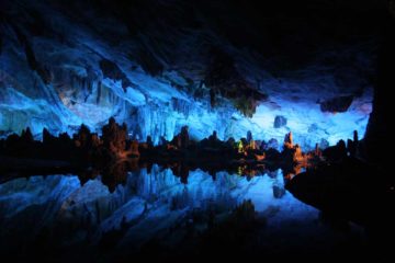
About Zengoro Waterfall (Zengoro-no-taki [善五郎の滝])

The Zengoro Waterfall (Zengoro-no-taki [善五郎の滝]; or just Zengoro Falls) was the third of three significant waterfalls that we visited on the Koonogawa (Koono River), which was the main river passing through the famed Norikura Highlands draining east of Mt Norikura on its way to the manmade Azusako (Lake Azusa). This modestly-sized falls (at least compared to the other waterfalls on the Koonogawa like Bandokoro Falls and Sanbon Falls) was said to be 30m tall and 10m wide. In trying to understand the translation of the falls’ name, I learned that the falls was said to be named after a local lumberjack who was apparently proficient at catching fish at this falls. However, one fish was huge and managed to drag him into the waterfall’s plunge pool. The lumberjack survived, but since that incident, the villagers started referring to this falls as the Zengoro Falls.
Of course instead of the fish that the lumberjack Zengoro was known to have caught, the kind of wildlife that was more pertinent to us hikers was the presence of bears. In fact, we noticed some hanging pipes with sticks to strike them with. So in essence, these contraptions acted like bear bells strategically placed throughout the trail as a sort of a means to try to scare bears away should a close encounter occur near any one of these pipes.
So from the unsigned large car park clearing, we had a choice of taking a shaded trail alongside the Koonogawa (which was a small stream at this point) or walking across the large car park or clearing, which had another trail starting at its opposite end. The trail eventually merged up with the trail that initially hugged the Koonogawa before veering away and descending steps and switchbacks towards the bottom of the gorge. About 120m downhill from the end of the clearing was that aforementioned overlook with a partial view of the Zengoro Waterfall backed by the peak of Mt Norikura. Shortly downhill from this overlook was a trail junction where we went right to continue descending towards the bottom. The trail on the left led another 0.5km to the aforementioned signposted trailhead that we didn’t start at.
After another 150m or so of switchbacks and stair-stepped descents, we then crossed a bridge over the Koonogawa before going up to another bridge that fronted the impressive Zengoro Waterfall. In addition to the views from the bridge itself, there were also viewing spots on the far side of the bridge for a closer and mistier look, and there was also a more elevated viewing area on the front side of the bridge. The trail actually continued climbing above this particular view, but we didn’t pursue going any further as it would ultimately lead up to the National Park Vacation Center in another 600m or so.
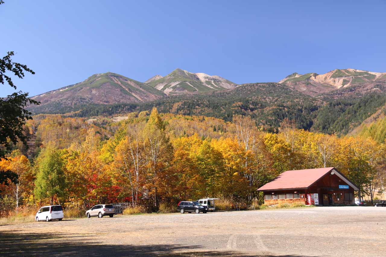
On the return hike, we decided to go across the large clearing that doubled as a car park. And when we did so, we were treated to a nice surprise as we had a nice view back towards Mt Norikura fronted by trees that just started to change color. Perhaps the only thing marring this view was the presence of construction vehicles parked in the middle of the clearing.
Related Trip Reports
Related Top 10 Lists
No Posts Found
Related Itineraries
Trip Planning Resources
Nearby Accommodations
This content is for members only. See Membership Options.Featured Images and Nearby Attractions
This content is for members only. See Membership Options.Visitor Comments:
Got something you'd like to share or say to keep the conversation going? Feel free to leave a comment below...No users have replied to the content on this page
Visitor Reviews of this Waterfall:
If you have a waterfall story or write-up that you'd like to share, feel free to click the button below and fill out the form...No users have submitted a write-up/review of this waterfall
Only logged in users can post a comment Please login or sign up to comment