About Shoji Waterfall (Shoji-ga-taki [精進ケ滝])

The Shoji Waterfall (Shoji-ga-taki [精進ケ滝]; also called just Shoji Falls) was a grand waterfall that my parents and I had to endure a bit of drama to reach. That drama included going on a bit of a “joyride” as the Japanese GPS included in our car rental took us on an unsanctioned route that involved dirt roads, unsigned turns, and a turnoff to a non-existent road when we just knew that the GPS
was wrong. Then, we had to go on a bit of a moderate hike once we finally found the trailhead (see directions below), but when my parents first reacted to their first sight of this impressive 121m waterfall (said to be the tallest in the Minami Alps), I knew that all the trouble it took to get here made the reward that much sweeter! We could see why this was a solid member of the government-backed Japan’s Top 100 Waterfalls List, and had we been here just two weeks later when the koyo would have arrived in greater force, then this place would have been real special.
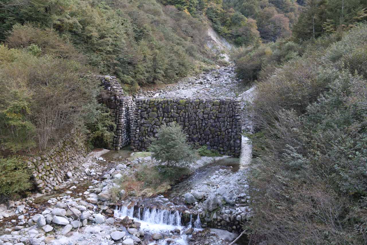
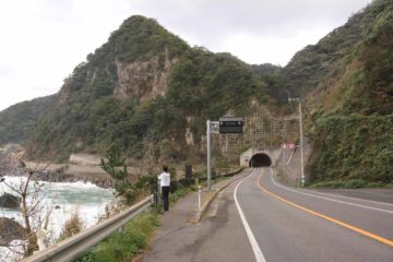
Our hike began from a fairly spacious car park with some porta potties and a wooden building nearby. We then walked back along the road towards a suspension bridge, which crossed high above the gorge spanning the Ishiutorokawa (or Ishiutoro River; a tributary to the Fujigawa or Fuji River) before reaching a series of faded interpretive signs on the opposite side of the gorge. The suspension bridge offered us views of the rocky stream bed as well as some man-made wall upstream with slits to allow the river to continue passing through.
Beyond this trio of falls, the trail then pretty much skirted the Ishiutorokawa while weaving between and besides giant boulders. In some parts the trail, we crossed some bridges that made traversing some of the giant boulders and stream crossings much easier. But there were a few sections where we had to exercise care as well as a little route finding, especially in spots where there were spray-painted red arrows to help us navigate through some of the trickier spots.
The further along the trail we went, the rougher the terrain was. Plus, the trail was predominantly uphill throughout though the only steep sections involved short stints on ladders and steps. One or two of them involved some minor bouldering requiring the use of our hands as well as our feet. Finally, after a final climb, we reached a signposted overlook where a clearing in the vegetation allowed us a clean look at the impressive multi-tiered drop of the Shoji Waterfall. Even though the view of the falls seemed distant from here, signs warned us not to proceed further as that would require steep scrambling in dangerous rockfall-prone terrain. So we were content with our views while enjoying a brief picnic lunch before heading back. Overall, we spent about 2 hours on the nearly 4km trail though we probably spent a good 15 minutes with the picnic lunch and a few minutes more taking our time shooting plenty of photos while admiring the scenery. Thus, I’d say the signage suggesting that the hike was 40 minutes in each direction was pretty accurate.
Lastly, I did notice that this waterfall was also referred to as the Kitashoji Falls (北精進ケ滝) suggesting that there was a north and south waterfall sharing the name of Shoji Falls, where the falls described on this page would be the north. I’m not sure if this is true, but I thought I’d put this in here in case you’re more familiar with the falls being called this way. In the same literature, I also noticed that they named the lower tier Kudan Falls (九段の滝 or Kudan-no-taki), which was said to comprise 40m of the overall 121m drop.
Related Trip Reports
Related Top 10 Lists
Related Itineraries
Trip Planning Resources

Nearby Accommodations
This content is for members only. See Membership Options.Featured Images and Nearby Attractions
This content is for members only. See Membership Options.Visitor Comments:
Got something you'd like to share or say to keep the conversation going? Feel free to leave a comment below...No users have replied to the content on this page
Visitor Reviews of this Waterfall:
If you have a waterfall story or write-up that you'd like to share, feel free to click the button below and fill out the form...No users have submitted a write-up/review of this waterfall
Only logged in users can post a comment Please login or sign up to comment