About Fukuroda Waterfall (Fukuroda-no-taki [袋田の滝])

The Fukuroda Waterfall (Fukuroda-no-taki [袋田の滝]; also referred to as just Fukuroda Falls) was a grand waterfall consisting of multiple layers on the Takigawa [滝川; “Falls River”] while sporting reported dimensions of a cumulative height of 120m and a width of about 73m. Since it was on a fairly major river system, it was said to have year-round flow and therefore provide the chance of experiencing the falls with the different moods of the seasons. We had targeted the arrival of the koyo (or Fall Colors) with our mid-October visit, but apparently we were a few weeks too early as you can see from the pictures on this page. Given our experience, I’d say that the koyo would probably peak more towards the end of October or early November depending on how soon the weather would turn cold. Apparently on the year we visited, the weather was still more on the warm side at this lattitude and altitude.
During our visit, we were able to view the falls from a handful of vantage points, including an in-your-face lower view where we were able to appreciate the reported dimensions as it was not possible to capture the whole falls in one picture without putting a smart phone in “pano” mode or doing some serious postprocessed stitching in some software like Photoshop
after taking a bunch of partial shots. We were also able to experience more contextual and less overwhelming views from higher platforms as you can see in the photo at the top of this page. I’d imagine such vantage points would also be best for capturing the koyo with the waterfall together.
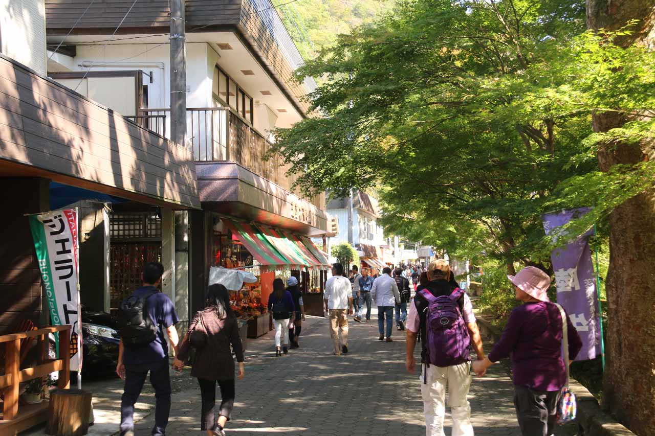
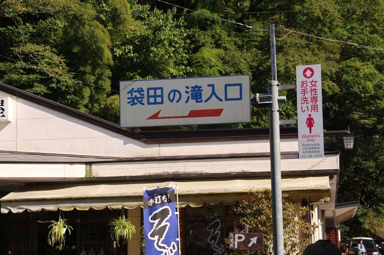
Eventually, we’d come to a bridge, where we saw most of the people cross it then continue along the road on the other side of the river. It turned out that it didn’t matter which side of the river we walked on because the path would ultimately loop, but we’ll continue describing our experience after crossing the bridge and continuing east. By now, there were even more shops and cafes leading further east upstream along the northern banks of the Takigawa River. We’d eventually see an arrowed signpost (in kanji) letting us know that the Fukuroda Waterfall was to our left at the next junction. The path then switchbacked up a ramping paved incline (going past a terraced stair-stepped garden with signage urging visitors not to take a shortcut through this garden) before finally getting to an entrance booth where we paid about 300 yen per person to proceed further.
The lower deck was close enough to the falls to feel some of the spray. I’m sure that under higher flow, it would be harder to take photos due to the amount of spray that would be blasting the sheltered concrete deck. The lower deck’s viewing area was wide enough to accommodate dozens of people without really getting in each other’s way. When we had our fill of this view, we then queued up for the elevator, which took us out of the tunnel and onto the upper viewing platforms. The way they labeled the walking path, they had us immediately go up the steps to the uppermost viewing decks. That was where we were able to get the photo you see at the top of this page. The viewing space was more limited than the lower deck, especially with the foliage below blocking parts of the falls so we had to wait our turn up there. We then slowly experienced the middle and bottom of the upper viewing decks before going back down the elevator.

Now during our visit, my parents and I did take some time to go up the steep steps on the far side of the suspension bridge. The steps were extensive enough and steep enough to cause us to sweat quite a bit from the workout. And given the amount of time and effort it took to scale most of the steps (we didn’t even get to the end of the climb before turning back near the top of the falls after nearly 15-20 minutes of climbing), we didn’t make it to any of the destinations that the upper trails would’ve taken us. In hindsight, had we persisted for another 10-20 minutes more, then we might have had an opportunity to see an upper waterfall upstream of Fukuroda Falls as well as the spring where the Takigawa would emerge from the mountain.
Finally, the Fukuroda Waterfall was the first waterfall that we visited as part of a return trip to Japan that focused mainly on visiting as many of the registered Japan Top 100 Waterfalls as we could that I hadn’t seen in person previously. Unlike most such lists that try to tackle this subjective and surprisingly tricky objective of ranking waterfalls (believe us, we know how hard this can be), the Japan Top 100 Waterfalls list actually has a bit of an official feel to it. This was because we saw interpretive trail signage (typically in kanji though) that would let visitors know that it was gazetted into such a list. This occurred on almost all such waterfalls, including the Fukuroda Waterfall. It’s very rare to see such a list be recognized in this manner, but it underscored the backing or legitimizing by the Japanese government of this list. Upon further research on the matter, we learned that the Japan Top 100 Waterfalls List was rubber-stamped by the Ministry of the Environment since 1990 thereby explaining the seemingly legitimate and official nature of the list as apparently this recognition went back at least a couple of decades.
Related Trip Reports
Related Top 10 Lists
Related Itineraries
Trip Planning Resources
Nearby Accommodations
This content is for members only. See Membership Options.Featured Images and Nearby Attractions
This content is for members only. See Membership Options.Visitor Comments:
Got something you'd like to share or say to keep the conversation going? Feel free to leave a comment below...No users have replied to the content on this page
Visitor Reviews of this Waterfall:
If you have a waterfall story or write-up that you'd like to share, feel free to click the button below and fill out the form...No users have submitted a write-up/review of this waterfall
Only logged in users can post a comment Please login or sign up to comment