About Detian Waterfall (德天瀑布 [Détiān Pùbù])
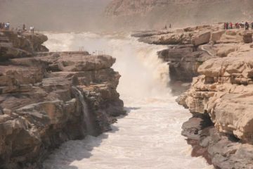
The Detian Waterfall (德天瀑布 [Détiān Pùbù]; Virtuous Heaven Waterfall) was said to be Asia‘s largest transnational waterfall because it was shared by both China and Vietnam. Surrounded by picturesque karst peaks (more famously present in places like Guilin in China, Phang-nga Bay in Thailand, and Halong Bay in Vietnam), this was definitely one of the more scenic waterfalls we had seen let alone one of the most scenic waterfalls in the country. In addition, the falls was conducive to taking those silky long exposure photos so it was also very photogenic to boot!
The falls consisted of two parts. There was the main waterfall (named Detian Waterfall) on the Chinese side of the Guichun River, and then there was the Ban Gioc Waterfall (Banyue Waterfall [meaning half-way across?] in Chinese) on the Vietnamese side of the river. Julie and I had no trouble seeing both falls from the Chinese side, but we were not sure about actually getting up to the Ban Gioc Waterfall since we didn’t actually take a boat across the river (plus I’m not sure if there would be border implications in doing that).
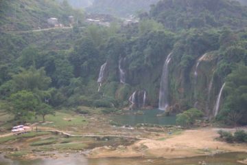
In terms of experiencing this waterfall, it was pretty easy to do. A walking path allowed Julie and I to get right up to the main waterfall on the Chinese side. That path ultimately climbed alongside part of the falls until we got up to the bottom of the uppermost tier. Then, the path stopped as we had to be content with taking partial profile views of the falls as well as enjoying the downstream views above the lower tiers of the Detian Waterfall.
The closer to the waterfall that we got, the less of it that we were able to see. But at least we were able to feel a little bit of the spray from the falls to help alleviate some of the discomforting stickiness brought about by the stifling heat and humidity. And regardless of where it was cooler and mistier, there was no relief from mosquitoes.
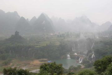
In addition to the path leading alongside the Guichun River to the 53rd border crossing with Vietnam, Julie and I also branched off the walkway and went up a series of steps (which were quite slippery when wet thanks to the combination of humidity and sporadic showers). The steps ultimately led us to an overlook that provided us with a wide open panoramic view towards the Vietnamese side of the river encompassing the entire Detian Waterfall plus the majestic and ghostly karst mountains in the background. It appeared the path kept going up but we didn’t explore further so we can’t say for sure what else was further up.
If there was one complaint I had about our visit, it would be that we happened to show up when Detian Waterfall was at its lowest flow of the year (late April). It was almost analogous to saying we were visiting Yosemite Falls in late August when it was either dry or barely trickling.
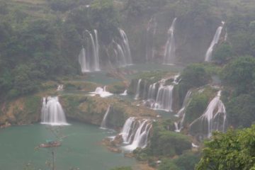
From some of the signage and relics at the Detian Waterfall, it seemed apparent to us that this place had been the site of many conflicts with the Vietnamese. I believe it was said that there was a canon perched atop one of the cliffs overlooking the area. During our visit, that trading market at the 53rd border tablet certainly was a stark contrast to the more turbulent history of the area. In any case, we didn’t feel comfortable straying too far into the other side of the border for we heard that border patrols were quite strict about entering either country illegally.
Julie and I actually spent a night at a hotel on the China side looking right at the Detian Waterfall. This allowed us to experience the falls in both the afternoon as well as the steamy early morning. It also afforded us the ability to enjoy the scenery without being in a rush. The only bad thing about our accommodation was that there were no mosquito nets around the bed, which meant that we were a little exposed to risk of contracting yellow fever or malaria, which Julie and I knew were carried by some of the mosquitoes in the area.
Anyways, perhaps one day we will return to this waterfall in a more reasonable time of year where we can see the falls in its “normal” flow. But for now, check out the photos here and take comfort in the fact that you’re likely to have better photos than we did of this wonder.
Related Top 10 Lists
Trip Planning Resources
Nearby Accommodations
This content is for members only. See Membership Options.Featured Images and Nearby Attractions
This content is for members only. See Membership Options.Visitor Comments:
Got something you'd like to share or say to keep the conversation going? Feel free to leave a comment below...No users have replied to the content on this page


Only logged in users can post a comment Please login or sign up to comment