About Kings Canyon Falls

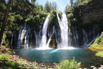
Kings Canyon Falls was kind of an oddity in that it was the only waterfall we’ve seen so far within the state boundaries of Nevada – said to be the driest state in the United States. That fact alone made us take the detour from our touring of the Lake Tahoe area to see for ourselves what this place was like. And as you can see from the photo at the top of this page, it was indeed a legitimate waterfall that we were able to get close to and touch as well as fully enjoy viewing from all sorts of different angles. While this waterfall’s dimensions were modest at around 30ft tall, it was that coolness of feeling the waterfall’s spray in an area that we wouldn’t even have considered would have a waterfall like this that made it memorable to us. Indeed, this oasis contrasted mightily with the otherwise hot and dry desert climate that much of the Great Basin (encompassing much of the state of Nevada and western Utah) was known for.
We started from a well-signed trailhead right at the edge of what seemed to be a new suburban development on the outskirts of the state capital of Carson City (see directions below). Sometimes Mom and I wondered what the resident of that home right next to the trailhead must think with so many strangers passing by his property. In any case, the trail passed by some signage that included a memorial for a group of firefighters who had lost their lives from a wildfire here that was caused by a campfire that was not properly extinguished. We noticed there was an old trail that seemed to follow the hidden stream from the waterfall directly, but we stayed with the main trail that bend over a couple of long switchbacks as it generally went uphill.
Well after the second switchback, we were able to look down at the parking area as well as glimpse further down Kings Canyon in the direction of Carson City. There was a signed trail junction where going left would have led another mile to the so-called Upper Waterfalls Loop. We kept straight ahead to the right, where the trail ultimately narrowed as it rounded a bend and eventually got us face-to-face with the rare waterfall. It turned out that the vegetation surrounding the creek responsible for this falls was thick enough to practically conceal the stream as well as the waterfall itself, which explained why we couldn’t really see it from the trailhead. Nevertheless, a local that was here sharing the waterfall with us told us that there was an upper waterfall in addition to this one, but he said that this one was way better and that we did well to find this one first. So we stuck to his advice and just enjoyed this spot for a bit before we headed back down to the trailhead.
Overall, we had spent about 45 minutes away from the car. Our timing couldn’t have been better because we started at around 5:45pm, which was right when the sun was starting to disappear behind the neighboring cliffs causing long shadows that provided relief from the desert heat (it was over 90F when we showed up in mid-June). Had we done this trail earlier in the day, the modest 1/4-mile hike up to the falls (or 1/2-mile round trip) would be a lot more taxing, especially given how dessicating the air was here. In addition, it seemed like the creek could easily dry up not that far into Summer so I’d imagine that it would be best to come here in the Spring or early Summer at the latest.
Related Trip Reports
Related Top 10 Lists
No Posts Found
Related Itineraries
Trip Planning Resources
Nearby Accommodations
This content is for members only. See Membership Options.Featured Images and Nearby Attractions
This content is for members only. See Membership Options.Visitor Comments:
Got something you'd like to share or say to keep the conversation going? Feel free to leave a comment below...No users have replied to the content on this page
Visitor Reviews of this Waterfall:
If you have a waterfall story or write-up that you'd like to share, feel free to click the button below and fill out the form...No users have submitted a write-up/review of this waterfall
Only logged in users can post a comment Please login or sign up to comment