About Silverfallet
The Silverfallet in Bjorkliden (or more accurately Björkliden) was the second such waterfall named “Silver Falls” that I encountered in Sweden during our epic Sandinavia Trip in 2019.
Unlike the one in Skövde, however, this particular waterfall sat way further north in the Kiruna Lappland (in English, apparently, they spell it like Lapland).
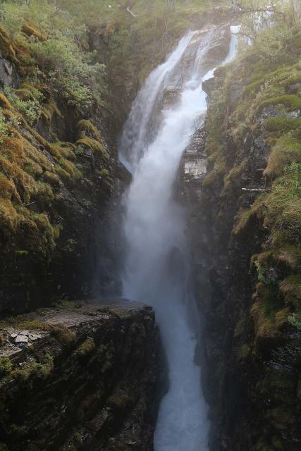
I encountered this falls while making a brief interlude into Sweden from Narvik, Norway.
The area featured several lakes and streams, which I eventually started to wonder if Sweden’s north was kind of like what I’d imagine Minnesota would be like with its take on “the land of a thousand lakes.”
In any case, regarding this waterfall, the Rakkasjokk dropped some 30m before feeding the lake Torneträsk.
The name of the stream reminded me of the Sami presence and influence as they span the international borders of Northern Scandinavia.
Experiencing Silverfallet
After parking the car at a big pullout on the north side of the bridge over Rakkasjokk (see directions below), I then followed a signed trail that went right towards the stream.
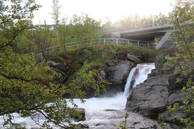
At the stream, there were already cascades and rapids in both directions.
The Silverfallet was further downstream, but I did briefly go under the road bridge to see what other things of interest might be in the immediate area (just more rapids and eventually a longer walk towards the village of Björkliden).
Anyways, continuing further downstream along the established path, I continued passing more cascades before reaching a bridge.
Once I was on the bridge, Silverfallet finally revealed its main drop.

With the confines of the narrow gorge that the falls plunged into, it definitely threw up lots of mist.
On the other side of the bridge, I saw that they closed off the trail leading back upstream on the opposite side of the Rakkasjokk due to unrailed dropoffs.
That said, I continued further down the trail where I saw access to the stony shore of Torneträsk.
One thing that I regret not doing was that I didn’t explore around the shore of the lake, where I could have explored the narrow gorge and gotten a narrows-like view back towards Silverfallet.
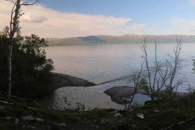
Oh well, you live and you learn.
Overall, I spent about 35 minutes around the falls, which included all the little exploration that I did.
Lapporten
I didn’t know it at the time, but apparently, I also managed to capture a picture of the Lapporten, or Laponian Mountain Gate.
Of course, since I wasn’t looking for it, the picture wasn’t great as you can see here.

In any case, Lapporten was a distinct U-shaped valley cut between a pair of mountains in the distance situated somewhat south of Torneträsk Lake.
I managed to get this photo while looking over the road bridge towards the lake.
I also managed to get a different photo of Lapporten while shooting over the top of Silverfallet towards the lake.
Like with other U-shaped valleys around the world, this “bite” out of the mountains was taken by glaciers in the last glacial period.
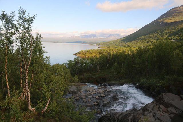
The mountain on the left is known as Nissuntjarro while the mountain on the right is known as Tjuonatjakka.
Authorities
Silverfallet was closest to the village of Björkliden, which belonged to the municipality of Kiruna. The municipality belonged to the county of Norrbotten. For information or inquiries about the area as well as current conditions, you may want to try the local municipality website.
Related Top 10 Lists
No Posts Found
Trip Planning Resources
No Posts Found
Nearby Accommodations
This content is for members only. See Membership Options.Featured Images and Nearby Attractions
This content is for members only. See Membership Options.Visitor Comments:
Got something you'd like to share or say to keep the conversation going? Feel free to leave a comment below...No users have replied to the content on this page
Visitor Reviews of this Waterfall:
If you have a waterfall story or write-up that you'd like to share, feel free to click the button below and fill out the form...No users have submitted a write-up/review of this waterfall

Only logged in users can post a comment Please login or sign up to comment