About Ristafallet
Ristafallet was the first of three significant waterfalls in a stretch of the drive along the E14 between Östersund and the Swedish border and ultimately to Trondheim.
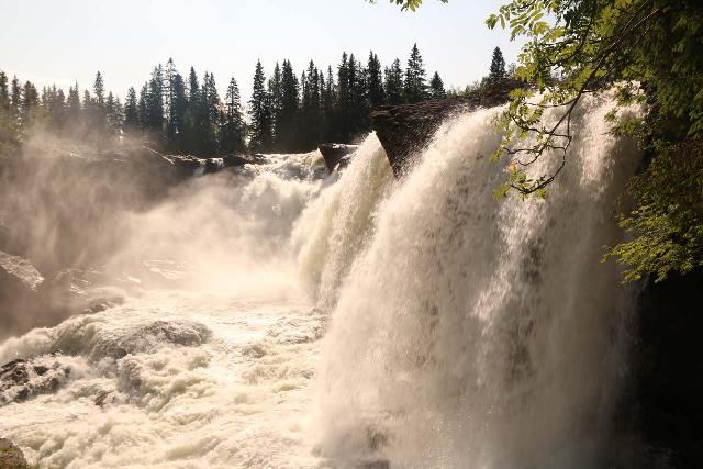
The falls featured a wide drop of 50m with a 14m drop as it spanned the Indals River (Indalsälva), which was apparently allowed to flow wild and free.

Thus, it was said to have a flow that can vary between 100-400 cubic meters per second.
And as you can see from the photo above, the operative word when it came to this falls was power.
When we made our visit, we could clearly see that it was one of Sweden’s more accessible (and thus popular) waterfalls thanks to a camping and cafe facility right by it.
Experiencing Ristafallet
From the car park (see directions below), we merely had to walk down the road leading past the campsite and towards a lookout within the shade of the surrounding trees.
That was pretty much all there was to our visit though we were cognizant of the risks of falling into the river if we wanted to get a closer look past the fence openings.

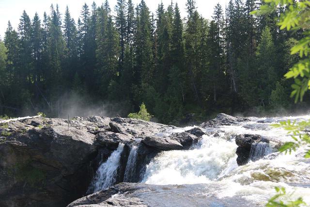
When I looked towards the falls from along the fence closer to its brink (and closer to the campground), I couldn’t help but notice that there was wafting mist rising from an unseen half of the opposite end of the falls.
That suggested to me that the falls had two segments split by some kind of rocky island, and that we only saw a fraction of the overall width of the falls.
Naturally, I was curious to see if it was possible to get a look at it, especially since I saw a pole on that island that made me wonder if there used to be a bridge or some kind of infrastructure to get onto that island.
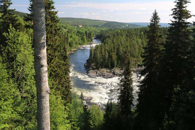
I also noticed that trails continued to descend alongside the Indals River in both directions, including a 650m and 1km path to the Upper and Lower Nylandsforsen rapids.
However, after spending a brief amount of time looking around the immediate vicinity, I didn’t see a bridge nor anything along the river that would have allowed me to get to the other side.

So that was pretty much our Ristafallet experience as far as just visiting the falls was concerned.
With hindsight being 20/20, I did notice on the maps that there was a bridge spanning the Indals River at the town of Nyland, and maybe I probably could have driven closer to the other side of Ristafallet to see its other side by going that route.
I’ll have to find out about that if we’re fortunate to come back to explore that option.
Mittnordenleden
I also noticed a sign at the car park mentioning something about Mittnordenleden.
It turned out that this was a former pilgrim’s route that was re-opened in 2015 as it was absorbed into the 564km long St Olavsleden.
This path stretched from Sundsvall, Sweden in the east to Trondheim, Norway in the west.
I’m pretty certain the Nidaros Cathedral in Trondheim was the major destination point for such travelers on St Olavsleden.
It seemed to be analogous to the manner in which the cathedral in Santiago de Compostela would be the endpoint for pilgrimage walkers across the North of Spain on the Camino de Santiago (St James).
Authorities
Linafallet was in the municipality of Åre. The municipality belonged to the county of Jämtland. For information or inquiries about the area as well as current conditions, you may want to try the local municipality website.
Related Top 10 Lists
No Posts Found
Trip Planning Resources
No Posts Found
Nearby Accommodations
This content is for members only. See Membership Options.Featured Images and Nearby Attractions
This content is for members only. See Membership Options.Visitor Comments:
Got something you'd like to share or say to keep the conversation going? Feel free to leave a comment below...No users have replied to the content on this page
Visitor Reviews of this Waterfall:
If you have a waterfall story or write-up that you'd like to share, feel free to click the button below and fill out the form...No users have submitted a write-up/review of this waterfall


Only logged in users can post a comment Please login or sign up to comment