About Raggaschlucht Waterfalls
The Raggaschlucht Waterfalls were a series of waterfalls nestled within the popular Raggaschlucht Gorge. While there were several smaller chutes and cascades squeezed into the depths of the gorge, the last (or uppermost) of the waterfalls was by far the most impressive as it had a classical drop of about 20-25m.
The gorge’s formation was the result of tectonic forces as European Continental Plate subducted under the East Alpine Plate creating the mountains and associated gorges and gullies that cut even deeper into the joints or faults in the plates already in existence. It’s said that the gorge was in the early stages of a transformation into a valley, and that over millions of years, it too, would eventually become a V-shaped valley much like other mature valleys in mountainous places like Austria.
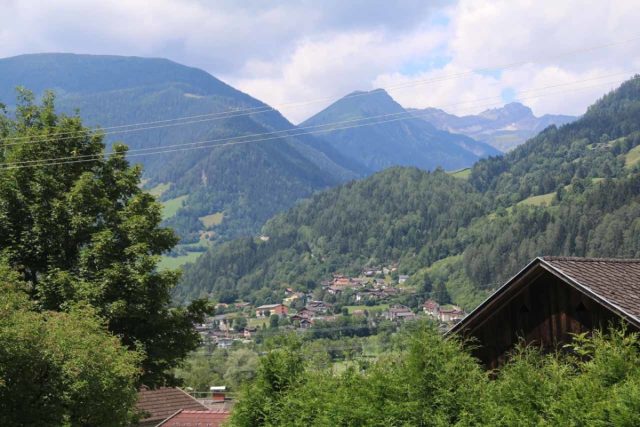
In the case of Raggaschlucht, it was said to be 800m long with an elevation gain of 200m. The hike was done one-way in a clockwise manner, which was a wise choice of traffic control considering how narrow the walkways were, and how difficult (and pointless) it would be for people to be going down the gorge from the top down instead of slowly going up from the bottom.
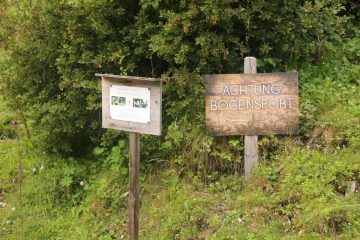
The excursion started with a short hike through a small village before ascending towards a kiosk at about 400m from the car park (see directions below). I paid 7 euros to get in (open from 9am to 5pm during peak Summer seaon), then promptly passed through the turnstile and continued on into the gorge walk.
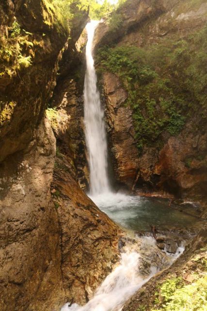
For pretty much the entire walk, the path would overhang above the Ragga River down below as it climbed up a combination of ramps and steps all the while with cascades and chutes roaring beneath. When I did this hike at midday, there were moments of looking against the sun, which also created harsh shadows that made photography difficult due to the sharp contrast between light and dark.
Some parts of the canyon were narrow enough to hold onto rocks wedged by the gorge’s width. Other parts of the gorge had circular shapes due to whirlpools and eddies drilling into the surrounding cliffs. Eventually towards the end of the 800m length of the hike, I encountered a final climb alongside a cascade then passing before the big waterfall finale at the end.
The rest of the Raggaschlucht portion of the hike went up switchbacking stairs providing higher views of the waterfall opposite the head of the gorge. And once I made it to the top, I was able to get a sweeping view across the Mölltal Valley before descending down a steep forest path where good shoes were a must in order to maintain decent traction on the steep slopes.
Overall, I managed to do this loop hike in around 90 minutes time (about 75 minutes on the loop part of the hike itself), which was more than the 60 minutes recommended time. Since my GPS wasn’t working well while in the confines of the gorge, I estimated that the overall distance covered by this hike was on the order of 2.5km round trip using the car park as the starting point.
Related Top 10 Lists
No Posts Found
Trip Planning Resources
Nearby Accommodations
This content is for members only. See Membership Options.Featured Images and Nearby Attractions
This content is for members only. See Membership Options.Visitor Comments:
Got something you'd like to share or say to keep the conversation going? Feel free to leave a comment below...No users have replied to the content on this page
Visitor Reviews of this Waterfall:
If you have a waterfall story or write-up that you'd like to share, feel free to click the button below and fill out the form...No users have submitted a write-up/review of this waterfall


Only logged in users can post a comment Please login or sign up to comment