About Dunn Falls
Dunn Falls seemed to be one of those waterfalls where I really had to work to see. Even though our sampling of waterfalls in the state of Maine was very small, I somehow got the sense that this waterfall typified the wild and off-the-beaten path feel given how seemingly undeveloped much of the state of Maine was. In any case, I felt that the effort I had to put in to both find and reach the waterfall were worth it, and I truly did feel like I was in a place where peace and solitude amidst some raw Nature was achievable at a waterfall that was worthwhile to go out of the way for.
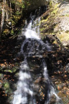
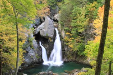
The waterfall experience experience was actually two main waterfalls. There was a Lower and Upper Dunn Falls. The lower waterfall featured a pair of steep drops in a narrow ravine mostly hidden from sight until I was able to get right into the ravine itself (see photo at the top of this page). It was said to have a cumulative drop of 80ft. There was a fallen log that was stuck within the narrow crevice that somehow gave it a bit of character underscoring the drama of how rough weather and flooding could have put it there, but who knows how much longer it will be there.
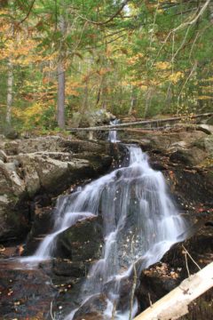
Meanwhile, the upper waterfall featured a sloping and fanned out shape over a 70ft cumulative drop. It was lighter flowing than the lower waterfall and the viewing was a bit more awkward thanks to the rocks and jumble of foliage beneath its largest tier as well as how close I had to stand in front of it. However, the large plunge pool that was out-of-sight below of this upper drop at the base of its lowest tier looked very inviting. If there was ever a place for a quiet swim in peace and solitude, this would be it (in the Summer, that is; the water was way too cold during my Autumn visit).
The trail began from an unassuming pullout besides the road (see directions below). Then, I had to explore a bit and walk along this road for about 200ft east towards a pair of trail openings on both sides of the road. The white hash that was marked on the road itself next to the south opening along with an Appalachian Trail signpost on the opposite side of the road for the north opening assured me that I had found the right place to start the hike. The path that I had to take was going downhill from the south opening (i.e. the one with the white blaze on the road).
After descending some steps, I quickly got close to a junction next to the brook. A sign indicated that the Cascade Trail was on the left while one of the Appalachian Trail junctions was on the right. This would be the beginning and end of the looping part of the hike so per the advice of the New England Waterfalls (NEW) book, I kept left and followed the brook downstream past a series of some small cascades and rapids.
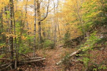
Immediately following this stream crossing, the trail steeply climbed uphill towards a ridge. The steep climb felt like a little bit of deja vu where the Bemis Brook Trail detour to get back to the Arethusa Falls Trail involved some rough scrambling where paying close attention to the hashes kept us from getting lost. In the Dunn Falls hike, I had to follow blue hashes (or blazes) while being careful not to fall and tumble back down the mountainside.
Once I was on the ridge, the hiking was much easier once again as the trail undulated then eventually descended back down towards the brook once again. At the bottom of the descent, the trail turned to the right and continued amongst a flat leafy section of forest before getting to the next stream crossing – this time of the Ellis River – about 0.2 miles from the first stream crossing. This particular crossing was also long and required me to do some rock hopping, but I could imagine how crossing it with the boots off might be required if the water level of the river was any higher than when I saw it.
When I realized that the falls was hidden out of sight in a ravine, I scrambled on the boulders that were in the way to get closer (being very careful not to slip and fall given how slippery they would be when wet), and eventually situated myself right in front of the impressive Lower Falls right beneath the fallen log spanning its narrow ravine. Since I didn’t bring a tripod with me, I had to get creative and use the boulders to steady the camera for that pleasing shot you see at the top of this web page.
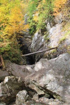
There was a gorgeous view of the forest and the Autumn colors beyond the ravine containing the Lower Dunn Falls, and I used this as a little bit of a break to assess where I was at while also snapping more photos (being careful not to get too close to the edge of the cliff). Then, I took the trail on the left to pursue the Upper Dunn Falls.
The trail was much flatter and fairly easy to follow, and I once again had to follow blue-colored hashes to ensure that I wouldn’t lose the trail. The path pretty much followed the West Branch of the Ellis River in the upstream direction the whole way so I never lost my sense of direction here. After about 0.3 miles (with a minor rock climb along the way), I eventually get to the large and pleasing plunge pool fronting a small waterfall. At first I thought this was the Upper Dunn Falls, but then I saw that there were more somewhat concealed tiers further upstream from this sun-drenched tier of the waterfall.
Anyways, compared with the Lower Dunn Falls, the Upper Dunn Falls was a bit of an anticlimax. However, it was still a pleasant reward for the trouble to get here, and I’m sure at a warmer time of the year, I probably could’ve gone for a dip back at that large plunge pool below.
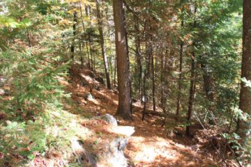
When I had my fill of this waterfall, I backtracked the 0.3 miles to the signposted trail junction at the top of the Lower Dunn Falls. Then, I went steeply uphill to the left (making sure I didn’t re-cross the river above the Lower Falls) where I was once again following white blazes to keep me from getting lost. I kept telling myself that this seemingly long and steep climb to regain the Appalachian Trail would be the end of the hardest part of the hike, but little did I know that the remainder of the hike after this climb would still undulate up and down along a ridge for the next 0.7 miles (from the top of the Lower Dunn Falls) before finally descending back towards the brook crossing next to the original trail junction at the very start of the hike.
After crossing the brook, I just had to go back up the steps and follow the road back to the parked car (as well as the awaiting Julie and Tahia) to resume our trip. Indeed, this wasn’t an easy hike, but it was rewarding. And I didn’t encounter another person the whole time I was on this trail. So I’d imagine if you want nice waterfalls without a crowd, going through the effort to see the waterfall ensemble that this loop trail had to offer would be just what the doctor ordered.
Related Top 10 Lists
Trip Planning Resources
Nearby Accommodations
This content is for members only. See Membership Options.Featured Images and Nearby Attractions
This content is for members only. See Membership Options.Visitor Comments:
Got something you'd like to share or say to keep the conversation going? Feel free to leave a comment below...No users have replied to the content on this page
Visitor Reviews of this Waterfall:
If you have a waterfall story or write-up that you'd like to share, feel free to click the button below and fill out the form...No users have submitted a write-up/review of this waterfall




Only logged in users can post a comment Please login or sign up to comment