About Feather Falls
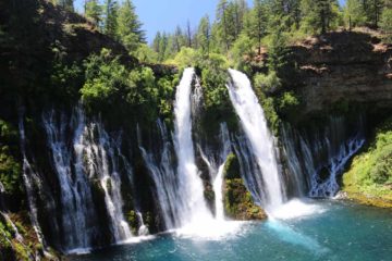
Feather Falls was certainly one of the most impressive waterfalls we’ve seen in the state of California outside of Yosemite National Park. Typically waterfalls with this much volume and size would be reserved for the place that John Muir fought hard to protect, but in this particular instance, it was always on our bucket list ever since we first became aware of it after flipping through our California Waterfalls book by Ann Marie Brown. In the past, I think the euphoria and hype around this waterfall went hand-in-hand with exaggerated claims about its height at being some 640ft tall though measurements made by fellow waterfall enthusiasts had put this falls more in line with being over 400ft. In any case, we were thoroughly awed by the sheer volume and grandeur of Feather Falls, and it even exhibited the kind of “feathery” characteristics (for lack of a better word) where we could be mesmerized by the fringes of the falling water splitting into tinier droplets as it hit some terminal velocity and eventually disappear into vapor, which was a kind of action typically reserved for massive freefalling waterfalls like Yosemite Falls or Bridalveil Fall. Perhaps the one thing this waterfall had going for it that most other waterfalls in Yosemite didn’t have was the sense that it was nestled in true wilderness for there were no cars, no roads, and just the minimum amount of infrastructure to support a trail and some overlooks.
As a result of all these positive aspects about the falls, it wasn’t surprising that this was also one of the most popular waterfalls in Northern California despite the amount of work necessary to even reach it. The park signage here indicated that we would need at least 4-5 hours to complete the hike, but it also turned out that there were many ways to do this trail with varying levels of exertion and enjoyment. Distance wise, the hike could be as little as 6.6 miles round trip, or upwards of 9 miles round trip, or more. We’ll describe how we did it, which we think was the “right” way to do it for reasons you’ll see later in this writeup. Our method covered a hiking distance of nearly 10 miles round trip.
Finally before getting into the detailed trail description, we have to give props to Leon Turnbull, who first made us aware that going against intuition and taking the longer part of the loop on the right first (i.e. going counterclockwise) was the best way to do this hike. Without knowing this, we could’ve easily done what just about everyone else did and follow the “shorter” trail in the clockwise direction, which in our experience didn’t even save time despite it being about 1.2 miles less in length. Not only were we able to experience a variety of other things about the Feather Falls Trail in addition to the main waterfall itself (e.g. a separate waterfall, less people, more open scenery, etc.), but the hard part was at the very end, where we were already looking forward to finishing off the hike (and thus be prone to missing out on some other nice aspects about the trail). From some of the prior comments made at the trailhead register saying “Don’t do it!”, it made us wonder if these folks went the harder way and suffered as a result of it (either that or they were trying to play a prank on would-be hikers).
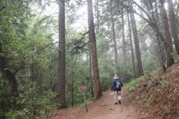
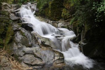
Anyways, going right at this junction, the trail gently descended for most of the way as we were surrounded by tall trees and weaved in and out of lush gullies with a mild degree of overgrowth (where we were always cognizant of poison oak exposure). This scenery would persist for a little over the first mile (taking us around 30 minutes) before we’d arrive at a bridge over the rushing Frey Creek. At this bridge, we encountered an attractive waterfall, which really lent itself to long exposure photographs, and fortunately, that bridge had railings to make it easier to do this without a tripod.
Beyond this overlook, the flattened out trail then undulated through more gullies as it generally gently descended for the next 1.8 miles or so (taking us about 50 minutes to hike along this stretch). The gullies each were very lush and somewhat overgrown. We also spotted some more of those red lizards or salamanders, especially around those gullies where there tended to be more water. There were a few more interpretive signs along the way, including one that identified poison oak, which was always on our minds whenever we had to traverse through overgrowth. Anyways, at the end of this stretch, we would reach another trail junction where a sign saying “Falls” pointed to our right, while we knew that going left at the junction would take us back to the trailhead along the “shorter” and lower loop.
Next, the trail hugged some cliff ledges with railings for assurance for the next 0.1-mile. It would eventually switch back where there was a sign pointing down and to our left for the “Overlook” while there was another trail that branched up and to our right along some stone steps. We followed the lower path to the overlook where Feather Falls was slowly revealing itself even though its view was mostly obstructed by the overgrowth throughout this part of the trail (probably fed by the mist wafting up from the waterfall itself). Eventually, we’d reach a set of steep steps leading right down to the Feather Falls Overlook, which seemed to be perched atop a rock outcrop at nearly eye level with the brink of the amazing waterfall itself. It took my mother and I about 2.5 hours to go the 4.5 miles to get to this point going about the loop hike in the anticlockwise direction.
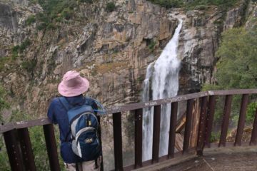
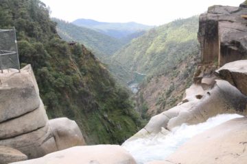
We then made a detour by going left onto the rock steps, which then led us on a somewhat overgrown trail that would eventually lead us to the top of Feather Falls. After about a half-mile from the overlook, we took one of the informal trails of use to our left descending steeply towards the banks of the Fall River. We suspected that under warmer weather and lower flow, these trails would lead to swimming holes to cool off. We did find some faint trails and rock scrambling paths leading further downstream to the brink of Feather Falls. After crawling through a small “arch” (or going around it), I found myself at a fenced section right above the brink of Feather Falls. Due to the fencing as well as the protruding rock ledges in front, it was hard to get a clean view, but given that a sign here indicated someone died from this spot not long ago, I guess the fencing was understandable.
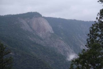
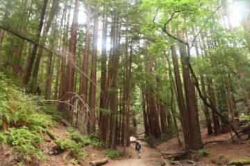
This lower loop trail continued to go downhill fairly moderately as we returned to lush forested terrain with more overgrown gullies. It was at this point of the trail that we ran into dozens of hikers going the other way (suggesting to us that this lower loop was definitely much more popular and well-used than the longer upper part of the loop that we did earlier). For the next 1.3 miles, the trail would eventually bottom out at one of these gullies before starting a gradual uphill that led us to another (but a bit closer) view of Bald Rock Dome. Beyond this overlook, the trail would climb a little more steeply as it would eventually reach a lower bridge across Frey Creek in the next half-mile or so (15 minutes).
Beyond the Frey Creek Bridge, that was when the trail sharply ascended up a series of many switchbacks. This was perhaps the most physically taxing part of the trail, but we also knew that once we could get up to the end of this climb, the hike was pretty much over. It took my Mom and I about 30 minutes to complete this steep uphill. Near the end of this uphill stretch was an interpretive sign and jumble of boulders labeled the “Maidu Native Food Prep Site”. Apparently, these boulders were used to store some of the collected grains or dried foods as well as acting as a place to grind some of these grains. We’d eventually be back at the trailhead some 6 hours after we had gotten started (though we easily spent at least an hour stopping for photos).
Related Top 10 Lists
Trip Planning Resources
Nearby Accommodations
This content is for members only. See Membership Options.Featured Images and Nearby Attractions
This content is for members only. See Membership Options.Visitor Comments:
Got something you'd like to share or say to keep the conversation going? Feel free to leave a comment below...No users have replied to the content on this page
Visitor Reviews of this Waterfall:
If you have a waterfall story or write-up that you'd like to share, feel free to click the button below and fill out the form...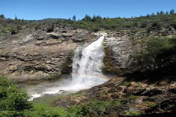 Feather Falls July 5, 2013 1:29 am - Feather Falls is located on the Fall River, a tributary of the Middle Fork Feather River, within the Plumas National Forest in Butte County. The trail from the parking lot to the observation deck and back is about 8 - 9 miles depending on which trail you take. Once at the observation platform it's another… ...Read More

Only logged in users can post a comment Please login or sign up to comment