About Shomyo Waterfall (Shomyo-daki [称名滝] and Hannoki Waterfall (Hannoki-no-taki [榛の木の滝])
The Shomyo Waterfall (Shomyo-daki [称名滝]; Shomyo Great Falls or just Shomyo Falls) and Hannoki Waterfall (Hannoki-no-taki [榛の木の滝]; Hannoki Falls) comprised the twin towers of waterfalls in the Japan Alps. Shomyo Daki (pictured above on the left) was said to be Japan’s tallest permanent waterfall. Hannoki-no-taki (pictured above on the right) was said to be Japan’s tallest waterfall though it was said to be seasonal as it would disappear rapidly when the snowpack was mostly depleted. From a statistics standpoint, Shomyo-daki was commonly quoted as having a cumulative height of 350m. Yet from the photo at the top of this page, you can also visually see that Hannoki-no-taki was even taller than Shomyo-daki.
Our experience with Shomyo Waterfall and Hannoki Waterfall almost resulted in utter disappointment due to nasty weather. Of course Julie and I have learned over the years of waterfalling that tall waterfalls in general tended to be more exposed to the whims of the fickle mountainous weather where we had to sweat the issue of clouds blocking the views. And in our case, we visited on a day where we started the 30- to 45-minute walk under some pouring rain and low clouds!
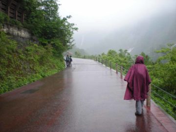
When we were lingering at the falls, we went beyond the Shomyo Bridge, where there was a couple of flights of steps leading to a shelter and a couple more overlooks. From this vantage point, we were able to see more of the Shomyo Waterfall, but the Hannoki Waterfall started to hide itself within its grooved watercourse on the facing mountain. By the way, that shelter was what allowed us to linger for as long as we did to wait out the remainder of the downpour we were experiencing.
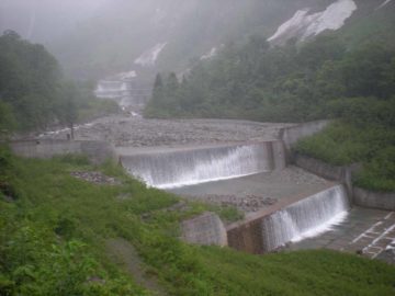
I would put this twin tower pairing of waterfalls (not the only waterfall pairing in the country, by the way; see Ginga and Ryusei Falls) right up there amongst Asia’s very best. However, the amount of man-modifications done immediately downstream of the falls kind of spoiled things a bit. That said, logging and hydroelectricity along with tourism and fishing drive the economy of the Toyama-ken (“ken” means prefecture). So, I guess having this waterfall was much better than have it sacrificed altogether!
Another thing worth mentioning was that if you’re up for it (and you’re willing to somehow figure out how to forward your luggage, which we didn’t bother doing), the Shomyo Waterfall and Hannoki Waterfall combo was actually a side trip to the well-publicized Kurobe-Tateyama Transalpine Route through the heart of the Japan Alps spanning both the Nagano and Toyama Prefectures en route. This alpine crossing involved a combination of funiculars, walks, and bus rides while taking in mountains, lakes, a big hydro scheme, and plenty of vistas.
As you can see from the crummy weather that we faced, we didn’t do it. Anyways, had we done it, there was a separate walkway that linked one of the stops higher up the mountain to these waterfalls directly. And from there, we could have taken the bus back to Tateyama Station to complete the alpine traverse.
Related Top 10 Lists
No Posts Found
Trip Planning Resources
Nearby Accommodations
This content is for members only. See Membership Options.Featured Images and Nearby Attractions
This content is for members only. See Membership Options.Visitor Comments:
Got something you'd like to share or say to keep the conversation going? Feel free to leave a comment below...No users have replied to the content on this page
Visitor Reviews of this Waterfall:
If you have a waterfall story or write-up that you'd like to share, feel free to click the button below and fill out the form...No users have submitted a write-up/review of this waterfall


Only logged in users can post a comment Please login or sign up to comment