About Osprey Falls
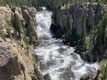
Osprey Falls was an attractive 150ft waterfall (though this might be a bit of an overestimate) nestled deep inside the steep and rugged Sheepeater Canyon on the Gardiner River.
Apparently, getting to the falls used to be a drive around to the east side of Bunsen Peak before a short but steep mile-long hike led to the falls.
However, during our visit (and beyond into the future), that road was only open to foot and mountain bike traffic along the four-wheel-drive track.
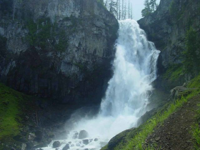
So that brought the total amount of hiking to 8 miles round trip.
By the way, Bunsen Peak was named after Robert Wilhelm Eberhard von Bunsen of “bunsen burner” fame which was lab equipment I recalled using in Chemistry class in both high school and college.
That was probably why this story rung a bell with me. However, Bunsen made his 19th century contributions to the study of geothermal phenomena in Iceland.
This association with geothermal research was probably how Bunsen got a peak named after him in Yellowstone National Park!
Hiking Around Bunsen Peak
Overall, the hike took us between 4 to 5 hours. The trail around the southern end of Bunsen Peak (about the first three miles of the hike) was pretty flat and easy as it passed through a mixture of mostly grasslands and some new sproutlings.
Those infant trees indicated to us that the forest cover that was once here was slowly starting to recover, but apparently this area was pretty hard hit by the 1988 wildfires.
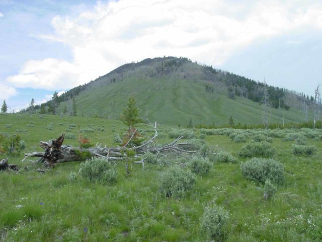
Throughout this section of the hike, Bunsen Peak always loomed to our left. We even spotted a few hikers wishing to check out the view from up there.
In addition to being flat, this flat three mile stretch was also pretty exposed to the sun thanks to the lack of mature trees providing shade.
We particularly thought of how exposed we were when we were overtaken by a quickly sprouting pop-up thunderstorm where lightning flashed around us.
You can imagine with lightning going off all around us while we had no chance of extensive shelter that we knew how easily we could’ve been lightning rods since we were just as tall (if not taller) than most of the sproutlings around us.
Needless to say we were quite scared and we were quite fortunate to have not been hit by a bolt as we weathered the storm, so to speak.
So based on this experience, perhaps it would be a good idea to get an earlier start than we did (we started at almost midday) to minimize the chances of getting caught in one of those pop-up afternoon thunderstorms in the Summer.
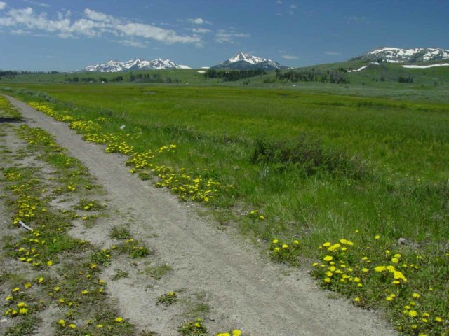
As we continued to get closer to the eastern slopes of Bunsen Peak, we could see off to our right the depths of Sheepeater Canyon and the Gardiner River that flowed through it.
When we eventually made it to the eastern slopes, that was when we saw a signpost indicated a fork in the trail.
Descending into Sheepeater Canyon
And that was where we took the fork that led downhill into the Sheepeater Canyon to our right. The other forks in the vicinity would have led us either around Bunsen Peak or up to the summit of the nearly 9000ft peak.
The Sheepeater Canyon part of the trail represented the last mile. It descended steeply in several switchbacks.
Although the trees (or what was left of them) seemed much taller than the flat area around the southern slopes of Bunsen Peak, this area looked like it too was severely affected by the 1988 forest fires.
Indeed, the trees we saw here were hauntingly bare and sickly.
Finally, at the base of the descent, the narrow trail eventually got us close to the base of Osprey Falls.
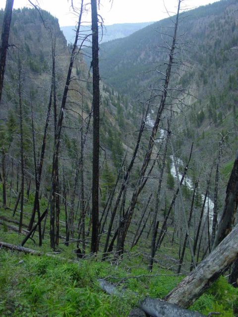
Even though the falls was stated to be 150ft tall, its twisting nature kind of made it difficult to fully appreciate its full height as it always seemed like we could only see part of it but never the whole thing in one shot.
In our temptation to improve our views, we had to exercise caution because the slopes were both loose (making them slippery) and steep with some mild drop off exposure.
Although we did make an attempt to scramble a little off the main trail for that better view of Osprey Falls, we didn’t try real hard given our comfort level with the risks involved.
Authorities
Osprey Falls resides in Yellowstone National Park. For information or inquiries about the park as well as current conditions, visit the National Park Service website.
Related Top 10 Lists
Trip Planning Resources
Nearby Accommodations
This content is for members only. See Membership Options.Featured Images and Nearby Attractions
This content is for members only. See Membership Options.Visitor Comments:
Got something you'd like to share or say to keep the conversation going? Feel free to leave a comment below...No users have replied to the content on this page
Visitor Reviews of this Waterfall:
If you have a waterfall story or write-up that you'd like to share, feel free to click the button below and fill out the form...No users have submitted a write-up/review of this waterfall

Only logged in users can post a comment Please login or sign up to comment