About Silver Cord Cascade
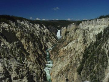
Silver Cord Cascade (I’ve also seen it spelled Silver Chord Cascade) was one of the seemingly lesser known waterfalls (at least compared to the waterfalls closer to the main roads further to the west).
This was peculiar since it could very well be Yellowstone National Park’s tallest waterfall as it was said to drop some 1,200ft (I’ve seen reports vary from as little as 1,000ft to as much as 1,300ft) where Surface Creek would drain Ribbon Lake before dropping into the Grand Canyon of the Yellowstone River.
Perhaps a big reason why it didn’t get as much fanfare was because it required a hike on the relatively quiet Seven Mile Hole Trail in order to get the view you see pictured above.
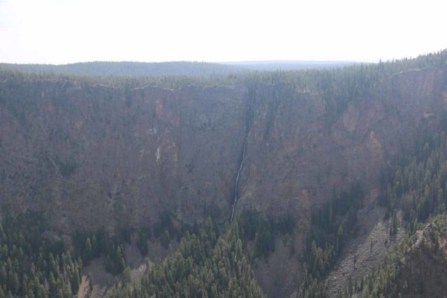
Moreover, it was also thin and hard to experience it up close in a satisfying way like most of the park’s other waterfalls.
The benefit to this relative obscurity was that each time I’ve done this hike, it was peaceful as I was but one of a handful of people on the trail.
About the Seven-Mile Hole
The Seven Mile Hole Trail was more known to hikers looking to really experience the bottom of the Grand Canyon of the Yellowstone River, especially since it could very well be the only such access in the Canyon Village vicinity.
The “hole” was said to refer to a fishing spot on the river. The hike was also said to have surprising geothermal features as well as a fairly high chance at seeing wildlife.
I’ve never done the entirety of this hike as it was said to be about 10 miles round trip with a brutal 1,400ft descent on loose and slippery terrain towards the end with an equally taxing climb on the return hike.
Fortunately, in order to experience Silver Cord Cascade, I only had to hike a mile in each direction from the Glacial Boulder Trailhead.
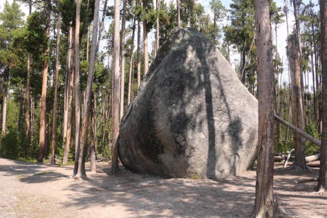
The glacial boulder was referring to a house-sized granite-gneiss rock that was assumed to have been carried here by a glacier since its composition was nothing like the bedrock around the Grand Canyon of the Yellowstone River.
The hiking was pretty benign as it was mostly on somewhat level terrain with only a few minor undulations.
The first time I did this hike in June 2004, it took me a little over an hour round trip.
The second time I did this hike in August 2017, the Inspiration Point Road was closed to vehicles. So I had to walk the additional mile for a four-mile round trip hike (not including the walk to Canyon Village from the barricade on North Rim Drive). Overall, that took me about 90 minutes.
The Out-and-Back Hike to Silver Cord Cascade
From the Glacial Boulder Trailhead, the trail followed a seemingly well-used path amongst lodgepole pine trees as it made a brief descent towards a small stream before briefly climbing out towards the north rim of the Grand Canyon of the Yellowstone River.
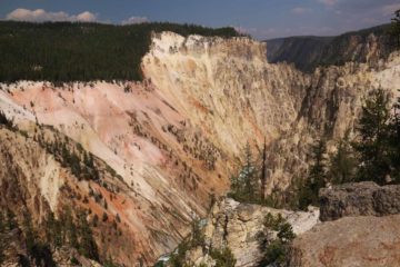
That was where I started to get partial views of the river down below as well as gaining a better appreciation for the yellows, oranges, and whites of the cliffs, which seemed to suggest some kind of volcanic or geothermal activity in the area.
The trail continued along the rim weaving in and out of edge of the lodgepole forest before there was a noticeable descent near the one-mile point of the hike.
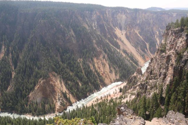
This was where I spotted some unsigned use-trails leading towards the canyon rim, and that was where I eventually was able to peer right across the Grand Canyon of the Yellowstone River towards the Silver Cord Cascade.
With no fencing, I had to use my best judgment to not get too close to the cliff edges.
Finally, each time I’ve been here, it was either at midday or early in the afternoon, and as you can see, the sun was pretty much on top of the canyon.
Since it was a north-facing waterfall, it was hard to tell when would be the best time of day for photos if the sun was out.
Authorities
Silver Cord Cascade resides in Yellowstone National Park. For information or inquiries about the park as well as current conditions, visit the National Park Service website.
Related Top 10 Lists
No Posts Found
Trip Planning Resources
Nearby Accommodations
This content is for members only. See Membership Options.Featured Images and Nearby Attractions
This content is for members only. See Membership Options.Visitor Comments:
Got something you'd like to share or say to keep the conversation going? Feel free to leave a comment below...No users have replied to the content on this page
Visitor Reviews of this Waterfall:
If you have a waterfall story or write-up that you'd like to share, feel free to click the button below and fill out the form...No users have submitted a write-up/review of this waterfall

Only logged in users can post a comment Please login or sign up to comment