About Union Falls and Ouzel Pool
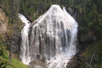
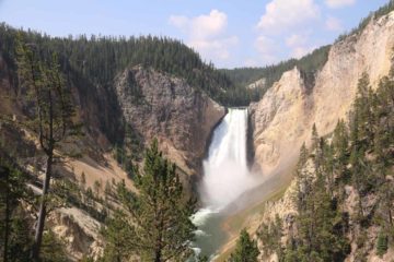
Union Falls had to have been my favorite waterfall in Yellowstone National Park besides the powerful Lower Falls of the Yellowstone River. It had been frequently described as the most beautiful waterfall in Yellowstone National Park, and it wasn’t difficult to imagine why as you can see from the photo at the top of this page. While Lower Falls had the obvious power and size residing within the impossibly beautiful Grand Canyon of the Yellowstone River, Union Falls possessed a more delicate and graceful quality punctuated by its uniqueness and size. The falls’ 250-260ft drop (said to be the second highest permanent waterfall behind Lower Falls) with a width that was seemingly at least as wide as it was tall made it an imposing sight. Yet its teepee or curtain shape (resulting from the union of Mountain Ash and an unnamed creek) ensured that there was no other waterfall quite like this. As if that wasn’t enough, I was even able to take a dip in a geothermally heated lukewarm swimming hole beneath a separate waterfall at the Ouzel Pool (also referred to as Scout Pool), which was a short side excursion for a little play and relaxation. Indeed, Union Falls seemed to have checked all the boxes in terms of all the things you’d want in a waterfall, and thus it earned a spot on our Top 10 Waterfalls of the United States List!
With so much going for Union Falls, there had to be a catch, right? Well, it turned out that in order to access Union Falls, I had to go on a lengthy hike that was a minimum of 15 miles round trip and included an intimidating ford of the Falls River as well as a nearly 1000ft of net elevation gain that involved quite a few undulations. Since I added the side excursion to the Ouzel Pool, that pretty much extended my hike by almost another mile. The trails also passed through areas frequented by grizzly bears so being bear aware in addition to being physically and mentally prepared was a must in this backcountry adventure. Julie and I learned the hard way back in June 2004 that it was not a waterfall that you could just show up without the necessary preparations and conditions. Back then, we went as far as the Falls River ford when the swift currents and depth of the river aborted that attempt. This waterfall had haunted me ever since that failed attempt, and it wasn’t until a subsequent visit to Yellowstone in August 2017 when all the precautions and lessons learned finally paid off.
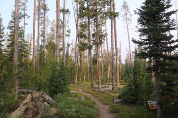
Logistically speaking, there were actually a few different ways to visit Union Falls, and each one had differing lengths and degrees of difficulty. On this page, I’m describing the shortest route, which began from the Grassy Lake Trailhead (see directions below). There were also trailheads at Cascade Creek (the same trailhead for Terraced Falls) as well as Cave Falls near the Bechler Ranger Station accessed from the Cave Falls Road, which crossed into Yellowstone National Park across the Idaho border. These longer options make the round trip hiking distances (not including Ouzel Pool) 15.6 miles and 23 miles, respectively.
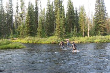
Although the routing of the trail seemed to suggest crossing the Falls River via a small grassy island just past the middle of the wide river, I was with a group that figured out that it was a bit less deep if we made our crossing not far to the left of that island. With the aid of wooden sticks or trekking poles, we managed to keep our balance, especially through the deepest part (which got to about thigh deep just past the island) while traversing diagonally facing downstream (so you’d fall forward if such a calamity happened) before reaching the other side. Surprisingly, the Falls River was not as cold as mountains rivers would typically be, which suggested that there were plenty of geothermal tributaries and sources feeding the Falls River to warm it up to the extent that the morning crossing wasn’t as painfully cold as anticipated. Once on the other side, we could change shoes to resume the hike (I was able to continue straight away since I was wearing Keens though I did experience a problem with chafing later on).
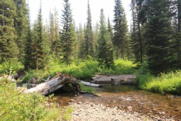
Unlike the Falls River ford, the crossing at Proposition Creek was more like ankle deep, and it was bitterly cold (more like what you’d expect the water temperatures to be on a typical mountain stream). Depending on its depth, some time would have to be spent changing shoes again. Beyond the crossing of Proposition Creek, the trail meandered through extensive patches of lush low-lying bush and shrub (many of which grew berries and wildflowers) surrounded by tall trees as it continued its descent towards Mountain Ash Creek. I’d have to say that this seemingly more moist part of the trail was a haven for mosquitos, which seemed to be pretty fierce during my visit so I tried to keep moving while also re-applying DEET. Finally after about another mile from the Proposition Creek crossing, the trail joined the Union Falls Trail, which ran alongside the fairly sizeable Mountain Ash Creek. I turned right at the junction to follow along the creek upstream.
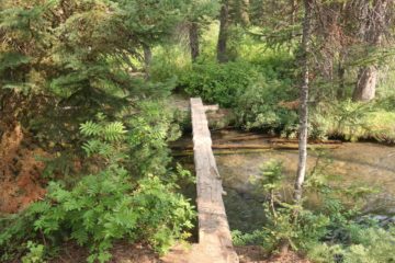
At this junction, there was a fairly large corral accompanied by a sign saying stock use ended there. I first took the right fork at the junction, which then proceeded to climb another 200ft on a narrower path. Eventually, after another 1/2-mile from the trail junction at the corral, the official trail terminated on a ridge overlooking the impressive Union Falls through a couple of clearings in the vegetation. At this point, I had hiked about 7.5 miles from the Grassy Lake Trailhead.
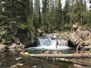
Nonetheless, on the other spur trail, it continued for the next 0.3-0.5 miles or so towards what the topographic maps had labeled as “Falls”. Well, towards the end of this trail, I approached an attractive small waterfall with a plunge pool that had a nice deep blue color to it. There were a trio of people here doing cliff jumps and swims, and there were some rock cairns set up to indicate the end of the short trail. It appeared that the trail kept going, but signage here said that this was the Ouzel Pool Restoration Area (by the way, this sign revealed to me the name of this place) and so I didn’t bother to pursue those trails any further.
Contrasting the physical exertion and amount of time spent hiking, this opportunity to dip at the Ouzel Pool was refreshing. It was also lukewarm as the stream must have had geothermal sources and springs feeding it further upstream. Over the next few minutes as more and more people started showing up, this place then took on a more festive (almost party-like) scene as people took turns doing cliff jumps and some kids were enjoying the water in some calmer spots further downstream. After having my fill of this falls, this would be the turnaround point and the start of the long return hike to the trailhead. I actually extended my hike by going back to Union Falls to take some more pictures of the falls in better afternoon lighting. If I had to be more efficient about my visit, I would have gone to this pool first and then go to the Union Falls later before starting the return hike.
On the return hike, I noticed a lot more stock groups going the other way (further attesting to the relative popularity of this backcountry adventure though there was no tourist crush you’d get by Yellowstone’s main roads) as well as a few dozen more hikers. Given their late starts, I’d imagine most of them were backcountry camping. Anyways, as expected, the hike went pretty swiftly with the exception of the long ascent that began on the Mountain Ash Creek Trail junction and really got steeper beyond the Proposition Creek crossing. This was where I caught up to the group of hikers I encountered throughout the day, who had gotten an early start than me on the return. On the Falls River ford, the water seemed to have gotten slightly deeper and more swift (as I’m sure more snow that was still around upstream had melted in the heat of the mid-Summer day) so again the hiking sticks and the slightly diagonal downstream trajectory while facing downstream were helpful. I then kept left at the trail junction with the Cascade Creek Trail, which could be potentially confusing if one forgot which trailhead he or she parked at. Eventually after 10 hours away from the car, I finally returned to the Grassy Lake Trailhead to conclude this epic hike. Though the end couldn’t have come soon enough as my hiking 16 miles in Keens also managed to chafe both my feet so they were bleeding and definitely needed the breathing room.
Related Top 10 Lists
Trip Planning Resources
Nearby Accommodations
This content is for members only. See Membership Options.Featured Images and Nearby Attractions
This content is for members only. See Membership Options.Visitor Comments:
Got something you'd like to share or say to keep the conversation going? Feel free to leave a comment below...No users have replied to the content on this page
Visitor Reviews of this Waterfall:
If you have a waterfall story or write-up that you'd like to share, feel free to click the button below and fill out the form...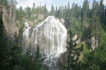 Have You Been To Union Falls? November 5, 2008 3:11 am - Have you seen Union Falls in the southeast part of Yellowstone? Height is 260 ft. ...Read More
Only logged in users can post a comment Please login or sign up to comment