About Perrine Coulee Falls

Perrine Coulee Falls was probably the surprise waterfall of the Twin Falls area for us. While the neighboring Snake River Waterfalls (e.g. Shoshone Falls and Twin Falls) were tampered with, this one seemed to be left to flow naturally (maybe with some additional help, which I’ll get to later). Perhaps the only tampering involved here had to do with all the developments around the falls itself. But the flip side to that was that we got to experience it in a variety of ways that probably wouldn’t have been obvious to us otherwise.
The two main ways we experienced this waterfall was from its base and from the Canyon Crest walking path for a gorgeous top down view. Both ways yielded completely different perspectives, and I’ll describe those separately on this page.
The falls itself was said to be nearly 200ft. Indeed, it was difficult to photograph the falls from close up without some form of a wide angle lens. Since the weather was unseasonably hot during the two times we visited the falls, we definitely appreciated feeling the waterfall’s spray when we managed to go behind the falls.
I had read in the literature that the flow of this waterfall might actually increase in Summer due to the way irrigation canals release their water. If that would be the case, then it probably wouldn’t be a good idea to go behind the falls under the increased flow. It had been speculated that this might be the only waterfall in Twin Falls County that would flow year-round. The photographs you see on this page show how well it was flowing during our April 2013 visit.
We managed to experience this waterfall in two distinctly different ways. So I’ve decided to describe each method (and its directions) separately so we can paint a clearer picture for you about the experience and the logistics of a visit to the intriguing Perrine Coulee Falls.
As for getting to the town of Twin Falls and getting directions from there, see the directions section further below on this page.
[tabby] [tabby title=”Base Of The Falls”]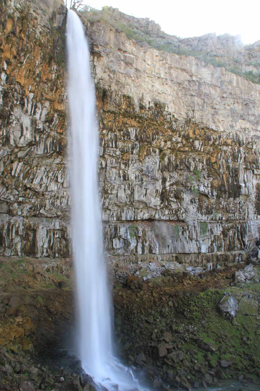
We then followed Canyon Springs Rd as it went past a few residential homes and descended into the Snake River Canyon. At the first hairpin turn (fringed by barricades), there were some informal pullout spaces that we used to park the car. Once we got out of the car, we could hear the falls so we knew we were in the right place.
We were able to see the falls from the barricades. However, we found some informal scrambling paths hugging the canyon wall that allowed us to get onto an informal foot trail that led directly behind the falls itself. It was from here that we could look past the falls and into the Blue Lakes Country Club at the base of the Snake River Canyon.
The scrambling path continued onto the other side of the falls where we managed to get a different angled view of the Perrine Coulee Falls once we got beyond the misty and slippery parts of the rocky scramble. This perspective especially was helpful in the late afternoon that we visited because we were looking directly against the sun when we tried to see it from the hairpin turn.
For all intents and purposes, this waterfall was pretty much a roadside waterfall, but with the additional scrambling we did to see the falls from other spots, we ended up spending about 35 minutes here.
[tabby title=”Top Of The Falls”]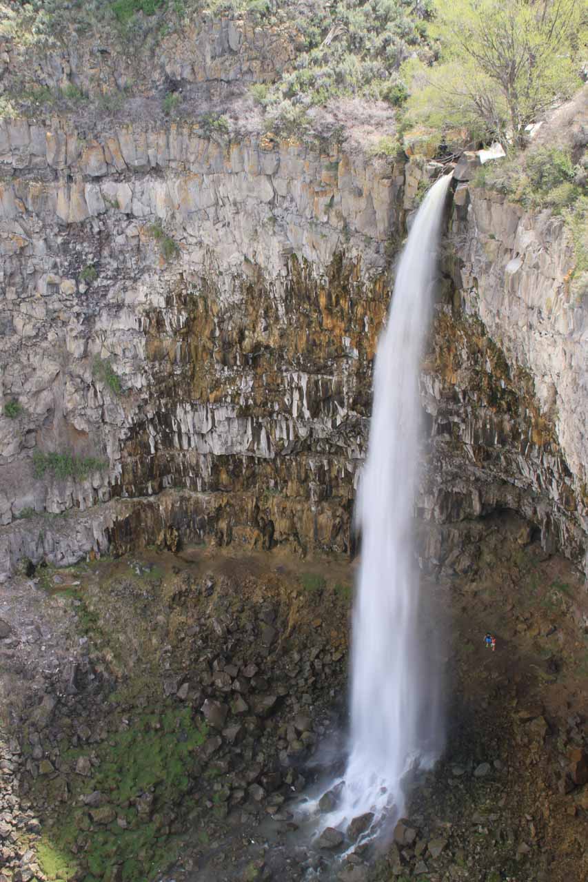
This was where we started the walk, which was on a paved walkway that I think might be called the Canyon Crest Walkway. Facing the canyon, we headed to our right on the paved walkway and followed it for about 10 minutes or so until we reached the first of two overlooks of the Perrine Coulee Falls.
Since we happened to walk behind a handful of businesses, it seemed like we didn’t park at the closest spot to minimize the walking to the overlooks. Nonetheless, we parked the car here because we had eaten at the restaurant before so we were at least familiar with the area.
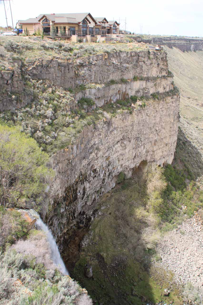
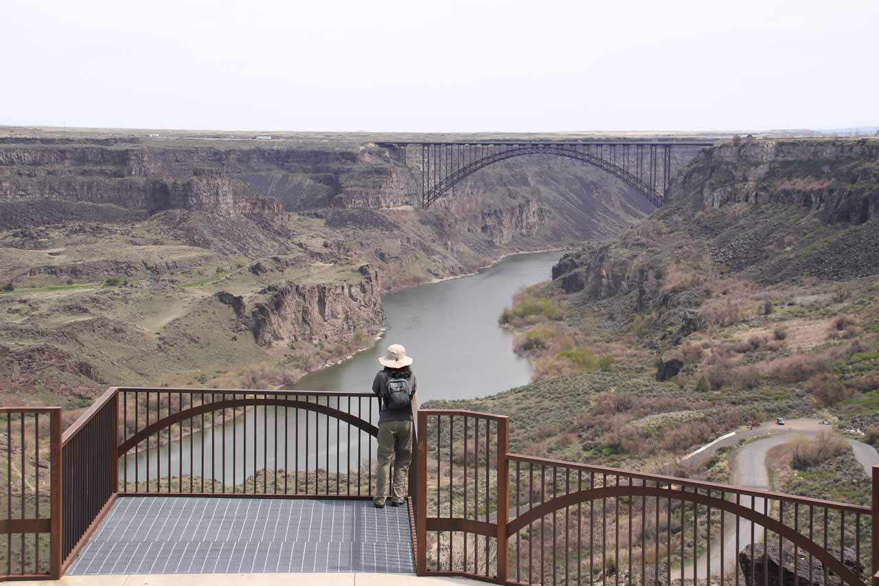
Looking down the Snake River Canyon from this overlook, we were also able to better appreciate the depth of the canyon itself as well as the entirety of the Blue Lakes Country Club at the base of the canyon.
I continued along the Canyon Crest Walkway, which went over a bridge spanning Perrine Coulee Creek, and then swung around to the second overlook. From that second overlook, I was only able to get a partial view of the Perrine Coulee Falls, but I could better appreciate the verticality of this vantage point as the canyon walls here were nearly completely vertical.
A bonus of this second viewpoint was that I could also see some upper cascades on Perrine Coulee Creek that ultimately would feed the main drop of the nearly 200ft falls.
Given the proximity of businesses and residences to the Canyon Crest Walkway, Julie and I shared this path with a lot of friendly locals who were either jogging or strolling about (many of them pushing strollers and/or walking their dogs).
[tabbyending]Related Trip Reports


Related Top 10 Lists
No Posts Found
Related Itineraries
Trip Planning Resources


Nearby Accommodations
This content is for members only. See Membership Options.Featured Images and Nearby Attractions
This content is for members only. See Membership Options.Visitor Comments:
Got something you'd like to share or say to keep the conversation going? Feel free to leave a comment below...No users have replied to the content on this page
Visitor Reviews of this Waterfall:
If you have a waterfall story or write-up that you'd like to share, feel free to click the button below and fill out the form...No users have submitted a write-up/review of this waterfall
Only logged in users can post a comment Please login or sign up to comment