About Grinnell Falls and Salamander Falls

Grinnell Falls and Salamander Falls, while spectacular in their own right, were really only incidental attractions on the epic hike to the Grinnell Glacier, which was rapidly becoming Upper Grinnell Lake. It was definitely one of the most popular excursions in the Many Glacier Valley section of Glacier National Park, but its popularity belied how much of a strenuously long hike it was (which you can see from the difficulty score I gave it). Nevertheless, this was one of the dream hikes of mine ever since I longed for a return to the park after my first visit back in 2010 and I finally got that chance in 2017. And in case you didn’t know, the Grinnell Glacier could very well be Glacier National Park’s most famous glacier because it seemed to be used as the poster child of global warming as before and after photos were frequently shown in the general literature (let alone the park itself) to illustrate the accelerated recession of mountain glaciers around the world. The glacier was named after George Bird Grinnell, who first discovered the glacier in 1885. He was also instrumental in getting Glacier National Park gazetted as a national park in 1910, and he was also a key advocate of getting Theodore Roosevelt and the US army involved in enforcing the national park protections for Yellowstone National Park at around the same time.
Grinnell Falls was the more prominent waterfall as its 280ft wishbone-shaped drop could clearly be seen from as far as Lake Josephine (though it’s much harder to spot, if at all possible, from Swiftcurrent Lake) and was pretty much visible for almost the entirety of the Grinnell Glacier Trail between the climb above Lake Josephine and the final stretch leading to the glacier itself. It also featured a long cascade tumbling its way down from the bottom of the main wishbone-shaped drop all the way to the colorful Grinnell Lake below. The Salamander Falls was a relatively new waterfall resulting from the rapidly receding Grinnell and Salamander Glaciers. This waterfall used to not exist when the two glaciers were joined, but now with both glaciers probably not going to exist in another 13 or so years, there’s no telling how much longer even these waterfalls will remain perennial.
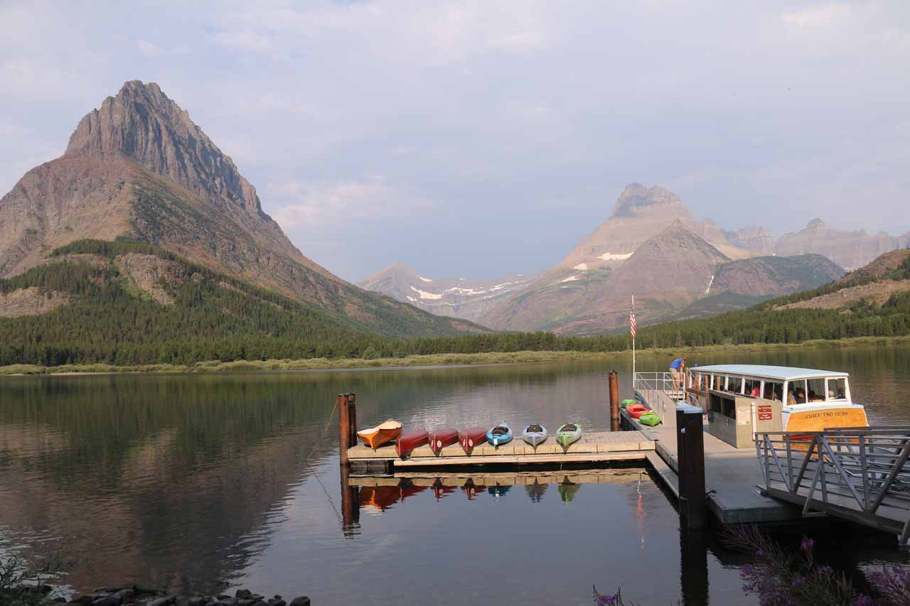
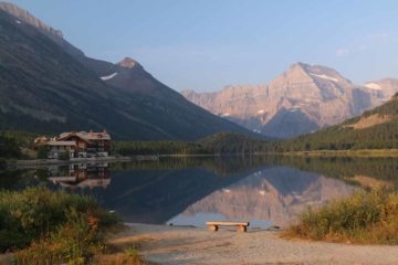
The boat dock was right on the shores between Many Glacier Hotel and the western shores of Swiftcurrent Lake. Once I managed to board the boat (said to seat around 50 people or so at a time), it then took us across Swiftcurrent Lake to its far southern shore, where there was a landing dock. I found the guided boat tour quite informative as the boat driver went into the history of the area as well as some of the need-to-know aspects of the Many Glacier area and the Grinnell Glacier hike itself. When we got off the boat, we then briefly walked a short quarter-mile route going from Swiftcurrent Lake to the dock on the northern shore of Lake Josephine. After boarding that boat while being serenaded with another informative narration of the area, we were then deposited onto the boat dock at the southeastern end of Lake Josephine. This was the pickup point for return boat rides, but it was now time for the hike to begin.

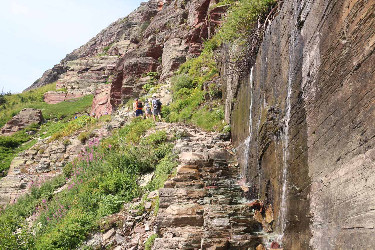
Once I was on the Grinnell Glacier Trail, it immediately started climbing a combination of short switchbacks and straight inclines in a pretty relentless uphill stretch. Since it was pretty much all exposed to the sun, it got hot and sweaty real fast. After about 0.3 miles of this climb, I started to get my first glimpses of both Grinnell Lake and Grinnell Falls. From here and for much of the next 2 miles, Grinnell Falls would remain in view. Anyways, as I continued further along this scenic stretch of trail, I also managed to look into the valley containing Cataract Creek, where at the head of this valley way in the distance was what appeared to be what I think was Morning Eagle Falls. At about 1.6 miles from where the Josephine Walk Trail junctioned with the Grinnell Glacier Trail, I encountered a series of wildflowers and cascades culminating in the so-called Thunderbird Falls, which was where a weeping wall of lightly-flowing water spilled right onto the narrow ledge of the Grinnell Glacier Trail pretty much inviting me to dip my head in the water to momentarily cool off.
Continuing on the Grinnell Glacier Trail, it would continue towards another series of tight and steep switchbacks and steps in another quarter-mile from the toilets. Given how much climbing it took to get up to this point, this next climb would really test the stamina and willpower as the end was tantalizingly near. Once at the top of the switchbacks and steps, the trail continued another quarter-mile before finally arriving at the Grinnell Glacier (or Upper Grinnell Lake) Overlook at about a half-mile from the junction by the toilets or 3.5 miles from the nearest Lake Josephine Boat Dock. There were additional “social” trails leading down from the overlook to the shores of Upper Grinnell Lake, which was full of thin icebergs. It took me about 2 hours to get to this point.
For all that hard work, I spent a good half-hour or more sitting on one of the giant rocks by the shore of the lake while staring at the bittersweet beauty of what was left of Grinnell Glacier and the Salamander Falls spilling into the lake at its far southern end (fed by the Salamander Glacier mostly hidden above). When I looked to the far western end of Upper Grinnell Lake, I noticed there were people high up the wall peering down at us. That was the Grinnell Glacier Overlook from the Skyline Trail (said to be 13 miles round trip from Logan Pass), and that was where the famous before-and-after photo of Grinnell Glacier was taken from. Anyways once I had my fill of this place and my picnic lunch, I headed back the way I came, which was now thankfully mostly downhill.
When I made it down to within eyesight of Lake Josephine, I somehow missed the trail junction for the Josephine Walk Trail, so I wound up continuing on the Josephine North Shore Trail. This trail was exposed to the sun and wasn’t as flat nor as downhill as I have liked, but it was still scenic and peaceful nonetheless (it was noticeably quieter than the Grinnell Glacier Trail). It would be another 1.3 miles of hiking along the North Shore Trail before I returned to the intersection with the trail linking the Swiftcurrent Lake Boat Dock and the Lake Josephine Boat Dock. I then continued hiking around the eastern shores of Swiftcurrent Lake for the remaining mile eventually arriving at the Swiftcurrent Loop Trailhead right by the far southern end of the Many Glacier Hotel. This stretch of trail offered some panoramic views northwards across Swiftcurrent Lake while passing by some residences that might be for park staff. Anyways, that was the conclusion of my hike, and I managed to make it back just in time to have a dinner at the Many Glacier Hotel and before the thunderstorms started to dump their load on the area.
Related Trip Reports
Related Top 10 Lists
Related Itineraries
Trip Planning Resources

Nearby Accommodations
This content is for members only. See Membership Options.Featured Images and Nearby Attractions
This content is for members only. See Membership Options.Visitor Comments:
Got something you'd like to share or say to keep the conversation going? Feel free to leave a comment below...No users have replied to the content on this page
Visitor Reviews of this Waterfall:
If you have a waterfall story or write-up that you'd like to share, feel free to click the button below and fill out the form...No users have submitted a write-up/review of this waterfall
Only logged in users can post a comment Please login or sign up to comment