About Scheidegger Waterfalls

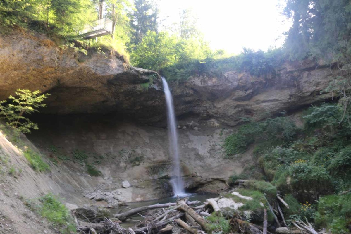
The Scheidegger Waterfalls were a collection of fair-sized waterfalls all experienced from a single excursion within the Rohrach Gorge. The main waterfalls consisted of a 22m upper drop followed by an 18m lower drop on the Rickenbach Creek. There was also a more intimate “Kleiner Wasserfall” (Small Waterfall) further upstream where I was able to walk behind it.
In addition to viewing the waterfalls, there was also a playground and animal petting zoo to pre-occupy the little ones. Amongst the playground apparati were more signs discussing the hydroelectric heritage of the Rickenbach as it was apparently the site of one of the first such water works in Bavaria.
Even though I didn’t do the trails in this order, they were labeled weg 1, weg 2, and weg 3. The word weg is German for “path” or “way”.
Weg 1 forked to the right (on the north side of the Rickenbach Creek), which swung around the gorge rim towards a protruding overlook of the upper Scheidegger Waterfall. In the morning, this view was against the sun as there was nothing to really block the sun’s rays from this position. And in looking downhill, I could clearly see that I was just upstream of the lower Scheidegger Waterfall.

Back at the kiosk, I then continued onto weg 2, which crossed another bridge over the Rickenbach before traversing the playground with interpretive signs about various aspects of hydroelectricity and the heritage of it here. The path continued towards a pair of views with the last one at the dead-end where I managed to get the view you see pictured at the top of this post, which revealed both the upper and lower Scheidegger Waterfalls in one “wasserfall panorama”.
It appeared that over the years, the lower waterfall view became more obstructed due to the growing foliage below as I had seen cleaner views in the literature than what I was able to get on my visit. In any case, this out-and-back route was around 350m round trip.
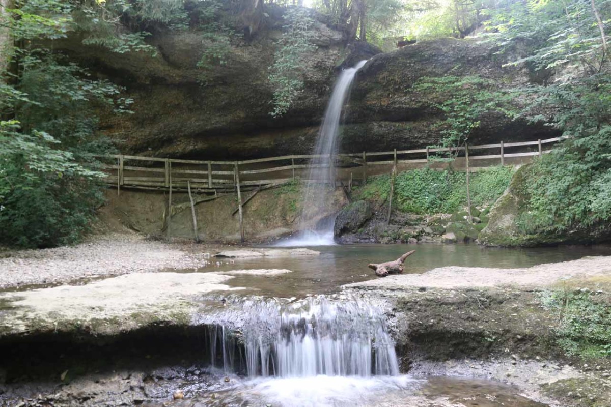
On the other side of the overhang through which the trail passed, there was a gate that was locked during business hours. However, under more normal times, this path would lead right through the animal farm and petting zoo before returning to the kiosk to complete the loop.
Overall, I had spent around an hour away from the car to cover the nearly 1.4km of trail that encompassed all three routes.
Finally, in terms of nomenclature, I’ve chosen to refer to this falls as the Scheidegger Waterfalls as the literature seemed to support this usage more so than the Scheidegg Waterfalls. In German, these falls were referred to in its plural form as die Scheidegger Wasserfälle.
Related Trip Reports
Related Top 10 Lists
No Posts Found
Related Itineraries
Trip Planning Resources

Nearby Accommodations
This content is for members only. See Membership Options.Featured Images and Nearby Attractions
This content is for members only. See Membership Options.Visitor Comments:
Got something you'd like to share or say to keep the conversation going? Feel free to leave a comment below...No users have replied to the content on this page
Visitor Reviews of this Waterfall:
If you have a waterfall story or write-up that you'd like to share, feel free to click the button below and fill out the form...No users have submitted a write-up/review of this waterfall
Only logged in users can post a comment Please login or sign up to comment