About Hinanger Waterfall

The Hinanger Waterfall was an eccentric karstic limestone type waterfalls though this particular one featured some interesting weeping rocks as well as a small natural arch making this one of the most scenic waterfalls of the Allgäu Region. While its main drop was said to be on the order of 12m or so, there was a long series of cascades throughout the stair-filled hike to get up to the main drop.
Beyond the waterfall, the trail skirted along some impressive overhanging cliffs, which was quite atmospheric and well worth the time and effort to do a little more than just the waterfall itself.
From the parallel parking spots by the trailhead (see directions below), we followed a fairly obvious path towards some mill before crossing a bridge over the Hinangerbach. Beyond the bridge, the trail would then climb and zig-zag its way across the creek a few times while allowing us a chance to check out several intermediate cascades and waterfalls along the way.
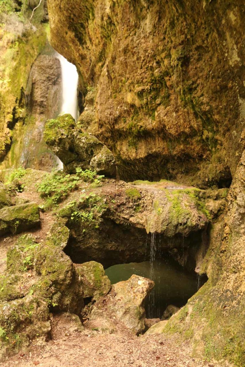
Eventually towards the top of the climb, the trail then fronted the main drop though it was difficult even to capture its modest drop in its entirety because of how close the steel bridge was to the waterfall itself. While examining the immediate area around the base of the falls, we saw that there were percolating springs and weeping rocks flanking the main waterfall as well as some hidden tiny alcoves and even a small natural arch!
Beyond the waterfall, I continued hiking alongside the base of some impressive overhanging cliffs as the trail continued its gradual ascent towards where the cliffs ended. At this point, the trail joined up with other trails that appeared to pass through pastures and lightly forested terrain. And so that was my turnaround point of this out-and-back hike.
Overall, we spent about an hour away from the car. According to my GPS logs, we hiked around 1.2km round trip (not including the added hike along the base of the cliffs beyond the waterfall, which added another 400m round trip.
Finally, for nomenclature’s sake, I’ve referred to this waterfall as the Hinanger Waterfall (as opposed to the Hinang Waterfall) because it seemed to be most commonly referred by its German moniker of Hinanger Wasserfall.
Related Trip Reports

Related Top 10 Lists
No Posts Found
Related Itineraries

Trip Planning Resources

Nearby Accommodations
This content is for members only. See Membership Options.Featured Images and Nearby Attractions
This content is for members only. See Membership Options.Visitor Comments:
Got something you'd like to share or say to keep the conversation going? Feel free to leave a comment below...No users have replied to the content on this page
Visitor Reviews of this Waterfall:
If you have a waterfall story or write-up that you'd like to share, feel free to click the button below and fill out the form...No users have submitted a write-up/review of this waterfall
Only logged in users can post a comment Please login or sign up to comment