About Cascata delle Marmore

Cascata delle Marmore (Waterfall of the Marmore) was probably one of Italy’s more famous waterfalls. We sensed it was famous because it was one waterfall where it seemed like most Italians that we encountered on our trip had either known about it or at least heard of it. The falls also seemed to have gained quite a bit of notoriety internationally as well. Yet despite its apparent fame, the quirky thing about this waterfall was that it was essentially a creation by the Romans!
Although we tend to be down on waterfalls that are artificial or man-made, in this instance (like in the case of Oxararfoss in Iceland), there was a bit of history tied to it. In particular, the Velino River was diverted in 271 BC because its flow was believed to have caused illness to the city of Rieti. It was speculated that the Romans were correct in their line of reasoning as the river’s outflow drained into marshlands neighboring the city, and those swamps were believed to have been spawning grounds for malaria-carrying mosquitoes. By the way, Rieti also happened to be the city where NBA player Kobe Bryant attended school between 1984-1992 and was said to be where he developed his fluency in Italian.

As for the experience of viewing the waterfall, we felt that this was an instance where less was more. We say this because during the scheduled release of the water over the cliff, we witnessed that there was too much mist being thrown up in the air combined with the midday sun causing bright reflections. The end result was that the main tier (the uppermost drop) was not visible in this state as it was shrouded in the mist.
As for walking to the falls, after paying for admission at the biglietteria (ticket office; we paid 8 euros per person) for the lower car park area (see directions below), we then walked for roughly 300m or so along a wide and paved walkway to the entrance kiosk. After showing our paid admission there, we then continued on the paved walkway, which passed right before the impressive multi-tiered Cascata delle Marmore. During the time the water was released, there was enough mist being generated to spray much of that walkway.
The walkway then continued beyond the waterfall and eventually joined with some trails that ultimately led up to the top of the waterfall. We didn’t go do the trail to the top given that we thought the falls only had one hour to flow, and we thought it would take too long to do the hike within the perceived time limit. However, in hindsight, we probably should have done it as we realized that we weren’t as time constrained as originally thought, because the waterfall still had satisfactory flow even after the flow was reduced from its peak flow after 1pm.
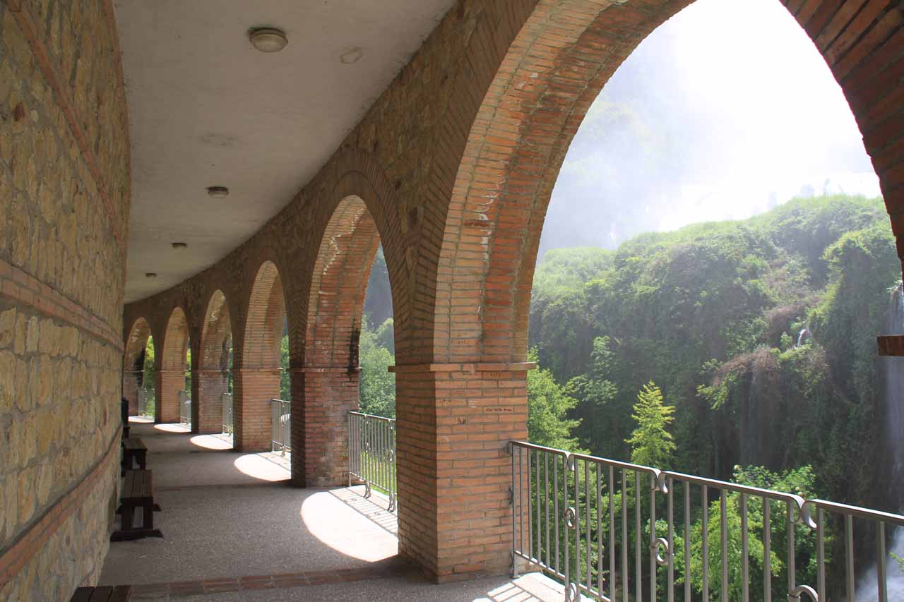
In addition to the walkway with the open air view of the falls, there were also stairs leading to a more sheltered area with archways providing a slightly less misty viewing experience. There were actually benches down there to relax and take in the scenery though every once in a while the winds would shift and allow some of the waterfall’s mist to blow right into the sheltered area.
Overall, Julie and I spent about 90 minutes at just the lower viewing area. However, much of that time was spent sitting and relaxing. So it would be conceivable that a visit here could be as short as a half-hour or so. However, if one were to go for the full experience (seeing both upper and lower viewpoints), then we can easily envision how two hours might be the minimum amount of time to devote to a visit here.
Related Trip Reports
Related Top 10 Lists
No Posts Found
Related Itineraries
Trip Planning Resources


Nearby Accommodations
This content is for members only. See Membership Options.Featured Images and Nearby Attractions
This content is for members only. See Membership Options.Visitor Comments:
Got something you'd like to share or say to keep the conversation going? Feel free to leave a comment below...No users have replied to the content on this page
Visitor Reviews of this Waterfall:
If you have a waterfall story or write-up that you'd like to share, feel free to click the button below and fill out the form...No users have submitted a write-up/review of this waterfall
Only logged in users can post a comment Please login or sign up to comment