About Brecon Beacons Four Falls Trail (Sgwd Clun-Gwyn, Sgwd Isaf Clun-Gwyn, Sgwd y Pannwr, Sgwd yr Eira)

The Brecon Beacons Four Falls Trail took me by surprise both with the amount of exertion need to visit all of the major waterfalls as well as with how scenic each of the falls were. I kind of expected something as long but lukewarm as the Ingleton Waterfalls Trail in England’s Yorkshire Dales, but this turned out to be quite the adventure and photo run, and the nice photo you see at the top of this page was just scratching the surface of what I was able to experience. But first, I have to preface everything by telling you that this was not an easy trail, and it would probably require at least a 2.5-hour time commitment to really experience it all (and it turned out that I took a bit of a shortcut from the official trailheads, which I’ll get to later). I say this wasn’t easy because there were some sections that involved some steep hand-over-foot scrambles that contained dropoff hazards as well as some slippery spots. It was also a very up-and-down hike largely because I had to drop down to each of the falls before going back up to the main trail.
As for the main features of the Four Falls Trail, they were pretty much the waterfalls Sgwd Clun-Gwyn [“SGOOD clin-goo-un”], Sgwd Isaf Clun-Gwyn [“SGOOD ee-sahv clin-goo-un”], Sgwd y Pannwr [“SGOOD uh PAN-noor”}, and Sgwd yr Eira [“SGOOD uhr ehr-uh”]. The first three falls were on the Afon Mellte (Mellte River) while the last falls was on the Afon Hepste (Hepste River). In terms of the Welsh meanings, apparently in South Wales, a lot of waterfalls had the name sgwd meaning “cascade” (as opposed to rhaeadr meaning “waterfall”, which we saw a lot of in North Wales). The word clun meant “hip” in my dictionary while gwyn meant “white” if the letter y was obscure, but it could have meant “ache” if the letter y was clear. Meanwhile isaf meant “lowest” so I suppose the first two falls could mean the White Hip Cascade and the Lower White Hip Cascade, respectively. As for the other waterfalls, pannwr meant “fuller” so it could be the Fuller Cascade, while eira meant “snow” so the last falls was the Snow Cascade.

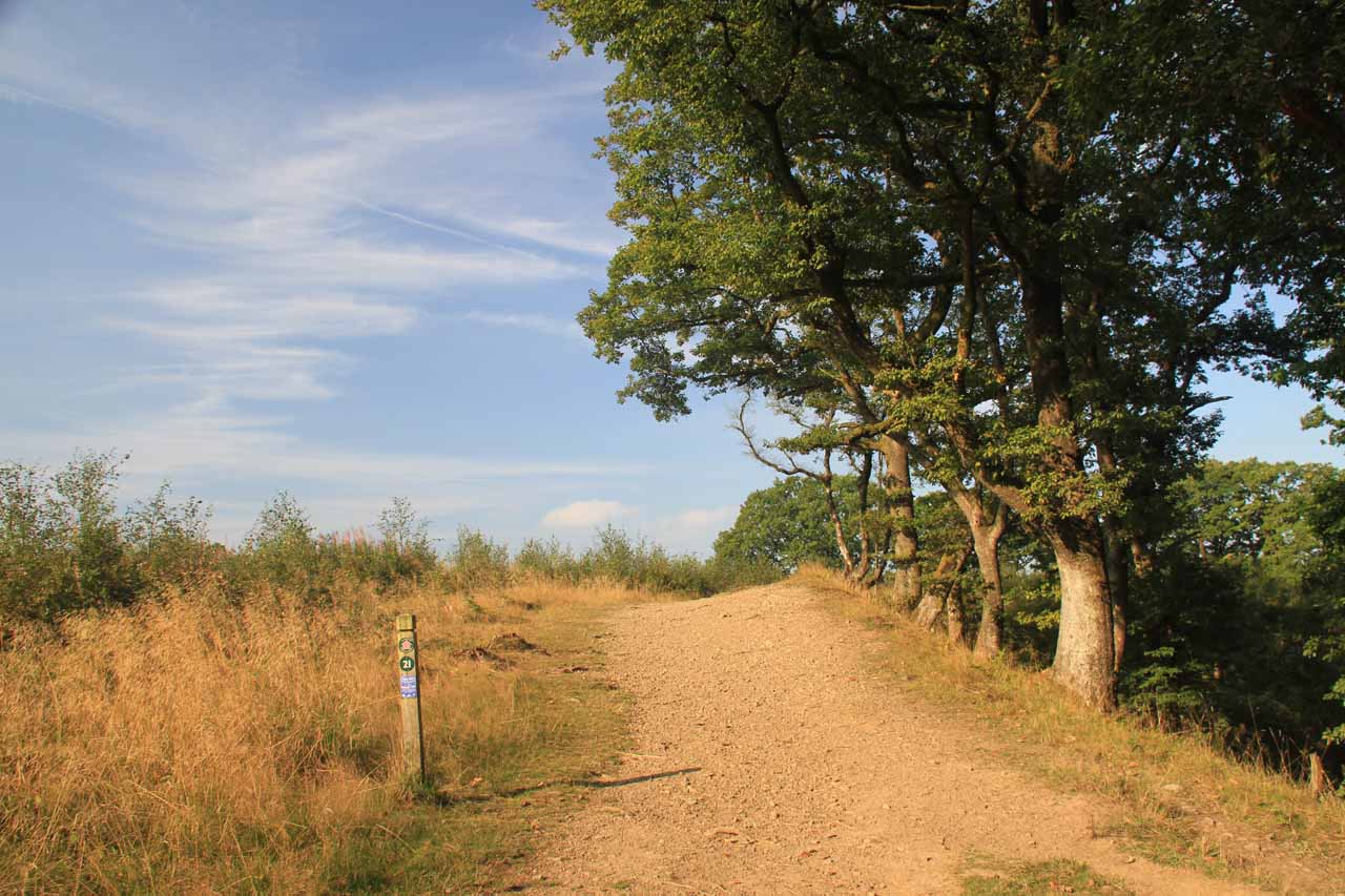
Speaking of the excursion, I actually started from an unmarked trailhead that was closest to the Sgwd Clun-Gwyn waterfall (see directions below). It really seemed like the authorities wanted visitors to either park further away at the Cwm Porth Car Park near Ystradfellte or the Gwaun Hepste Car Park nearby to the east (both near Ystradfellte). I wasn’t sure if the more established Waterfall Centre further south would provide access because it would make for an even longer than an already long walk. Anyways, the more official car parks were pay and display so perhaps that might have a lot to do with it, because I couldn’t imagine why anyone would want to add another hour or more of hiking just to park further away. I’m pretty sure there must be a reason why the trailhead I ended up taking was as obscure and unknown as it was, and I’m willing to bet the situation would be prone to changing (maybe they might close it off or they might do other things to discourage using it) to force most of the traffic towards the car parks they wanted you at in the first place.

As I continued walking further upstream on the trail, I then got to a bridge crossing the Afon Mellte. On the other side of it, there was a trail junction branching left towards the Cwm Porth Car Park some 25 minutes away, where that trail would eventually lead to a cave where the river would disappear from the surface and flow right through it (called Porth yr Ogof or “Door of the Cave”). I didn’t have time to do it, but I always wondered whether I would regret the decision not to explore it. Anyways, as I continued uphill on the linking trail, it ultimately joined with with the official Four Falls Trail where I saw more red arrows reassuring me that I was indeed on the official trail. And just when I got onto that trail, there was steps on a branch trail leading down to a more frontal view of Sgwd Clun-Gwyn from the other side of the river. I had to be careful here because there was some mild cliff exposure at this overlook. Then, when I had my fill of this viewpoint, I followed the “recommended route” back up the steps to the main trail above me though it wasn’t lost on me that there were red signs in the area telling me that a path closer to the river was “closed” for reasons that would become clearer later on.
I was content to take somewhat distant photos of the falls from the riverbank because the morning sun was against me. I didn’t feel a need to scramble on the slick boulders along the river to get closer to the falls so I basically took my photos (wishing I had a tripod though it wouldn’t have been easy to lug it around this far), then went back up the way I came on the long series of steps. And about 20 minutes after I was done with the Sgwd yr Eira (35 minutes since I first saw the memorial), I then found myself at the bottom of the next spur trail descent for the Sgwd y Pannwr waterfall. This waterfall was shorter but intimate as I was able to sit on a ledge and watch the Afon Mellte spread out over a ledge as the waterfall then plunge into a dark pool below me.
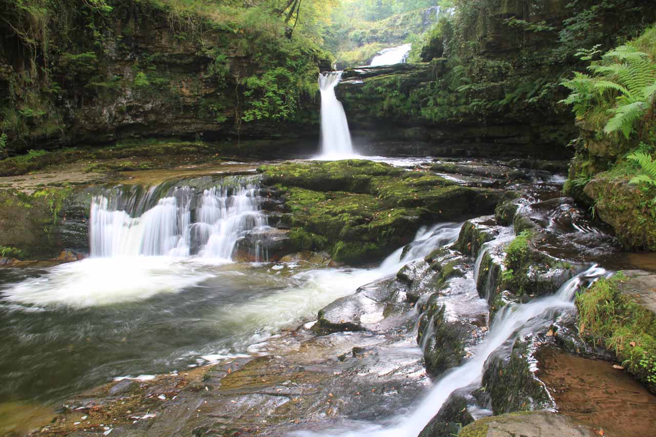
As I ascended this very steep stretch, that was when I went above the lower cascades and started to see the upper two most drops of what had to be the Sgwd Isaf Clun-Gwyn, which was the last of the four major waterfalls on this trail that I would see. Eventually after a little more of the somewhat dangerous and steep scramble, I would finally get up to the base of the uppermost of the tiers of the waterfall, which was the waterfall you see pictured at the top of this page. Even though I wanted to linger here a bit longer and just bask in the remoteness and tranquility of this spot, I knew Julie and Tahia had been waiting for me for over 2 hours at this point so I had to keep moving.
The trail continued scrambling very steeply along the gorge walls above the waterfall. It was a good thing I was climbing this stretch, because I couldn’t imagine how anyone would want to scramble down this very steep stretch. Clearly, a fall here would have been fatal. Eventually, the scary part of the scramble was over when I finally found more familiar (albeit narrow) trail still hugging the ledges above the Afon Mellte River as it followed its general course. Ten minutes later, I would eventually be at the other side of the red closure sign I had seen earlier near the Sgwd Clun-Gwyn waterfall. That was when I realized that this “closure” was really a one-sided closure as they wanted you to do this part of the hike in one direction, which turned out to be for good reason because the steep scramble was best done as an ascent and not a descent.
When I was back at the Sgwd Clun-Gwyn, I saw a lot of abseilers making their way down the Afon Mellste within the river itself. And eventually after another 20 minutes from the closure sign, I was finally back at the car park to rejoin Julie and Tahia.
Related Trip Reports

Related Top 10 Lists

Related Itineraries
Trip Planning Resources

Nearby Accommodations
This content is for members only. See Membership Options.Featured Images and Nearby Attractions
This content is for members only. See Membership Options.Visitor Comments:
Got something you'd like to share or say to keep the conversation going? Feel free to leave a comment below... Welsh Translations October 28, 2015 9:26 pm - Just to say that Sgwd Clun-gwyn means the "fall of the white meadow" in Welsh and is pronounced "skood-klin-g-win" whilst Sgwd y Pannwr is the "fall of the fuller" (a fuller being a wool-washer -see wikipedia entry on 'fulling') thanks ...Read More
Visitor Reviews of this Waterfall:
If you have a waterfall story or write-up that you'd like to share, feel free to click the button below and fill out the form... Sgwd Clun Gwyn (Wales UK) May 25, 2014 2:45 pm - Located in the Brecon Beacons National Park in South Wales the waterfall Sgwd Clun Gwyn (Fall of the White Meadow) can be found on the challenging 5.5mile Four Falls Trail. The River Mellte crashes about 40ft over two ledges. At times of high water this fall can extened all the way across the ledge and… ...Read More
Nearest Waterfalls
