About Allerheiligen Waterfalls

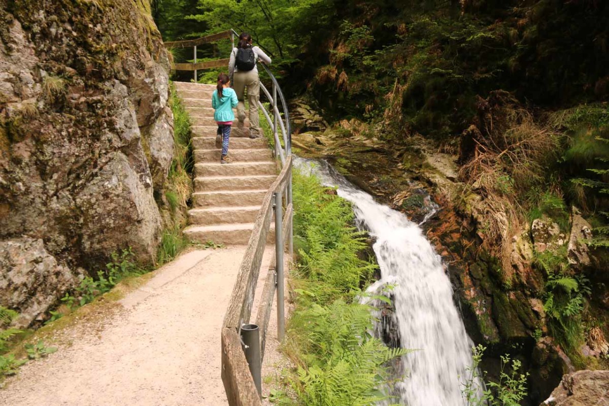
The Allerheiligen Waterfalls were actually a series of small all-season waterfalls tumbling over apparently seven drops within the Schwarzwald National Park. It’s said that the cumulative height of all these drops was about 83m. We were able to experience the falls along a steep but well-made series of steps that climbed alongside each of the waterfall’s drops.
From the spacious car park (see directions below), we crossed the road (being careful due to the blind hairpin turn), then proceeded beneath the procession of man-made archways before getting onto the trail.
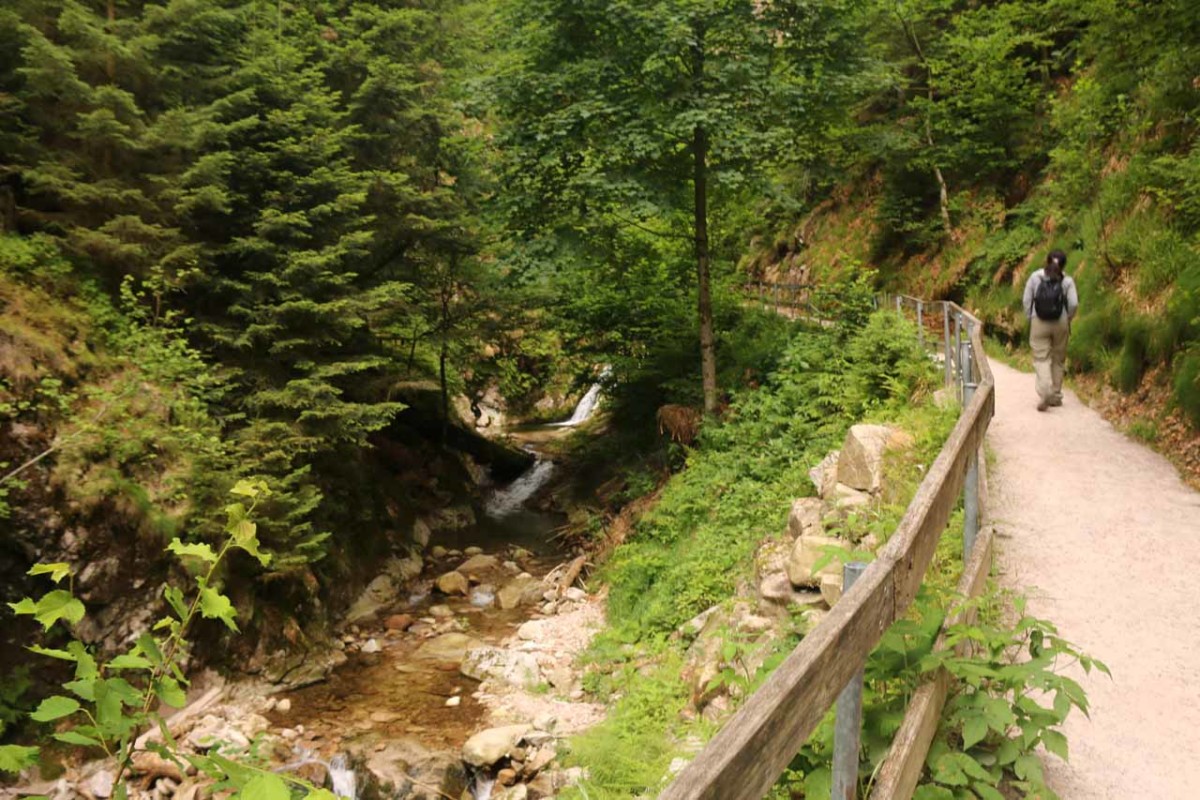
Indeed, at the top of the steps, the path then rounded a bend and momentarily descended as it revealed the next waterfall drop as well as an even longer series of steps going up. On this next round of steps, we were able to glimpse more partial views of the Allerheiligen Waterfalls as it continued to reveal more even longer drops the higher we went.
It was hard to tell when one drop stopped and the next one started, but the highest drops of the waterfall series appeared to be more towards the upper middle of the entire waterfall ensemble. The uppermost pair of drops were each a bit shorter.
This entire excursion only took us an hour covering the entirety of the 0.4km stretch of trail alongside the waterfalls (or 0.8km round trip). It would have been an additional 1.3km further (one-way) to the Allerheiligen Closer Ruins further upstream, which itself had a separate car park and cafe in addition to the Roman ruins themselves.
As for other interesting facts about this waterfall, it turned out that the English translation of Allerheiligen meant “All Saints”. That was apparently due to the Allerheiligen Monastery that dated back to Roman times. Apparently, lots of stories and legends were said about the falls due to its inaccessibility as a result of the steep terrain. The steepness and the stair-stepped nature of the trail certainly attested to that.
This waterfall also assumed many different names over the years. Such names included Büttensteiner Wasserfälle (“Tub Stone Waterfalls”), die Sieben Bütten (“Seven Tubs”), Lierbachfälle, and of course die Wasserfälle Allerheiligen.
Related Trip Reports

Related Top 10 Lists
No Posts Found
Related Itineraries

Trip Planning Resources

Nearby Accommodations
This content is for members only. See Membership Options.Featured Images and Nearby Attractions
This content is for members only. See Membership Options.Visitor Comments:
Got something you'd like to share or say to keep the conversation going? Feel free to leave a comment below...No users have replied to the content on this page
Visitor Reviews of this Waterfall:
If you have a waterfall story or write-up that you'd like to share, feel free to click the button below and fill out the form...No users have submitted a write-up/review of this waterfall
Only logged in users can post a comment Please login or sign up to comment