Slave Falls

Big South Fork National Recreation Area, Tennessee, USA

About Slave Falls


Hiking Distance: 2.6 miles round trip (to falls); 3 miles round trip (to both arch and falls)
Suggested Time: 90-105 minutes

Date first visited: 2012-10-22
Date last visited: 2012-10-22

Waterfall Latitude: 36.53181
Waterfall Longitude: -84.76703

Waterfall Safety and Common Sense

Slave Falls was a trickling waterfall during our visit in Autumn 2012. Based on this experience, I’d have to say you have to come during Spring or immediately after a significant rain event if you want to see this waterfall as more than a puny trickle.

The falls is said to be 60ft as it freefalls into a large alcove. Unlike at Yahoo Falls, this trail ended at a fence discouraging further access into the alcove. So although it physically looked possible to go behind the waterfall, infrastructure was put in to not sanction it.

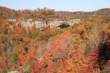
Speaking of alcoves, I learned that the reason why this waterfall was called Slave Falls was because during pre-Civil War times, slaves would hide in the many alcoves here to avoid capture. We noticed there were at least three such alcoves along the trail leading to the falls. I’m sure there are probably more of them outside of the trail system.

The trail we took to this waterfall began at the Sawmill Trailhead (see directions below) and was about 1.3 miles one-way. There was actually a trail junction at the 1.1-mile point of the hike where we could continue for 0.2 miles to the left for the waterfall or 0.2 miles to the right for Needle Arch.

Since the waterfall was disappointing during our visit, we were keen to visit Needle Arch, which was a small but attractive natural arch surrounded by trees. So the total overall hiking distance was probably about 2.8 to 3 miles. We didn’t do the longer Slave Falls/Needle Arch loop as we were content to visit just the arch and the falls before returning to the trailhead.

The out-and-back Y-shaped route that we took was generally downhill en route to each of the attractions and all uphill on the way back to the car park. However, the elevation gain was gradual and not terribly strenuous. All in all, we spent about 1 hour 45 minutes for both the hike and all the picture-taking.

Slave_Falls_Needle_Arch_002_20121022
Slave_Falls_Needle_Arch_008_20121022
Slave_Falls_Needle_Arch_009_20121022
Slave_Falls_Needle_Arch_013_20121022
Slave_Falls_Needle_Arch_018_20121022
Slave_Falls_Needle_Arch_020_20121022
Slave_Falls_Needle_Arch_022_20121022
Slave_Falls_Needle_Arch_024_20121022
Slave_Falls_Needle_Arch_025_20121022
Slave_Falls_Needle_Arch_026_20121022
Slave_Falls_Needle_Arch_039_20121022
Slave_Falls_Needle_Arch_047_20121022


From the town of Oneida, TN (along the US27 near the Tennessee/Kentucky border), drive west on the Highway 297 for about 22.5 miles as it will junction with Hwy 154. Turn right onto Hwy 154 (going north) then drive for another 1.7 miles to a turnoff on the right for the Divide Rd. Turn right to go onto the unpaved Divide Rd and drive another mile to a fork.

Turn right at this fork, which is now a narrower unpaved road shared with hikers, horse carriages, and other non-motorized traffic that ultimately leads to the Charrit Creek Lodge. You only need to go about 1.8 miles on this road before reaching the open grassy car park for the signposted Sawmill Trailhead.

Twin_Arches_038_20121022
Looking back at the South Arch
It turns out that another 0.2 miles or so down the road, there is a different connecting trail for Slave Falls and Needle Arch. However, there’s no sanctioned parking besides the gravel road here, and I think it was really meant to be part of the Slave Falls/Needle Arch loop trail. If you’re entertaining thoughts about reducing the length of the out-and-back hike to Slave Falls and Needle Arch, I think you’re only saving about 0.1 mile going this way anyways.

By the way, this trail and the corresponding attractions belong to the Big South Fork National Recreational Area. The Big South Fork refers to a branch of the Cumberland River that is the central feature of this region. If you’re visiting this waterfall, we highly recommend also visiting the Twin Arches (North and South Arches), which are on a separate trailhead not far from the Sawmill Trailhead.

To get there from the Sawmill Trailhead, go back towards Divide Rd (about 1.8 miles), then turn right onto Divide Rd and continue for about 3 miles. There will be a junction (I believe it’s signposted) where you turn right and follow this road for 2 miles or so to the Twin Arches car park at the end of the unsealed road. It’s only a mile hike each way to both arches, which are much bigger than Needle Arch. The trail even lets you go on top of the North Arch.

To give you a sense of drive times, it took us about 1 hour and 15 minutes to drive from Williamsburg, KY through Oneida to the Sawmill Trailhead. When we crossed over from Kentucky to Tennessee, we had to watch out for the time difference.

For some additional context, Williamsburg (the nearest town where we stayed) was 70 miles (over an hour drive) north of Knoxville, Tennessee, 183 miles (3 hours drive) northwest of Asheville, North Carolina, and 103 miles (over 90 minutes drive) south of Lexington.

Find A Place To Stay

Left to right sweep along the alcove before zooming in on the trickling falls with a top down sweep


Left to right sweep from the backside of Needle Arch

Related Top 10 Lists

No Posts Found

Trip Planning Resources


Nearby Accommodations


Tagged with: big south fork, national recreation area, picket county, daniel boone, twin arches, kentucky, tennessee, waterfall, needle arch, sawmill


Visitor Comments:

Got something you'd like to share or say to keep the conversation going? Feel free to leave a comment below...

No users have replied to the content on this page


Share your thoughts about what you've read on this page

You must be logged in to submit content. Refresh this page after you have logged in.

Visitor Reviews of this Waterfall:

If you have a waterfall story or write-up that you'd like to share, feel free to click the button below and fill out the form...

No users have submitted a write-up/review of this waterfall


Have you been to a waterfall? Submit a write-up/review and share your experiences or impressions

Review A Waterfall

Nearest Waterfalls

The Waterfaller Newsletter

The Waterfaller Newsletter is where we curate the wealth of information on the World of Waterfalls website and deliver it to you in bite-sized chunks in your email inbox. You'll also get exclusive content like...

  • Waterfall Wednesdays
  • Insider Tips
  • User-submitted Waterfall Write-up of the Month
  • and the latest news and updates both within the website as well as around the wonderful world of waterfalls


How To Build A Profitable Travel Blog In 4 Steps