About Wapta Falls

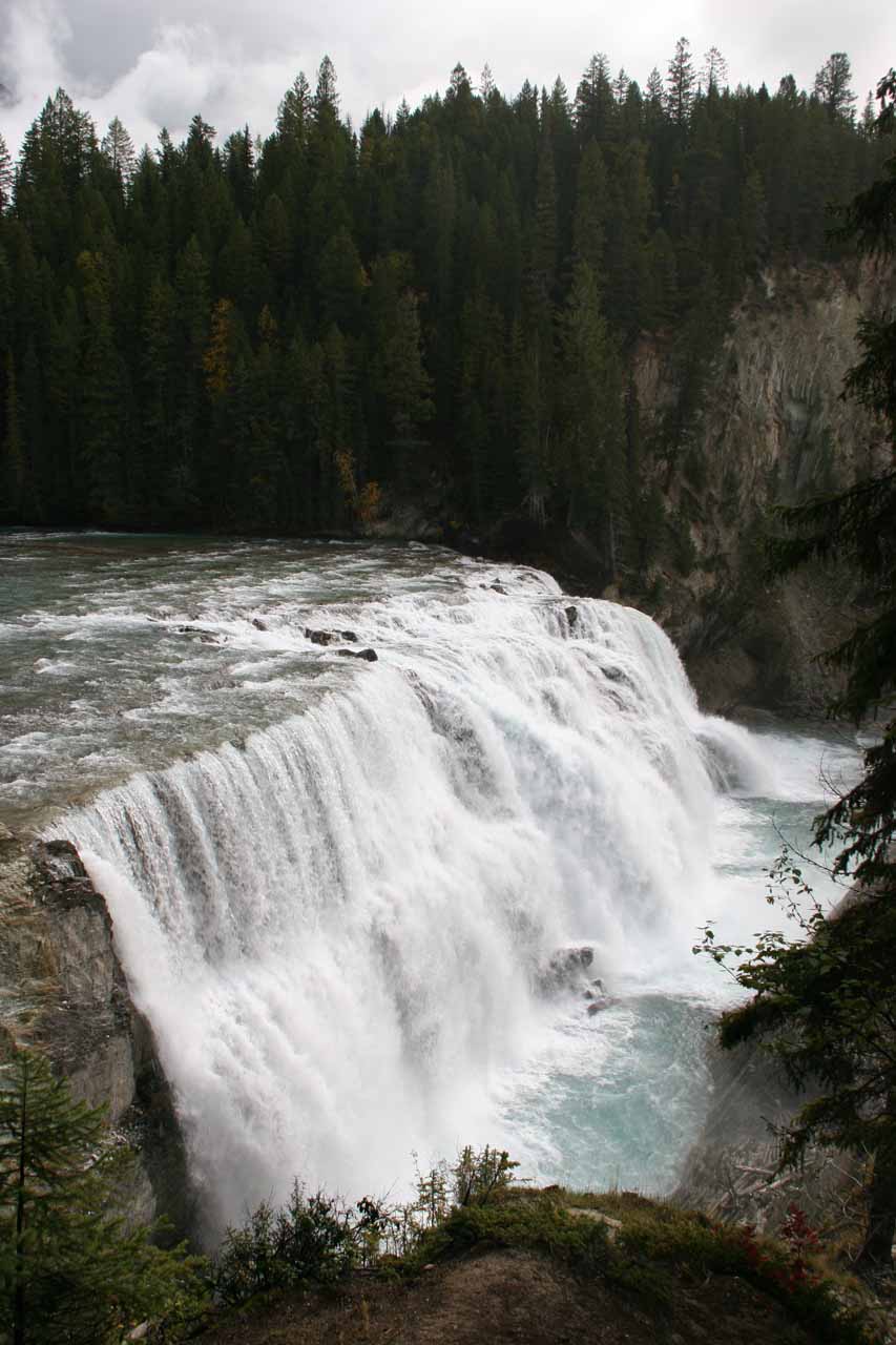
Wapta Falls was a wide river-type waterfall that pleasantly surprised Julie and I though we did get into a little bit of an adventure just trying to find it. In any case, it’s said to be 30m high and 150m wide, which would back up our impressions that it was a pretty grand waterfall. And since it was on the fairly sizable Kicking Horse River, for sure this waterfall would have year-round flow so even our late Summer-early Autumn visit in September 2010 didn’t disappoint. In fact, the Autumn colors seemed to have added to our experience both on the trail and at the falls itself!
I recalled the hiking was about 1.6km each way (or 3.2km [2 miles] round trip). It took Julie and I two hours to hike to the falls, enjoy it, and hike back to the car park.
The hike was mostly flat (or with a slight uphill) for at least the first kilometer as we were flanked by pretty Autumn colors on the foliage of low-lying bush and trees. The trail was mostly quiet until we got closer to the Kicking Horse River when we could start to hear the rush of water.
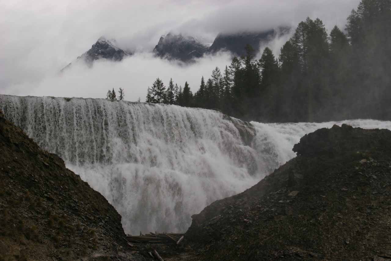
So a short distance further down the trail, there was a fork where the path on the left descended steeply in a narrow but well-worn path. The path straight ahead seemed to be the official trail, but I opted to take the narrow path on the left. And after a few minutes of doing so (there was some minor dropoff exposure), I reached another fenced overlook. But this time, the view was more of an angled profile perspective (see photo at the top of this page) that I thought was much better than the one above.
Continuing further downhill, I eventually made it to the bottom where a faint path continued on the left side towards the opening that was sheltered by the hill. That misty notch on the left side of the hill was practically impossible to take a photo from (at least not without risk of water damage to the camera let alone waterspots all over the lens).
Meanwhile, with some minor stream scrambling, I was also able to scramble to the far side of the waterfall sheltered by the hill where there was another path scrambling up that side of the hill for another misty in-your-face view of Wapta Falls. At least the mist there wasn’t as bad as the little opening on the left side of the hill.
I was never able to get that all encompassing frontal view of the falls thanks to the hill. However, I can only imagine how the situation would change completely if that hill were to be gone. I often wondered how much time it would take before that hill would completely erode away.
In any case, I went back up the way I came to rejoin Julie and complete the hike. However, I did notice other people who reached the basin area further downstream. I believe this was where that path I didn’t take ultimately would’ve gone. That path was probably the more official path judging by its width and gentle grade. The one I took almost felt like a scramble and I figured it would probably be more prone to closure due to exposure to dropoffs, tree roots, and erosion.
Related Trip Reports
Related Top 10 Lists
No Posts Found
Related Itineraries
Trip Planning Resources
Nearby Accommodations
This content is for members only. See Membership Options.Featured Images and Nearby Attractions
This content is for members only. See Membership Options.Visitor Comments:
Got something you'd like to share or say to keep the conversation going? Feel free to leave a comment below...No users have replied to the content on this page
Visitor Reviews of this Waterfall:
If you have a waterfall story or write-up that you'd like to share, feel free to click the button below and fill out the form...No users have submitted a write-up/review of this waterfall
Only logged in users can post a comment Please login or sign up to comment