About Lower Bertha Falls

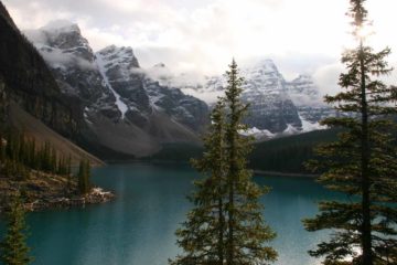
Lower Bertha Falls was the last Canadian waterfall that we saw during our September 2010 trip. What Julie and I enjoyed most about this excursion were the views of Waterton Lake as well as the folded yet pointy mountains making up the landscape surrounding the 2.7km (each way) trail to the falls. In fact, it was probably that Rocky Mountain feel of the trail that really made us sense that we really were hiking within the Crown of the Continent.
As for the falls itself, it was mainly an upside-down triangular fan-type waterfall before twisting and turning into a cascade as it passed beneath the footbridge that passed over the creek and continued the trail towards the Upper Bertha Falls and beyond. While we were able see the falls from that bridge, we noticed a steep and slippery scrambling path yielding a more open (less obstructed view) of the falls, which you see pictured at the top of this page.
As for the hike, it started at the Lower Bertha Trailhead (see directions below). Then, the trail went mostly uphill on a fairly gentle grade as it eventually yielded lakeside views after about 15-20 minutes or so on the trail.
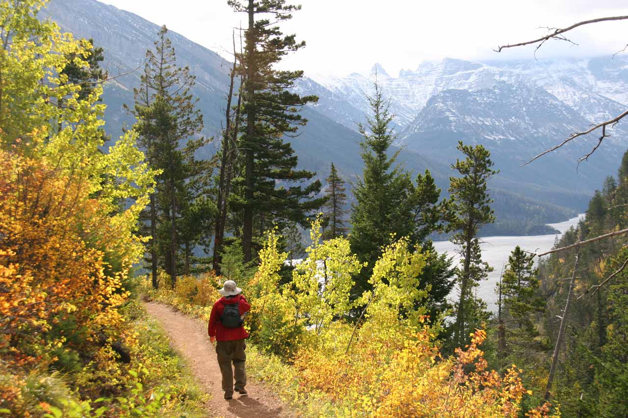
Throughout much of the stretch where the trail more or less paralleled above the western shore of Waterton Lake, it was very easy for me to get distracted with the vistas of the mountains rising high above the lake itself. There was even a short spur trail leading to a lookout point towards the backside of the lake as well as the mouth of the lake in the direction of town.
Shortly after this spur somewhere past the one-hour point of the hike, the trail veered inland past a trail junction (where the path we didn’t take on the left continued along the lake). Beyond the junction, the trail entered a canyon as it narrowed and provided vistas of the folded mountains ahead. And after a few more minutes of hiking past more berries and a few small cascades, eventually we reached the footbridge from where we were able to see Lower Bertha Falls at about 2.7km from the trailhead.
The outfitter in Waterton where I bought bear spray from suggested that I continue past the footbridge towards the Upper Bertha Falls and the lake nearby. Unfortunately with a pregnant Julie being on the hike with me, the grizzly bear activity, and the lack of time we allowed ourselves for continuing on, we passed on that suggestion and turned back. Though I’m sure it would’ve been beautiful, it’ll have to be punted to next time…
To give you an idea of the time commitment for this excursion, we spent a little over 2 hours on this hike.
Related Trip Reports
Related Top 10 Lists
No Posts Found
Related Itineraries
Trip Planning Resources
Nearby Accommodations
This content is for members only. See Membership Options.Featured Images and Nearby Attractions
This content is for members only. See Membership Options.Visitor Comments:
Got something you'd like to share or say to keep the conversation going? Feel free to leave a comment below...No users have replied to the content on this page
Visitor Reviews of this Waterfall:
If you have a waterfall story or write-up that you'd like to share, feel free to click the button below and fill out the form...No users have submitted a write-up/review of this waterfall
Only logged in users can post a comment Please login or sign up to comment