About Moonlight Falls
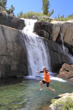
Moonlight Falls is one of those backcountry waterfalls that’s really more of an incidental attraction in an area better known for 14,000ft peaks and alpine lakes. But then again, I guess that’s kind of what makes this waterfall stand out on its own. Even though the falls itself isn’t big (I’m guessing only 30ft or so), nor is it wide and powerful, it does have gorgeous granite peaks as a backdrop (especially those surrounding Hungry Packer Lake) and it allows for hardy backcountry backpackers an opportunity to enjoy a refreshing (and well-earned) swim.
Now that I’ve talked about this waterfall in terms of the backcountry, you’ve probably guessed by now that this isn’t a day hike waterfall though there’s nothing to stop you from doing it as a day hike. It’ll be a very long day hike, however, and the altitude will make it even more strenuous than the distance might indicate.
According to my GPS trip log it’s about 6.6 miles one-way from the Lake Sabrina trailhead to the base of this waterfall. In addition to the distance, we had to go from 9000ft to 11,000ft in elevation and it is conceivable that the GPS
trip log underestimated the overall distance thanks to the numerous switchbacks during climbs combined with cumulative inaccuracies concerning elevation on the receiver (so it could be another mile or so each way). Add it all up and it’s a difficult hike either way.
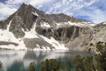
But considering all the physical exertion required at high altitude for Moonlight Falls, the real reason we went out here was for the pretty glacial lakes and the impressive peaks, which still had lots of snow on them during our trip in mid-August 2011! And I don’t think we were alone in this thought as we saw plenty of other hikers and backpackers doing this trail as well.
From the trailhead near the shores of Lake Sabrina, we hiked gradually uphill along the southeastern shores of the manmade lake. In the morning, the lake was calm enough to produce attractive reflections. After about a mile of hiking, the trail diverged from from the lake and started climbing more steeply. At nearly 2 miles from the trailhead, we encountered steep switchbacks, which were very taxing with packs on.
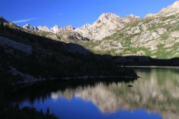
After another 1.3 miles or so, the trail (which continued climbing albeit somewhat gradually) eventually reached the diminutive Dingleberry Lake. We actually set up our camping spot another 1/4-mile south of Dingleberry Lake just above a long and potentially wet creek crossing of Bishop Creek. At around 1/4 mile beyond the long crossing of Bishop Creek, there was a very easy-to-miss spur trail on the left leading to Topsy Turvy Lake. This spur was significant only in that I spotted an interesting cascade on the opposite side of Bishop Creek that appeared to be draining Topsy Turvy Lake. After going about 0.1-mile on this detour towards Topsy Turvy Lake, I found perhaps the best view of the falls after leaving the trail and climbing up a rocky bluff where I managed to see the fairly significant cascade between trees.
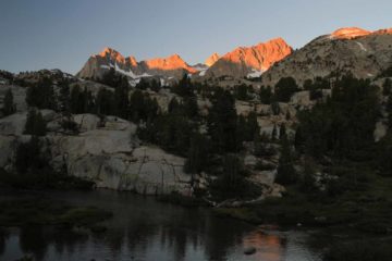
In another 1/3 mile, we reached another trail junction. Since we were able to see Moonlight Falls in the distance en route to this junction, we knew that this junction led closer to the waterfall highlight of this trip. Sure enough, we descended a half-scramble on a faint trail passing by a pair of small cascades before reaching the pool before Moonlight Falls in about 1/4-mile.
Although the Topo Map labeled Sailor Lake very close to the actual location of Moonlight Falls, the waterfall actually drained Moonlight Lake. Sailor Lake appeared to be a swampy multitude of smaller lakes that might also partially contribute to the creek draining Moonlight Lake and hence augment the falls.
Now even though this was the waterfall goal of our trip, we did continue the extra 1/2-mile beyond the Moonlight Falls detour to Hungry Packer Lake, which was the last of the significant lakes we encountered on this trip. There was also a rocky spur deviating from this trail towards a view of Moonlight Lake, which was also a large lake backed by tall peaks though not quite in an enclosed bowl like Hungry Packer. However, the kicker was that we found another attractive cascade spilling into Hungry Packer Lake. So really, a visit to Moonlight Falls and the achievable extension towards Hungry Packer Lake yielded multiple surprise waterfalls.
In other words, don’t let Moonlight Falls be the goal. It’s just one scenic attraction in a myriad of Eastern Sierra backcountry that was worth checking out, which included more waterfalls as well as the lakes and the peaks.
Even though I’ve claimed that an out-and-back hike focusing only on Moonlight Falls would be 13.2 miles round trip (give or take), we really logged about 16 miles round trip to encompass all the aforementioned lakes in this writeup plus some of the side scrambles and detours to other cascades or lakes begging for a better view.
Related Top 10 Lists
No Posts Found
Trip Planning Resources
Nearby Accommodations
This content is for members only. See Membership Options.Featured Images and Nearby Attractions
This content is for members only. See Membership Options.Visitor Comments:
Got something you'd like to share or say to keep the conversation going? Feel free to leave a comment below...No users have replied to the content on this page
Visitor Reviews of this Waterfall:
If you have a waterfall story or write-up that you'd like to share, feel free to click the button below and fill out the form...No users have submitted a write-up/review of this waterfall


Only logged in users can post a comment Please login or sign up to comment