About Darwin Falls

Darwin Falls epitomized what was perhaps one of the great paradoxes when it comes to waterfalling in California. Sitting within the boundaries of Death Valley National Park, which was known as one of the hottest and driest places on earth, there was this oasis of a said-to-be year-round 25-30ft waterfall making it all the more crazy that such a place could exist in such a harsh desert landscape. Now I should caveat its location in that the falls was technically in a side canyon of Panamint Valley, which was just on the other side of the Telescope Range from the main basin of Death Valley. Nevertheless, from looking at the bare mountains surrounding Panamint Valley and the Panamint Springs area, that doesn’t diminish the fact that the falls indeed sits in a place where water was rare.
What made the falls’ existence even possible in such a harsh environment was that it was fed by springs, which are underground watercourses (or aquifers) mostly protected from the evaporative heat and low humidity that Death Valley and its surroundings are notorious for. The desert conditions are mostly a result of the presence of the 14,000ft peaks of the Eastern Sierra (including Mt Whitney, which is said to be the tallest mountain in the contiguous 48 states), which would put anything east of these mountains in its rain shadow. Nonetheless, during the Winter months, snow could accumulate on the Panamint Ranges (further to the east of the Sierras and the Owens Valley) before melting and feeding the aquifers, and the Summer monsoon could also help add a little more water to the drainage as well.
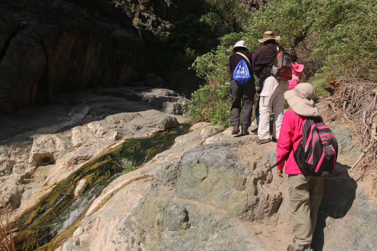
After the first half-mile, the canyon walls closed in to such an extent that the trail then bent to our right followed Darwin Creek. The sudden appearance of water (where there wasn’t any to be seen in the wash earlier on) was because the canyon walls essentially acted as a funnel allowing vegetation to concentrate around the creek and further retain the precious moisture. There were also a couple of minor cascades as well as tiny ponds where we happened to see toads or frogs the first time we did this hike (not so the second time as apparently this hike had gotten too popular). Given the presence of the water and the more rugged terrain, the scrambling that was required to both avoid wetting the shoes while also avoiding bushwhacking made things a little interesting when we brought kids along for this hike. While they were able to do it without issue for almost the entire hike, there were a couple of spots where they needed assistance. In general, when the scrambling yielded head-scratching moments, we generally kept to the left of the creek (going upstream).
Eventually after a mile from the trailhead, we would reach the attractive plunge pool fronting Darwin Falls with its split upside-down Y appearance thanks to a rock at its base splitting the course of the creek. Each time we’ve done this hike, this was the turnaround point as the canyon walls were really rugged and nearly vertical at this point. However, I did notice some people finding a way to scramble higher up on the cliffs to the left (facing the falls) as there were apparently more waterfalls on Darwin Creek further upstream from the Darwin Falls. I can’t comment any further on those since we’ve never done it. Anyways, it was easy to spend lots of time just marveling at the miracle of this waterfall in Death Valley, especially since the kids loved chucking rocks into the pool or attempt to climb the tree that was right at the edge of the plunge pool.
After having our fill of the falls, we went back down the way we came, which seemed to be much easier and faster as it only took us around 30 minutes to return (as opposed to nearly an hour or so on the way to the falls). Given how many people we saw on the return hike, it wasn’t lost upon us just how popular Darwin Falls was. Indeed, this had to have been one of the highlights of a visit to Death Valley National Park.
Related Trip Reports
Related Top 10 Lists
No Posts Found
Related Itineraries
Trip Planning Resources


Nearby Accommodations
This content is for members only. See Membership Options.Featured Images and Nearby Attractions
This content is for members only. See Membership Options.Visitor Comments:
Got something you'd like to share or say to keep the conversation going? Feel free to leave a comment below... Death Valley National Park November 1, 2010 12:15 pm - I along with my family have been to Death Valley National Park in Summer. It was too hot that time and completely dry. We didn't find any waterfall over there. I guess we missed out on the beautiful scene and well as your toad floating in ponds (kidding). Apart from this scenery we managed to… ...Read More
Visitor Reviews of this Waterfall:
If you have a waterfall story or write-up that you'd like to share, feel free to click the button below and fill out the form...No users have submitted a write-up/review of this waterfall
Nearest Waterfalls
