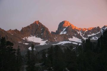
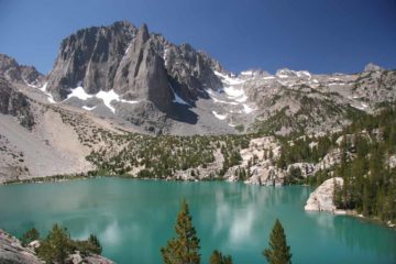
About Big Pine Creek Waterfalls

The Big Pine Creek Waterfalls are the series of waterfalls and cascades primarily on the North Fork of Big Pine Creek. However, I’d imagine that the real objective for visitors to this part of the John Muir Wilderness would be the wonderfully colorful glaciated lakes surrounded by very tall mountains (some of which peak above 14,000ft). It’s classic Eastern Sierra scenery, and the waterfalls were merely my excuse to include the gorgeous High Sierras backcountry scenery on this website.
Now when I was invited to join a backpacking group for a weekend backpack in July 2009 (which happened to be my 1st backpack in at least 5 years), I didn’t expect much from the waterfalls and cascades here. But once we got on the trail, the cascades and waterfalls were much bigger and more vigorous than I expected (though I have to admit the expectations were quite low).
The main waterfalls of the lot were named First Falls and Second Falls. Second Falls was probably the most impressive cascade since it looked very tall as it snaked its way down granite gullies beneath Mt Alice. Roughly a couple of miles into the Upper Trail yielded distant frontal views of the falls. Then, as we got closer to the falls, that was when we could appreciate the sloping nature of the cascade. Once you’re at the top of the falls, we could hear it tumble loudly, but it was no longer very photographable at this point.
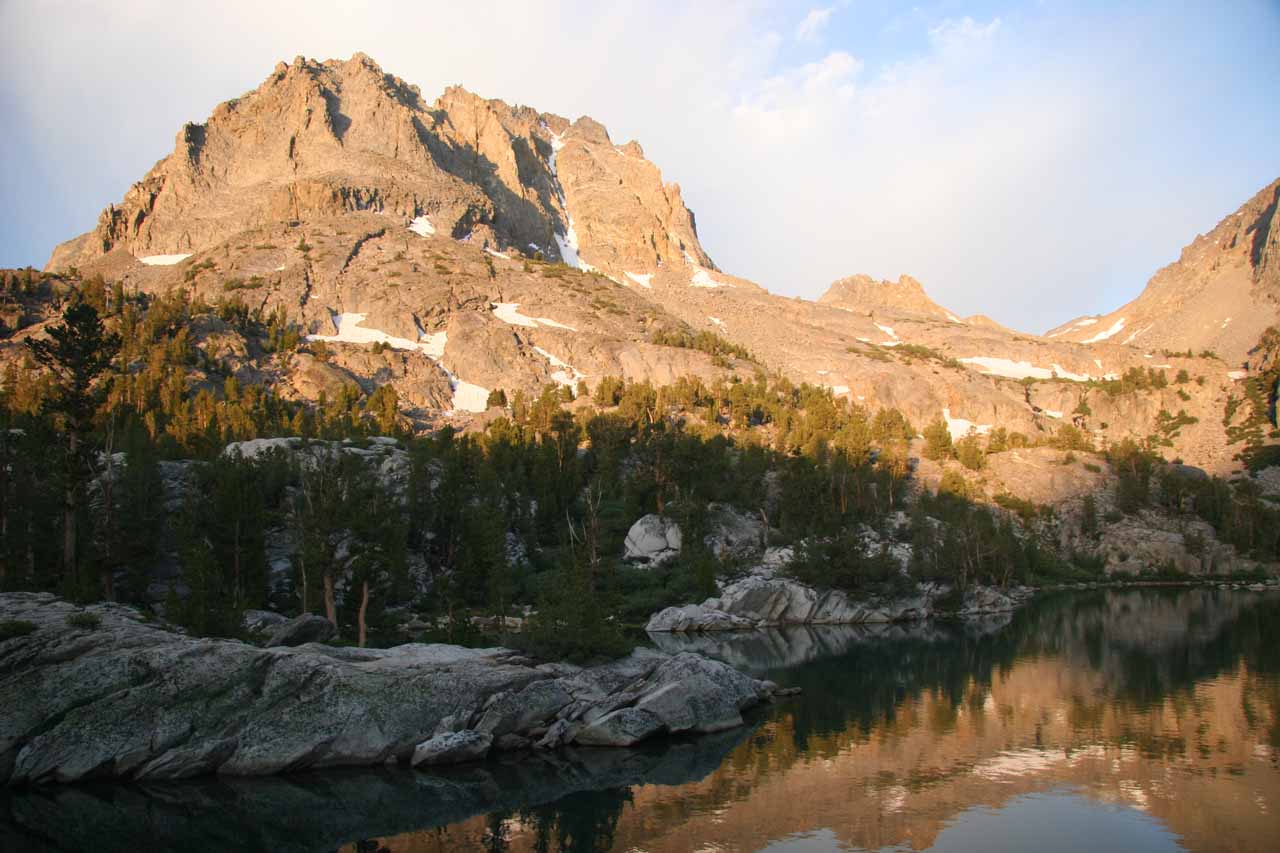
Beyond Second Falls, there were other cascades on Big Pine Creek. I recalled we spotted waterfalls beneath First Lake, between First and Second Lake, between Second and Third Lake, and just above and below Fifth Lake. We camped at Fifth Lake and I think we logged about 23 miles round trip (as a loop as we didn’t go out the same way we came in) with 3500ft elevation gain. And I’m not including the day hike to 6th Lake.
Finally, we should mention that we gave this excursion a difficulty of 3 because we only assumed the minimum distance to at least see Second Falls. However, if you do what we did and visit most of the lakes of Big Pine Creek, then the hiking difficulty would most certainly be a 5 due to length.
Related Trip Reports
Related Top 10 Lists
No Posts Found
Related Itineraries
Trip Planning Resources


Nearby Accommodations
This content is for members only. See Membership Options.Featured Images and Nearby Attractions
This content is for members only. See Membership Options.Visitor Comments:
Got something you'd like to share or say to keep the conversation going? Feel free to leave a comment below...No users have replied to the content on this page
Visitor Reviews of this Waterfall:
If you have a waterfall story or write-up that you'd like to share, feel free to click the button below and fill out the form...No users have submitted a write-up/review of this waterfall
Only logged in users can post a comment Please login or sign up to comment