About Jim Jim Falls

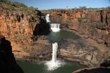
Jim Jim Falls (Aboriginal name Barrkmalam) was in our minds the Northern Territory‘s (let alone Kakadu National Park’s) most spectacular waterfall. It was said to plunge about 200m off the escarpment and tended to flow spectacularly in the Wet Season. The picture you see at the top of this page was taken during our visit in June 2006, which was towards the start of the Dry Season. And as you can see from that photo plus the rest of the photos on this page, the dual-segmented plunge along with its sheer size and awesome settings were what really compelled Julie and I to place this at the top of our Top 10 Australia Waterfalls list.
It was hard to believe that we almost weren’t able to visit this waterfall! To make a long story short, we originally intended to do a land tour to both Jim Jim Falls and the nearby Twin Falls, but an unseasonably late cyclone (Cyclone Monica, I believe) had hit the area just a month prior thereby prolonging the threat of Saltwater Crocodiles and closing all 4wd roads, including the ones needed to reach this falls. To snatch victory from the jaws of defeat, we booked a helicopter tour instead at the last minute. Thus, all the photos you see on this page were taken from the air.
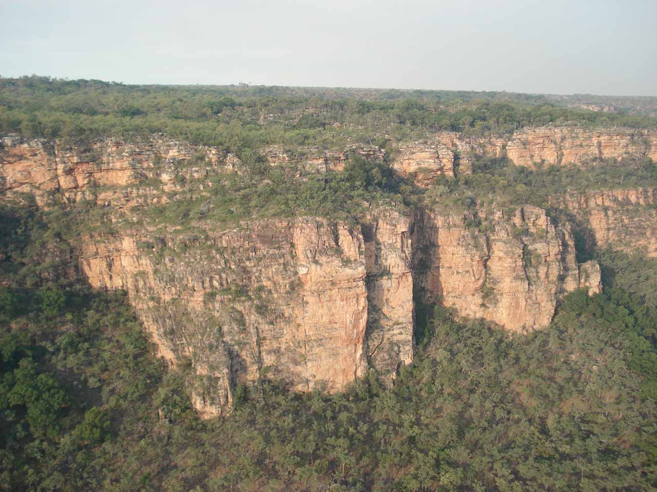
At least the benefit of doing the aerial tour was that we were able to see the surrounding escarpment lands of Kakadu National Park, and we were really able to get a sense of the grandeur and context of not only the falls but also the vast wilderness that was around us. The aerial tour also bought us sightings of bonus waterfalls such as Double Falls in the Death Adder Valley.
Had we been able to do the 4wd land tour to the base of Jim Jim Falls, then our experience would’ve obviously been a lot more intimate. However, we knew that it would’ve been a rough and rugged ride along Jim Jim Falls Road (roughly 2-3 hours each way to cover the 66km). I doubted that rental car companies would be comfortable letting us go it alone with their vehicle on this road, which was primarily why we booked a land tour so the experts in the know would handle the difficult logistics (especially the creek crossings).
Unfortunately, with Cyclone Monica keeping all the 4wd roads closed, the land tour operator wanted to substitute the Jim Jim Falls experience with a tour to Gunlom Falls and Motor Car Falls. It was an unacceptable trade in our minds since we had already visited the falls on our own, and it was nowhere near as good as what they were replacing. So the moral of the story here would be to take a wait-and-see approach when trying to time a visit to see this waterfall. Nonetheless, we felt that our Jim Jim Falls experience was incomplete and we’re itching to come back here to do the land tour.
Related Trip Reports

Related Top 10 Lists
Related Itineraries

Trip Planning Resources


Nearby Accommodations
This content is for members only. See Membership Options.Featured Images and Nearby Attractions
This content is for members only. See Membership Options.Visitor Comments:
Got something you'd like to share or say to keep the conversation going? Feel free to leave a comment below...No users have replied to the content on this page
Visitor Reviews of this Waterfall:
If you have a waterfall story or write-up that you'd like to share, feel free to click the button below and fill out the form...No users have submitted a write-up/review of this waterfall
Only logged in users can post a comment Please login or sign up to comment